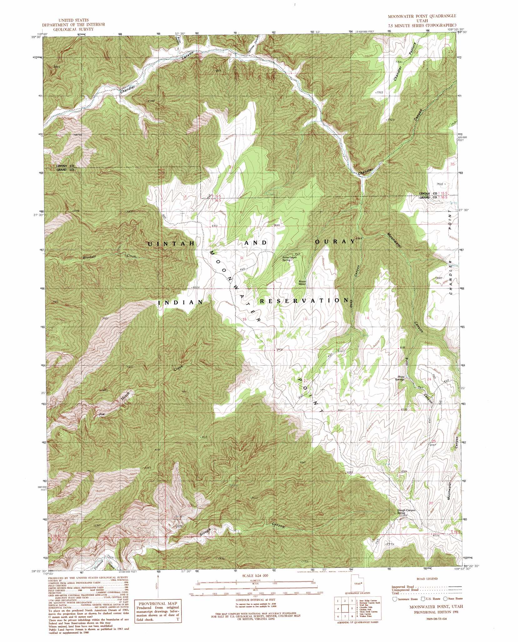
Moonwater Point Topo Map Utah
To zoom in, hover over the map of Moonwater Point
USGS Topo Quad 39109d8 - 1:24,000 scale
| Topo Map Name: | Moonwater Point |
| USGS Topo Quad ID: | 39109d8 |
| Print Size: | ca. 21 1/4" wide x 27" high |
| Southeast Coordinates: | 39.375° N latitude / 109.875° W longitude |
| Map Center Coordinates: | 39.4375° N latitude / 109.9375° W longitude |
| U.S. State: | UT |
| Filename: | o39109d8.jpg |
| Download Map JPG Image: | Moonwater Point topo map 1:24,000 scale |
| Map Type: | Topographic |
| Topo Series: | 7.5´ |
| Map Scale: | 1:24,000 |
| Source of Map Images: | United States Geological Survey (USGS) |
| Alternate Map Versions: |
Moonwater Point UT 1991, updated 1991 Download PDF Buy paper map Moonwater Point UT 2011 Download PDF Buy paper map Moonwater Point UT 2014 Download PDF Buy paper map |
1:24,000 Topo Quads surrounding Moonwater Point
Twin Hollow |
Cedar Ridge Canyon |
Firewater Canyon North |
Dog Knoll |
Agency Draw Nw |
Summerhouse Ridge |
Steer Ridge Canyon |
Firewater Canyon South |
Wolf Flat |
Flat Rock Mesa |
Lighthouse Canyon |
Chandler Falls |
Moonwater Point |
Chicken Fork |
Black Knolls |
Turtle Canyon |
Three Fords Canyon |
Lion Canyon |
Walker Point |
Supply Canyon |
Jenny Canyon |
Butler Canyon |
Bobby Canyon North |
Floy Canyon North |
Bogart Canyon |
> Back to 39109a1 at 1:100,000 scale
> Back to 39108a1 at 1:250,000 scale
> Back to U.S. Topo Maps home
Moonwater Point topo map: Gazetteer
Moonwater Point: Capes
Moonwater Point elevation 2559m 8395′Moonwater Point: Flats
Chandler Pasture elevation 2348m 7703′Moonwater Point: Springs
Anna Laura Spring elevation 2412m 7913′Marys Water elevation 2432m 7979′
Pinto Springs elevation 2410m 7906′
Slough Canyon Spring elevation 2550m 8366′
Moonwater Point: Valleys
Burnt Canyon elevation 1577m 5173′Deep Canyon elevation 1950m 6397′
Moonwater Canyon elevation 1801m 5908′
Papoose Canyon elevation 1647m 5403′
Pinto Canyon elevation 2309m 7575′
Moonwater Point digital topo map on disk
Buy this Moonwater Point topo map showing relief, roads, GPS coordinates and other geographical features, as a high-resolution digital map file on DVD: