Firewater Canyon South Topo Map Utah
To zoom in, hover over the map of Firewater Canyon South
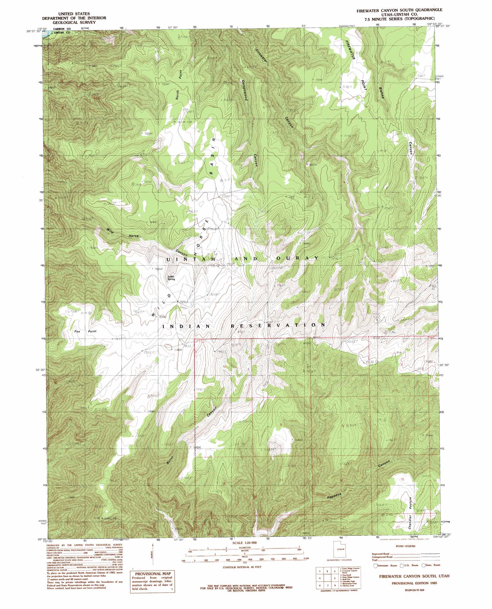
USGS Topo Quad 39109e8 - 1:24,000 scale
| Topo Map Name: | Firewater Canyon South |
| USGS Topo Quad ID: | 39109e8 |
| Print Size: | ca. 21 1/4" wide x 27" high |
| Southeast Coordinates: | 39.5° N latitude / 109.875° W longitude |
| Map Center Coordinates: | 39.5625° N latitude / 109.9375° W longitude |
| U.S. State: | UT |
| Filename: | o39109e8.jpg |
| Download Map JPG Image: | Firewater Canyon South topo map 1:24,000 scale |
| Map Type: | Topographic |
| Topo Series: | 7.5´ |
| Map Scale: | 1:24,000 |
| Source of Map Images: | United States Geological Survey (USGS) |
| Alternate Map Versions: |
Firewater Canyon South UT 1985, updated 1985 Download PDF Buy paper map Firewater Canyon South UT 2011 Download PDF Buy paper map Firewater Canyon South UT 2014 Download PDF Buy paper map |
1:24,000 Topo Quads surrounding Firewater Canyon South
Cowboy Bench |
Pinnacle Canyon |
Duches Hole |
Nutters Hole |
Big Pack Mountain |
Twin Hollow |
Cedar Ridge Canyon |
Firewater Canyon North |
Dog Knoll |
Agency Draw Nw |
Summerhouse Ridge |
Steer Ridge Canyon |
Firewater Canyon South |
Wolf Flat |
Flat Rock Mesa |
Lighthouse Canyon |
Chandler Falls |
Moonwater Point |
Chicken Fork |
Black Knolls |
Turtle Canyon |
Three Fords Canyon |
Lion Canyon |
Walker Point |
Supply Canyon |
> Back to 39109e1 at 1:100,000 scale
> Back to 39108a1 at 1:250,000 scale
> Back to U.S. Topo Maps home
Firewater Canyon South topo map: Gazetteer
Firewater Canyon South: Basins
Wild Horse Basin elevation 2242m 7355′Firewater Canyon South: Capes
Fox Point elevation 2367m 7765′North Point elevation 2209m 7247′
Firewater Canyon South: Springs
Bishop Spring elevation 2255m 7398′Judith Spring elevation 2245m 7365′
Firewater Canyon South digital topo map on disk
Buy this Firewater Canyon South topo map showing relief, roads, GPS coordinates and other geographical features, as a high-resolution digital map file on DVD: