Petes Summit Topo Map Nevada
To zoom in, hover over the map of Petes Summit
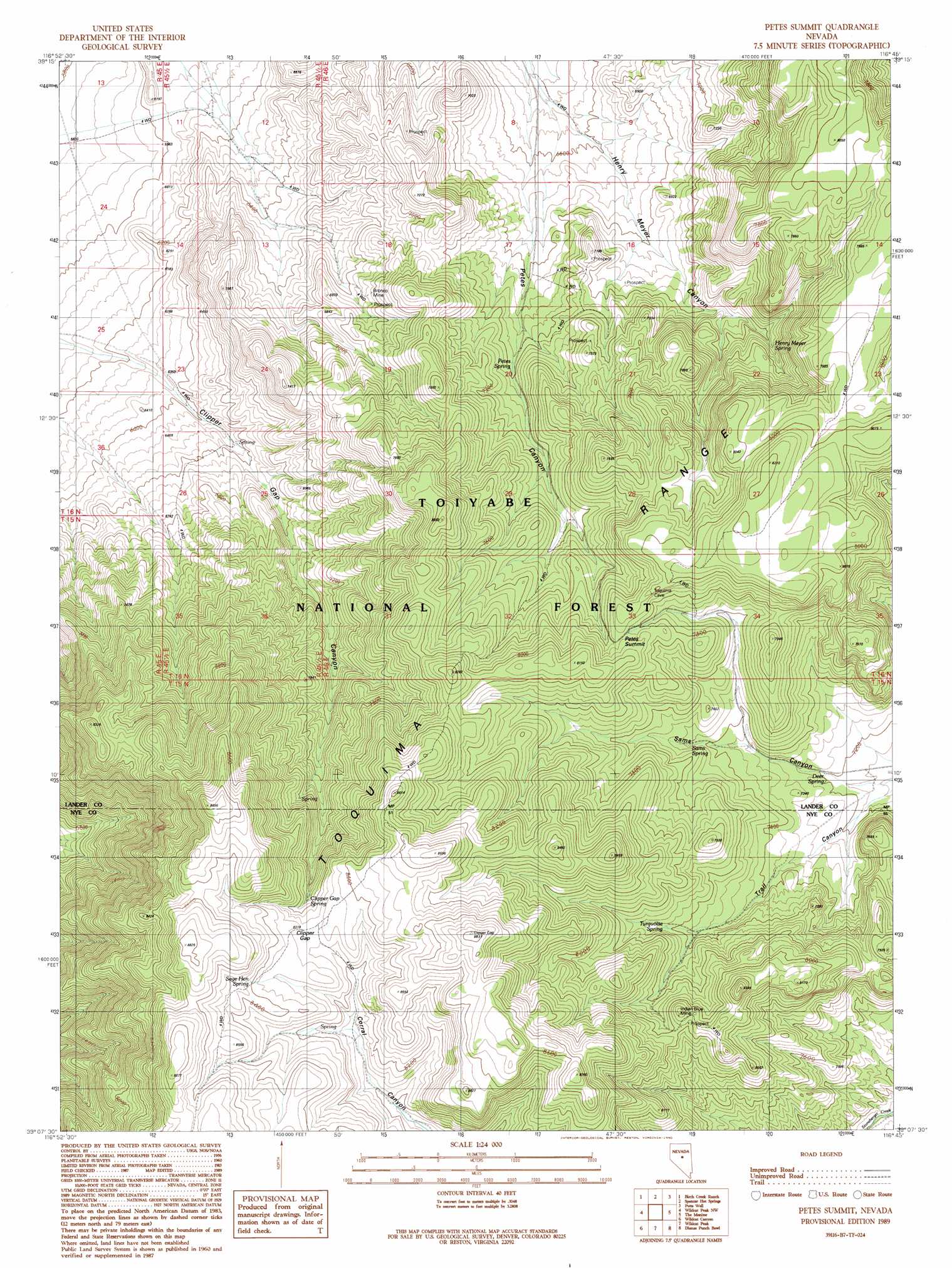
USGS Topo Quad 39116b7 - 1:24,000 scale
| Topo Map Name: | Petes Summit |
| USGS Topo Quad ID: | 39116b7 |
| Print Size: | ca. 21 1/4" wide x 27" high |
| Southeast Coordinates: | 39.125° N latitude / 116.75° W longitude |
| Map Center Coordinates: | 39.1875° N latitude / 116.8125° W longitude |
| U.S. State: | NV |
| Filename: | o39116b7.jpg |
| Download Map JPG Image: | Petes Summit topo map 1:24,000 scale |
| Map Type: | Topographic |
| Topo Series: | 7.5´ |
| Map Scale: | 1:24,000 |
| Source of Map Images: | United States Geological Survey (USGS) |
| Alternate Map Versions: |
Petes Summit NV 1989, updated 1990 Download PDF Buy paper map Petes Summit NV 2012 Download PDF Buy paper map Petes Summit NV 2015 Download PDF Buy paper map |
| FStopo: | US Forest Service topo Petes Summit is available: Download FStopo PDF Download FStopo TIF |
1:24,000 Topo Quads surrounding Petes Summit
Austin |
Simpson Park Canyon |
Cape Horn |
Hickison Summit |
Jackrabbit Spring |
North Toiyabe Peak |
Birch Creek Ranch |
Spencer Hot Springs |
Potts Well |
Wallace Canyon |
Kingston |
Wildcat Peak Nw |
Petes Summit |
The Monitor |
White Sage Canyon |
East Of Millett Ranch |
Wildcat Canyon |
Wildcat Peak |
Dianas Punch Bowl |
Butler Ranch |
Carvers Ne |
Jet Spring |
Northumberland Pass |
Box Spring |
Dobbin Summit |
> Back to 39116a1 at 1:100,000 scale
> Back to 39116a1 at 1:250,000 scale
> Back to U.S. Topo Maps home
Petes Summit topo map: Gazetteer
Petes Summit: Gaps
Clipper Gap elevation 2523m 8277′Petes Summit elevation 2398m 7867′
Petes Summit: Mines
Bronco Mine elevation 2096m 6876′Indian Blue Mine elevation 2319m 7608′
Petes Summit: Springs
Clipper Gap Spring elevation 2482m 8143′Deer Spring elevation 2195m 7201′
Henry Meyer Spring elevation 2212m 7257′
Petes Spring elevation 2130m 6988′
Sage Hen Spring elevation 2577m 8454′
Sams Spring elevation 2266m 7434′
Turquoise Spring elevation 2324m 7624′
Petes Summit: Valleys
Henry Meyer Canyon elevation 1959m 6427′Trail Canyon elevation 2171m 7122′
Petes Summit digital topo map on disk
Buy this Petes Summit topo map showing relief, roads, GPS coordinates and other geographical features, as a high-resolution digital map file on DVD: