Jet Spring Topo Map Nevada
To zoom in, hover over the map of Jet Spring
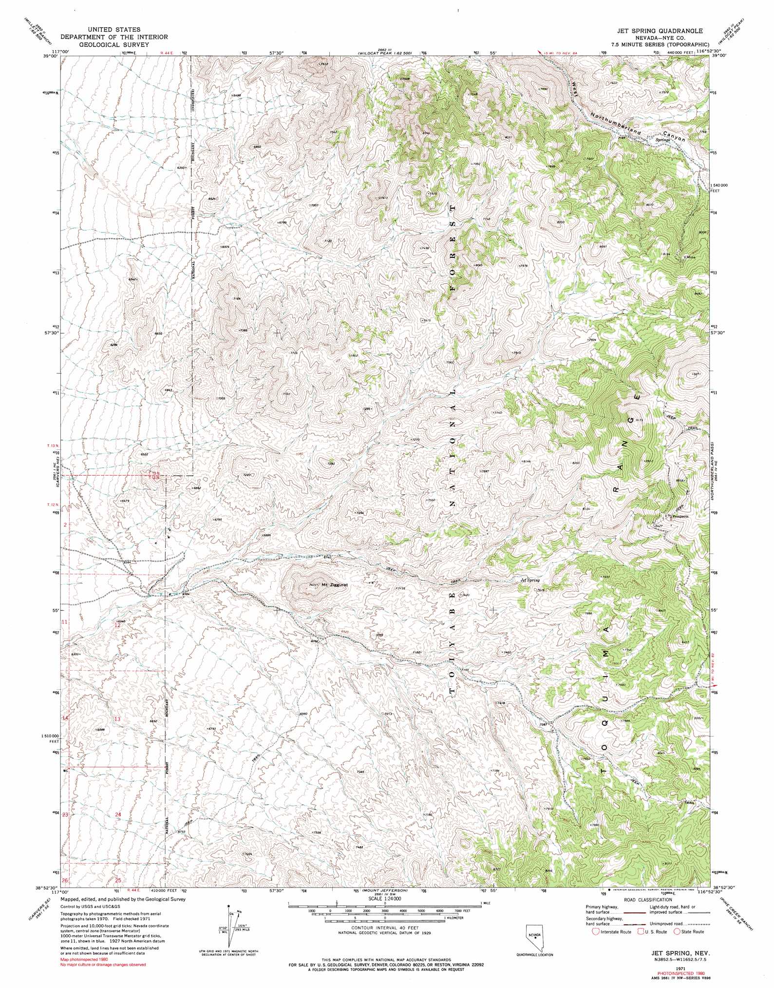
USGS Topo Quad 38116h8 - 1:24,000 scale
| Topo Map Name: | Jet Spring |
| USGS Topo Quad ID: | 38116h8 |
| Print Size: | ca. 21 1/4" wide x 27" high |
| Southeast Coordinates: | 38.875° N latitude / 116.875° W longitude |
| Map Center Coordinates: | 38.9375° N latitude / 116.9375° W longitude |
| U.S. State: | NV |
| Filename: | o38116h8.jpg |
| Download Map JPG Image: | Jet Spring topo map 1:24,000 scale |
| Map Type: | Topographic |
| Topo Series: | 7.5´ |
| Map Scale: | 1:24,000 |
| Source of Map Images: | United States Geological Survey (USGS) |
| Alternate Map Versions: |
Jet Spring NV 1971, updated 1974 Download PDF Buy paper map Jet Spring NV 1971, updated 1990 Download PDF Buy paper map Jet Spring NV 2012 Download PDF Buy paper map Jet Spring NV 2014 Download PDF Buy paper map |
| FStopo: | US Forest Service topo Jet Spring is available: Download FStopo PDF Download FStopo TIF |
1:24,000 Topo Quads surrounding Jet Spring
Brewer Canyon |
Kingston |
Wildcat Peak Nw |
Petes Summit |
The Monitor |
Millett Ranch |
East Of Millett Ranch |
Wildcat Canyon |
Wildcat Peak |
Dianas Punch Bowl |
Carvers Nw |
Carvers Ne |
Jet Spring |
Northumberland Pass |
Box Spring |
Carvers |
Carvers Se |
Mount Jefferson |
Pine Creek Ranch |
Mosquito Creek |
Pablo Canyon Ranch |
Round Mountain |
Jefferson |
Corcoran Canyon |
Barley Creek |
> Back to 38116e1 at 1:100,000 scale
> Back to 38116a1 at 1:250,000 scale
> Back to U.S. Topo Maps home
Jet Spring topo map: Gazetteer
Jet Spring: Springs
Jet Spring elevation 2255m 7398′Jet Spring: Summits
Mount Ziggurat elevation 2249m 7378′Jet Spring: Trails
Austin Belmont Winter Stage Route elevation 1936m 6351′Jet Spring digital topo map on disk
Buy this Jet Spring topo map showing relief, roads, GPS coordinates and other geographical features, as a high-resolution digital map file on DVD: