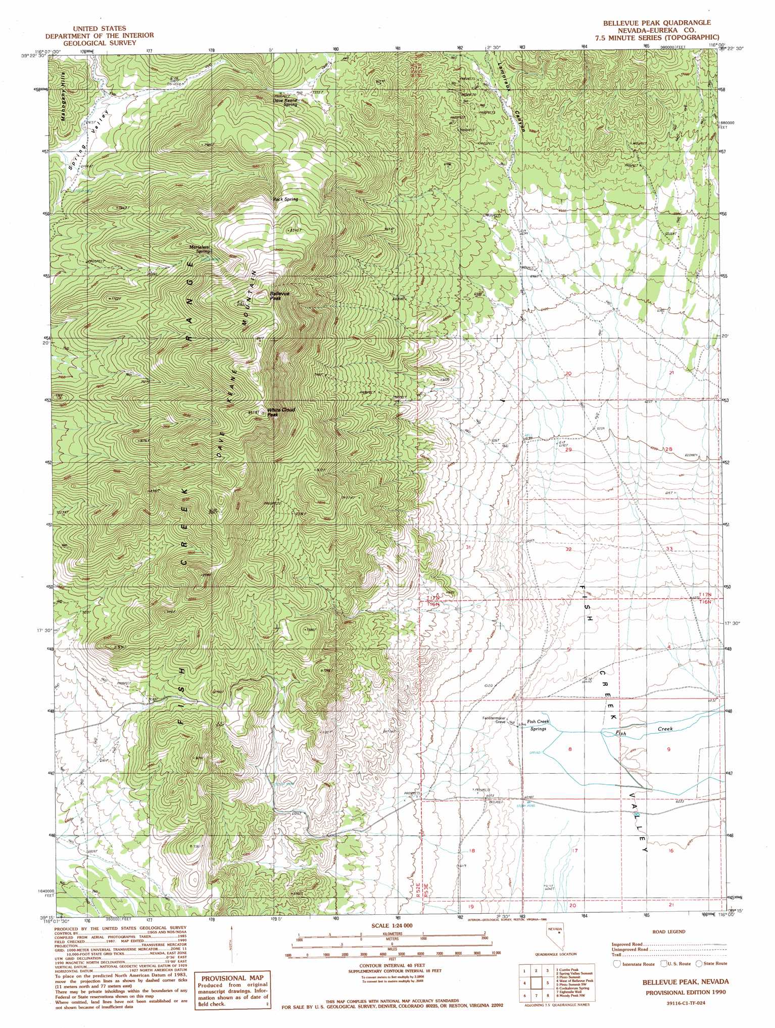
Bellevue Peak Topo Map Nevada
To zoom in, hover over the map of Bellevue Peak
USGS Topo Quad 39116c1 - 1:24,000 scale
| Topo Map Name: | Bellevue Peak |
| USGS Topo Quad ID: | 39116c1 |
| Print Size: | ca. 21 1/4" wide x 27" high |
| Southeast Coordinates: | 39.25° N latitude / 116° W longitude |
| Map Center Coordinates: | 39.3125° N latitude / 116.0625° W longitude |
| U.S. State: | NV |
| Filename: | o39116c1.jpg |
| Download Map JPG Image: | Bellevue Peak topo map 1:24,000 scale |
| Map Type: | Topographic |
| Topo Series: | 7.5´ |
| Map Scale: | 1:24,000 |
| Source of Map Images: | United States Geological Survey (USGS) |
| Alternate Map Versions: |
Bellevue Peak NV 1990, updated 1990 Download PDF Buy paper map Bellevue Peak NV 2012 Download PDF Buy paper map Bellevue Peak NV 2014 Download PDF Buy paper map |
1:24,000 Topo Quads surrounding Bellevue Peak
Bartine Ranch |
Hay Ranch |
Devon Peak |
Eureka |
Diamond Peak |
Antelope Meadow |
Combs Peak |
Spring Valley Summit |
Pinto Summit |
Silverado Mountain |
Sullivan Wash |
West Of Bellevue Peak |
Bellevue Peak |
Pinto Summit Sw |
Black Point |
Ninemile Peak |
Cockalorum Spring |
Eightmile Well |
Moody Peak Nw |
Pogues Station |
Segura Ranch |
Snowball Ranch |
East Of Snowball Ranch |
Moody Peak |
Bull Fork |
> Back to 39116a1 at 1:100,000 scale
> Back to 39116a1 at 1:250,000 scale
> Back to U.S. Topo Maps home
Bellevue Peak topo map: Gazetteer
Bellevue Peak: Ranges
Fish Creek Range elevation 2477m 8126′Bellevue Peak: Springs
Dave Keane Spring elevation 2307m 7568′Fish Creek Springs elevation 1845m 6053′
Marteletti Spring elevation 2415m 7923′
Rock Spring elevation 2440m 8005′
Bellevue Peak: Summits
Bellevue Peak elevation 2683m 8802′Dave Keane Mountain elevation 2689m 8822′
White Cloud Peak elevation 2710m 8891′
Bellevue Peak: Valleys
Lamoreux Canyon elevation 2010m 6594′Bellevue Peak digital topo map on disk
Buy this Bellevue Peak topo map showing relief, roads, GPS coordinates and other geographical features, as a high-resolution digital map file on DVD: