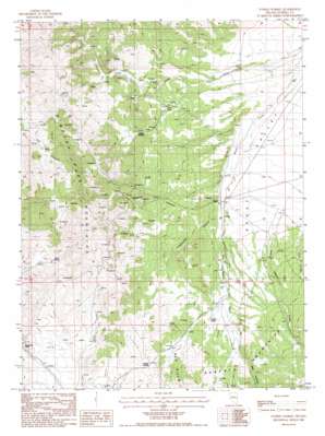
Tonkin Summit Topo Map Nevada
To zoom in, hover over the map of Tonkin Summit
USGS Topo Quad 39116h4 - 1:24,000 scale
| Topo Map Name: | Tonkin Summit |
| USGS Topo Quad ID: | 39116h4 |
| Print Size: | ca. 21 1/4" wide x 27" high |
| Southeast Coordinates: | 39.875° N latitude / 116.375° W longitude |
| Map Center Coordinates: | 39.9375° N latitude / 116.4375° W longitude |
| U.S. State: | NV |
| Filename: | o39116h4.jpg |
| Download Map JPG Image: | Tonkin Summit topo map 1:24,000 scale |
| Map Type: | Topographic |
| Topo Series: | 7.5´ |
| Map Scale: | 1:24,000 |
| Source of Map Images: | United States Geological Survey (USGS) |
| Alternate Map Versions: |
Tonkin Summit NV 1986, updated 1986 Download PDF Buy paper map Tonkin Summit NV 2012 Download PDF Buy paper map Tonkin Summit NV 2015 Download PDF Buy paper map |
1:24,000 Topo Quads surrounding Tonkin Summit
> Back to 39116e1 at 1:100,000 scale
> Back to 39116a1 at 1:250,000 scale
> Back to U.S. Topo Maps home
Tonkin Summit topo map: Gazetteer
Tonkin Summit: Dams
Tonkin Reservoir Dam elevation 1966m 6450′Tonkin Summit: Gaps
McClusky Pass elevation 2139m 7017′Tonkin Summit elevation 2121m 6958′
Tonkin Summit: Populated Places
Tonkin elevation 1887m 6190′Tonkin Summit: Post Offices
Tonkin Post Office (historical) elevation 1889m 6197′Tonkin Summit: Springs
Black Spring elevation 2093m 6866′Indian Spring elevation 2036m 6679′
Lower Tonkin Creek Spring elevation 1977m 6486′
Pat Canyon Number One elevation 2096m 6876′
Pat Canyon Number Two elevation 2167m 7109′
Pat Canyon Spring elevation 2218m 7276′
Tonkin Spring elevation 2002m 6568′
Upper Tonkin Creek Spring elevation 1990m 6528′
Tonkin Summit: Streams
Niel Creek elevation 1942m 6371′Tonkin Summit: Valleys
Pete Hanson Canyon elevation 1956m 6417′Red Canyon elevation 2009m 6591′
Rooster Canyon elevation 1899m 6230′
Telephone Canyon elevation 1892m 6207′
Tonkin Summit digital topo map on disk
Buy this Tonkin Summit topo map showing relief, roads, GPS coordinates and other geographical features, as a high-resolution digital map file on DVD:


