Wharton Topo Map Ohio
To zoom in, hover over the map of Wharton
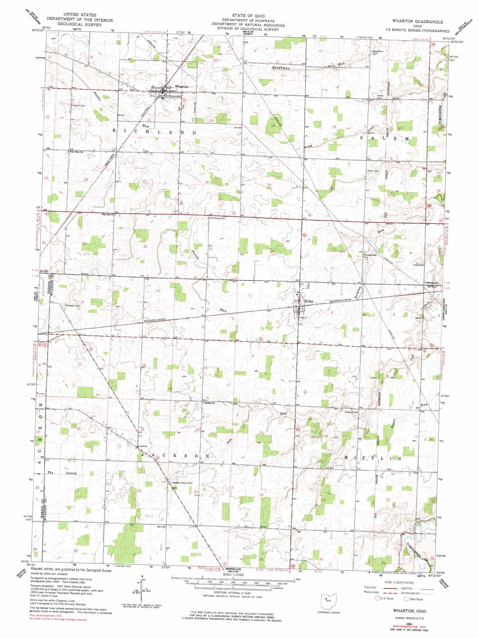
USGS Topo Quad 40083g4 - 1:24,000 scale
| Topo Map Name: | Wharton |
| USGS Topo Quad ID: | 40083g4 |
| Print Size: | ca. 21 1/4" wide x 27" high |
| Southeast Coordinates: | 40.75° N latitude / 83.375° W longitude |
| Map Center Coordinates: | 40.8125° N latitude / 83.4375° W longitude |
| U.S. State: | OH |
| Filename: | o40083g4.jpg |
| Download Map JPG Image: | Wharton topo map 1:24,000 scale |
| Map Type: | Topographic |
| Topo Series: | 7.5´ |
| Map Scale: | 1:24,000 |
| Source of Map Images: | United States Geological Survey (USGS) |
| Alternate Map Versions: |
Wharton OH 1961, updated 1963 Download PDF Buy paper map Wharton OH 1961, updated 1978 Download PDF Buy paper map Wharton OH 2010 Download PDF Buy paper map Wharton OH 2013 Download PDF Buy paper map Wharton OH 2016 Download PDF Buy paper map |
1:24,000 Topo Quads surrounding Wharton
Findlay |
Arcadia |
Alvada |
New Riegel |
Tiffin South |
Arlington |
Mount Blanchard |
Carey |
Mccutchenville |
Sycamore |
Dunkirk |
Forest |
Wharton |
Upper Sandusky |
Nevada |
Foraker |
Kenton |
Marseilles |
Meeker |
Morral |
Silver Creek |
Mount Victory |
La Rue |
New Bloomington |
Marion West |
> Back to 40083e1 at 1:100,000 scale
> Back to 40082a1 at 1:250,000 scale
> Back to U.S. Topo Maps home
Wharton topo map: Gazetteer
Wharton: Canals
Blake Ditch elevation 258m 846′Wharton: Populated Places
Kirby elevation 267m 875′Wharton elevation 269m 882′
Wharton: Post Offices
Kirby Post Office elevation 266m 872′Wharton: Streams
Perkins Run elevation 247m 810′Wharton: Swamps
Potato Creek Swamp (historical) elevation 261m 856′Wharton digital topo map on disk
Buy this Wharton topo map showing relief, roads, GPS coordinates and other geographical features, as a high-resolution digital map file on DVD:
 map DVD")