Rockford Topo Map Ohio
To zoom in, hover over the map of Rockford
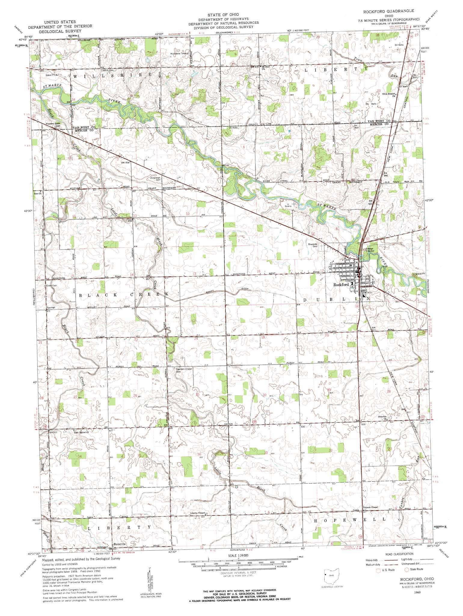
USGS Topo Quad 40084f6 - 1:24,000 scale
| Topo Map Name: | Rockford |
| USGS Topo Quad ID: | 40084f6 |
| Print Size: | ca. 21 1/4" wide x 27" high |
| Southeast Coordinates: | 40.625° N latitude / 84.625° W longitude |
| Map Center Coordinates: | 40.6875° N latitude / 84.6875° W longitude |
| U.S. State: | OH |
| Filename: | o40084f6.jpg |
| Download Map JPG Image: | Rockford topo map 1:24,000 scale |
| Map Type: | Topographic |
| Topo Series: | 7.5´ |
| Map Scale: | 1:24,000 |
| Source of Map Images: | United States Geological Survey (USGS) |
| Alternate Map Versions: |
Rockford OH 1960, updated 1961 Download PDF Buy paper map Rockford OH 2010 Download PDF Buy paper map Rockford OH 2013 Download PDF Buy paper map Rockford OH 2016 Download PDF Buy paper map |
1:24,000 Topo Quads surrounding Rockford
Hoagland |
Dixon |
Convoy |
Scott |
Wetsel |
Decatur |
Wren |
Glenmore |
Van Wert |
Middle Point |
Berne |
Willshire |
Rockford |
Mendon |
Elgin |
Geneva |
New Corydon |
Erastus |
Celina |
Saint Marys |
Portland |
Fort Recovery |
Coldwater |
Montezuma |
New Bremen |
> Back to 40084e1 at 1:100,000 scale
> Back to 40084a1 at 1:250,000 scale
> Back to U.S. Topo Maps home
Rockford topo map: Gazetteer
Rockford: Airports
Ripley Airport elevation 242m 793′Rockford: Canals
Sanift Ditch elevation 244m 800′Rockford: Mines
Rockford Stone Quarry elevation 243m 797′Rockford: Populated Places
Bursville elevation 256m 839′Rockford elevation 248m 813′
Rockford: Post Offices
Rockford Post Office elevation 248m 813′Rockford: Streams
Black Creek elevation 237m 777′Little Black Creek elevation 240m 787′
Rockford digital topo map on disk
Buy this Rockford topo map showing relief, roads, GPS coordinates and other geographical features, as a high-resolution digital map file on DVD:
Northern Illinois, Northern Indiana & Southwestern Michigan
Buy digital topo maps: Northern Illinois, Northern Indiana & Southwestern Michigan