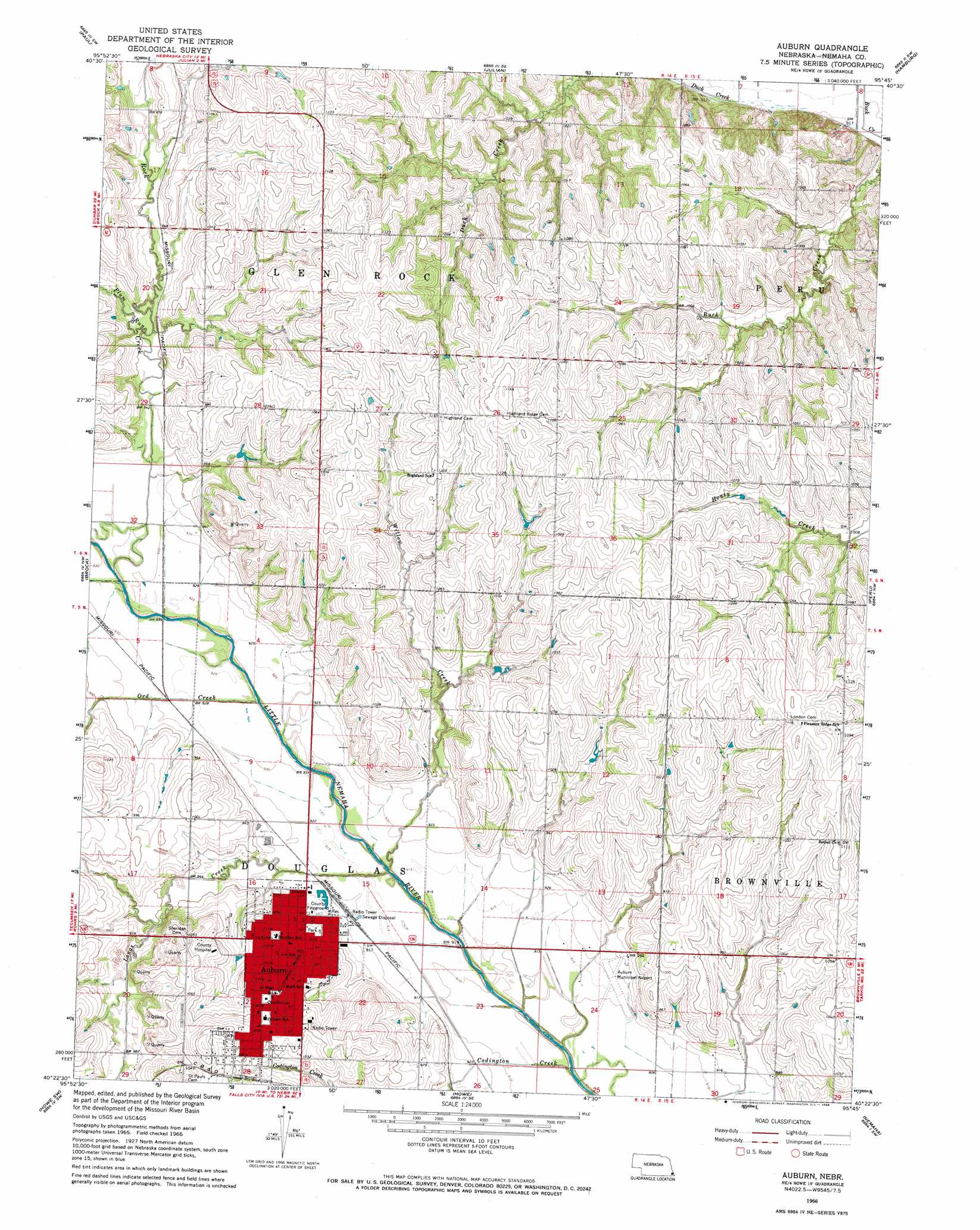
Auburn Topo Map Nebraska
To zoom in, hover over the map of Auburn
USGS Topo Quad 40095d7 - 1:24,000 scale
| Topo Map Name: | Auburn |
| USGS Topo Quad ID: | 40095d7 |
| Print Size: | ca. 21 1/4" wide x 27" high |
| Southeast Coordinates: | 40.375° N latitude / 95.75° W longitude |
| Map Center Coordinates: | 40.4375° N latitude / 95.8125° W longitude |
| U.S. State: | NE |
| Filename: | O40095D7.jpg |
| Download Map JPG Image: | Auburn topo map 1:24,000 scale |
| Map Type: | Topographic |
| Topo Series: | 7.5´ |
| Map Scale: | 1:24,000 |
| Source of Map Images: | United States Geological Survey (USGS) |
| Alternate Map Versions: |
Auburn NE 1966, updated 1968 Download PDF Buy paper map Auburn NE 2011 Download PDF Buy paper map Auburn NE 2014 Download PDF Buy paper map |
1:24,000 Topo Quads surrounding Auburn
Dunbar |
Nebraska City Nw |
Nebraska City |
Sidney |
Riverton |
Talmage |
Paul |
Julian |
Hamburg |
Mcelroy Creek |
Tecumseh Ne |
Brock |
Auburn |
Peru |
Rockport |
Tecumseh Se |
Howe Sw |
Howe |
Nemaha |
Langdon |
Table Rock |
Humboldt |
Dawson |
Verdon |
Barada |
> Back to 40095a1 at 1:100,000 scale
> Back to 40094a1 at 1:250,000 scale
> Back to U.S. Topo Maps home
Auburn topo map: Gazetteer
Auburn: Airports
Farington Field elevation 279m 915′Nemaha County Hospital Heliport elevation 314m 1030′
Auburn: Dams
Ely Dam elevation 304m 997′Auburn: Parks
Half-Breed Tract Historical Marker elevation 281m 921′Auburn: Populated Places
Auburn elevation 300m 984′Southside Trailer Park elevation 318m 1043′
Terrace Mobile Home Park elevation 316m 1036′
Auburn: Post Offices
Auburn Post Office elevation 302m 990′London Post Office (historical) elevation 350m 1148′
South Auburn Post Office (historical) elevation 321m 1053′
Auburn: Reservoirs
Ely Reservoir elevation 304m 997′Auburn: Streams
Codington Creek elevation 271m 889′Longs Creek elevation 274m 898′
Ord Creek elevation 276m 905′
Plum Run elevation 290m 951′
Rock Creek elevation 276m 905′
Willow Creek elevation 277m 908′
Auburn digital topo map on disk
Buy this Auburn topo map showing relief, roads, GPS coordinates and other geographical features, as a high-resolution digital map file on DVD: