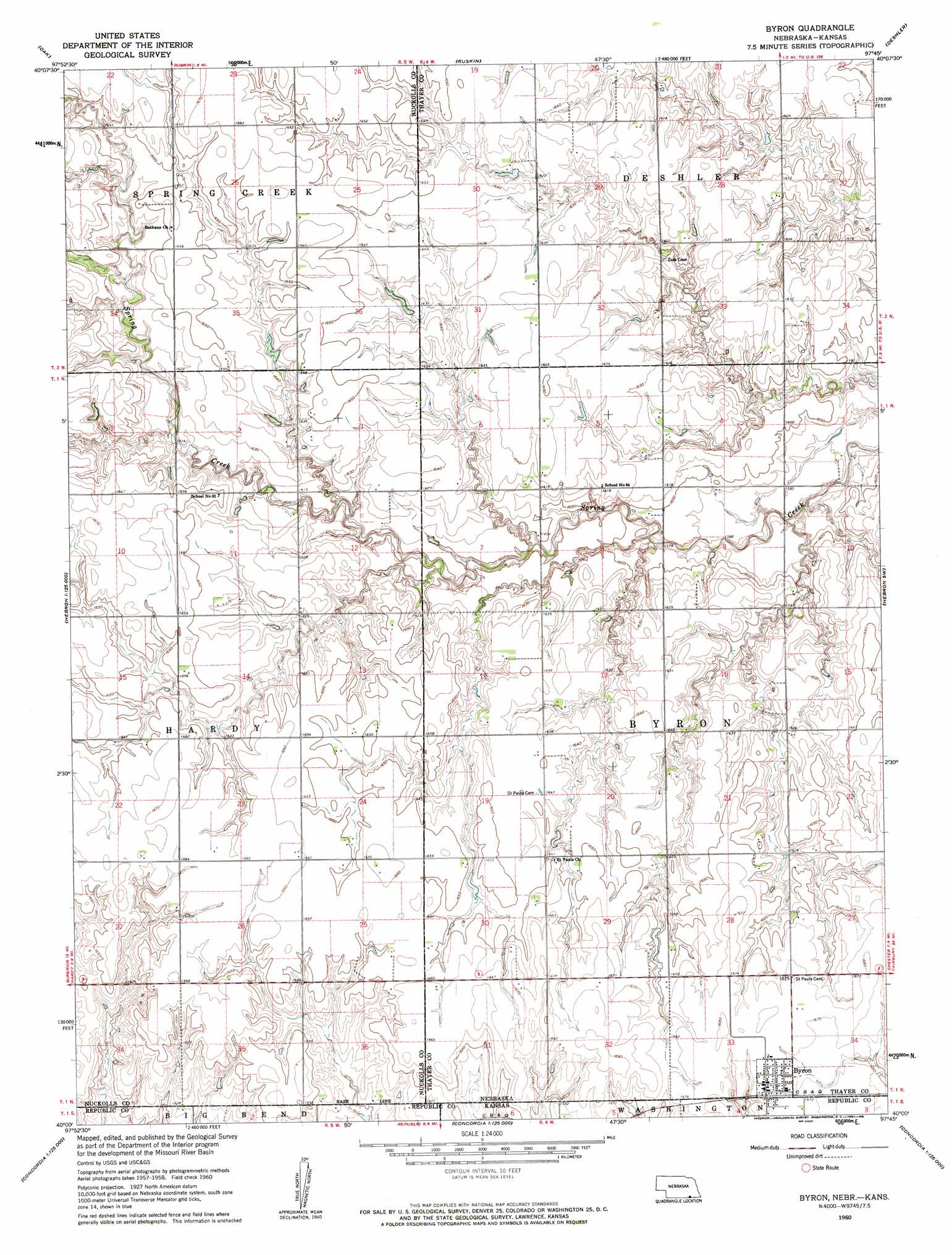
Byron Topo Map Nebraska
To zoom in, hover over the map of Byron
USGS Topo Quad 40097a7 - 1:24,000 scale
| Topo Map Name: | Byron |
| USGS Topo Quad ID: | 40097a7 |
| Print Size: | ca. 21 1/4" wide x 27" high |
| Southeast Coordinates: | 40° N latitude / 97.75° W longitude |
| Map Center Coordinates: | 40.0625° N latitude / 97.8125° W longitude |
| U.S. States: | NE, KS |
| Filename: | O40097A7.jpg |
| Download Map JPG Image: | Byron topo map 1:24,000 scale |
| Map Type: | Topographic |
| Topo Series: | 7.5´ |
| Map Scale: | 1:24,000 |
| Source of Map Images: | United States Geological Survey (USGS) |
| Alternate Map Versions: |
Byron NE 1960, updated 1961 Download PDF Buy paper map Byron NE 2011 Download PDF Buy paper map Byron NE 2014 Download PDF Buy paper map |
1:24,000 Topo Quads surrounding Byron
Fairfield Se |
Edgar |
Davenport |
Carleton |
Bruning |
Nelson |
Oak |
Ruskin |
Deshler |
Hebron |
Superior |
Hardy |
Byron |
Hebron Sw |
Chester |
Webber |
Scandia Nw |
Republic |
Belleville Nw |
Munden |
Montrose |
Courtland |
Scandia |
Belleville |
Belleville Se |
> Back to 40097a1 at 1:100,000 scale
> Back to 40096a1 at 1:250,000 scale
> Back to U.S. Topo Maps home
Byron topo map: Gazetteer
Byron: Airports
Byron Airport elevation 510m 1673′Byron: Dams
Eggers Dam elevation 496m 1627′Fintel Dam elevation 486m 1594′
Hofts Dam elevation 497m 1630′
Byron: Populated Places
Byron elevation 509m 1669′Byron: Post Offices
Byron Post Office elevation 509m 1669′Byron: Reservoirs
Eggers Reservoir elevation 496m 1627′Fintel Reservoir elevation 486m 1594′
Hofts Reservoir elevation 497m 1630′
Byron digital topo map on disk
Buy this Byron topo map showing relief, roads, GPS coordinates and other geographical features, as a high-resolution digital map file on DVD: