Courtland Topo Map Kansas
To zoom in, hover over the map of Courtland
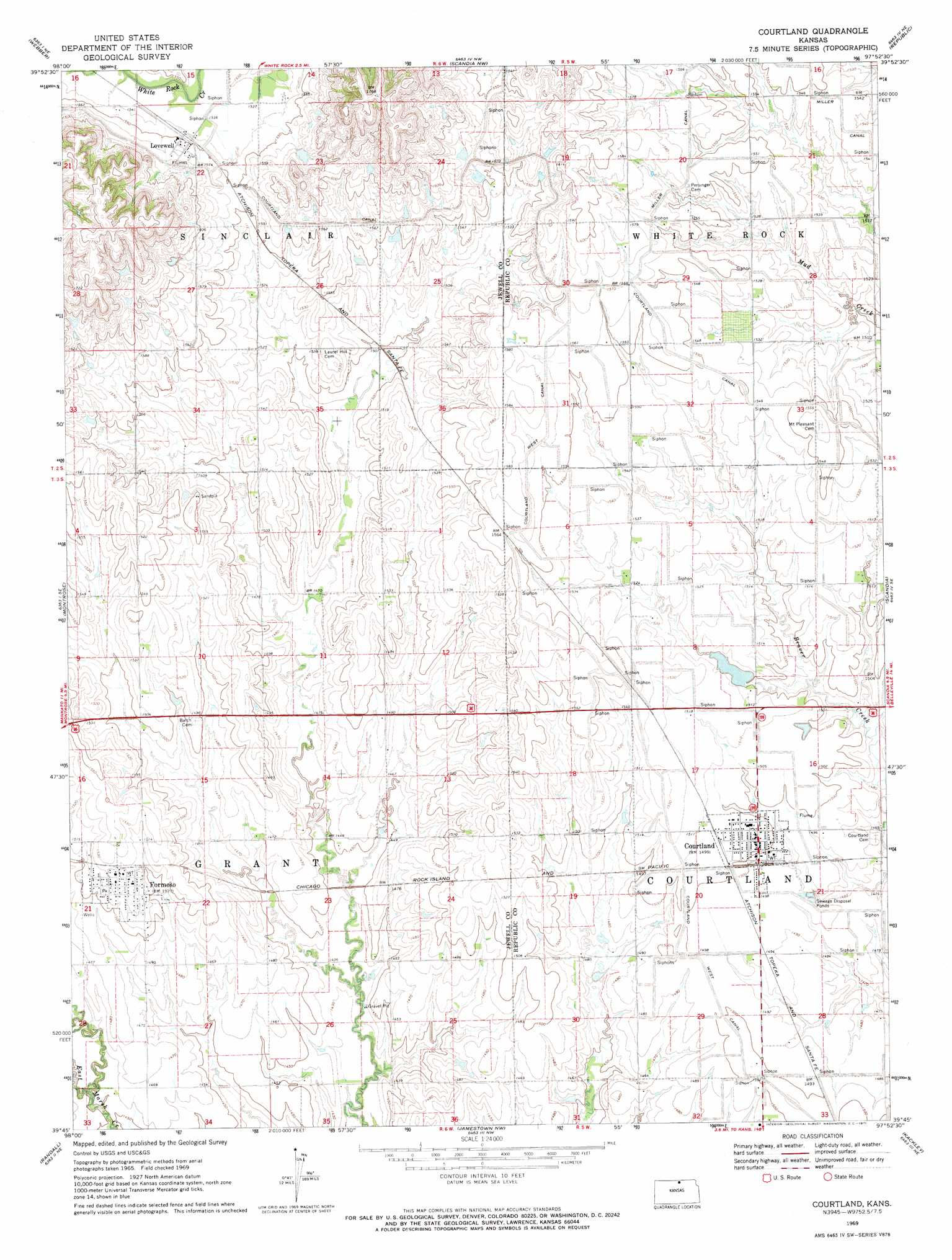
USGS Topo Quad 39097g8 - 1:24,000 scale
| Topo Map Name: | Courtland |
| USGS Topo Quad ID: | 39097g8 |
| Print Size: | ca. 21 1/4" wide x 27" high |
| Southeast Coordinates: | 39.75° N latitude / 97.875° W longitude |
| Map Center Coordinates: | 39.8125° N latitude / 97.9375° W longitude |
| U.S. State: | KS |
| Filename: | o39097g8.jpg |
| Download Map JPG Image: | Courtland topo map 1:24,000 scale |
| Map Type: | Topographic |
| Topo Series: | 7.5´ |
| Map Scale: | 1:24,000 |
| Source of Map Images: | United States Geological Survey (USGS) |
| Alternate Map Versions: |
Courtland KS 1969, updated 1971 Download PDF Buy paper map Courtland KS 2009 Download PDF Buy paper map Courtland KS 2012 Download PDF Buy paper map Courtland KS 2015 Download PDF Buy paper map |
1:24,000 Topo Quads surrounding Courtland
Bostwick |
Superior |
Hardy |
Byron |
Hebron Sw |
Mankato Nw |
Webber |
Scandia Nw |
Republic |
Belleville Nw |
Mankato |
Montrose |
Courtland |
Scandia |
Belleville |
Jewell |
Randall |
Jamestown Nw |
Kackley |
Condordia Nw |
Jewell Sw |
Jewell Se |
Scottsville |
Jamestown |
Concordia |
> Back to 39097e1 at 1:100,000 scale
> Back to 39096a1 at 1:250,000 scale
> Back to U.S. Topo Maps home
Courtland topo map: Gazetteer
Courtland: Canals
Courtland Canal elevation 481m 1578′Courtland West Canal elevation 458m 1502′
Miller Canal elevation 471m 1545′
Courtland: Populated Places
Courtland elevation 456m 1496′Formoso elevation 464m 1522′
Lovewell elevation 475m 1558′
Courtland digital topo map on disk
Buy this Courtland topo map showing relief, roads, GPS coordinates and other geographical features, as a high-resolution digital map file on DVD: