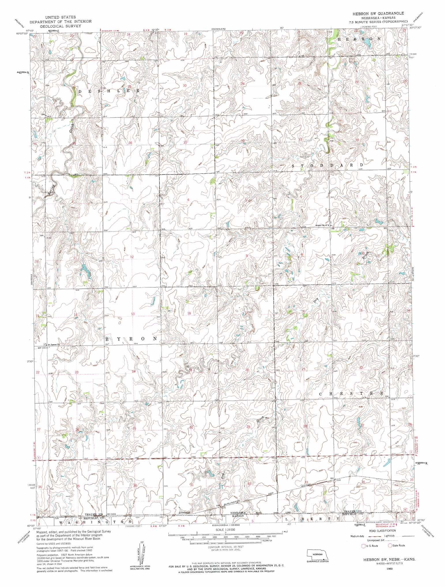
Hebron Sw Topo Map Nebraska
To zoom in, hover over the map of Hebron Sw
USGS Topo Quad 40097a6 - 1:24,000 scale
| Topo Map Name: | Hebron Sw |
| USGS Topo Quad ID: | 40097a6 |
| Print Size: | ca. 21 1/4" wide x 27" high |
| Southeast Coordinates: | 40° N latitude / 97.625° W longitude |
| Map Center Coordinates: | 40.0625° N latitude / 97.6875° W longitude |
| U.S. States: | NE, KS |
| Filename: | O40097A6.jpg |
| Download Map JPG Image: | Hebron Sw topo map 1:24,000 scale |
| Map Type: | Topographic |
| Topo Series: | 7.5´ |
| Map Scale: | 1:24,000 |
| Source of Map Images: | United States Geological Survey (USGS) |
| Alternate Map Versions: |
Hebron SW NE 1960, updated 1962 Download PDF Buy paper map Hebron SW NE 2011 Download PDF Buy paper map Hebron SW NE 2014 Download PDF Buy paper map |
1:24,000 Topo Quads surrounding Hebron Sw
Edgar |
Davenport |
Carleton |
Bruning |
Tobias Sw |
Oak |
Ruskin |
Deshler |
Hebron |
Alexandria |
Hardy |
Byron |
Hebron Sw |
Chester |
Hubbell |
Scandia Nw |
Republic |
Belleville Nw |
Munden |
Narka |
Courtland |
Scandia |
Belleville |
Belleville Se |
Cuba |
> Back to 40097a1 at 1:100,000 scale
> Back to 40096a1 at 1:250,000 scale
> Back to U.S. Topo Maps home
Hebron Sw topo map: Gazetteer
Hebron Sw: Dams
Bostelman Dam elevation 485m 1591′Dittmer Dam elevation 464m 1522′
Harms Dam elevation 498m 1633′
Koester Dam elevation 490m 1607′
Hebron Sw: Reservoirs
Bostelman Reservoir elevation 485m 1591′Dittmer Reservoir elevation 464m 1522′
Harms Reservoir elevation 498m 1633′
Koester Reservoir elevation 490m 1607′
Hebron Sw digital topo map on disk
Buy this Hebron Sw topo map showing relief, roads, GPS coordinates and other geographical features, as a high-resolution digital map file on DVD: