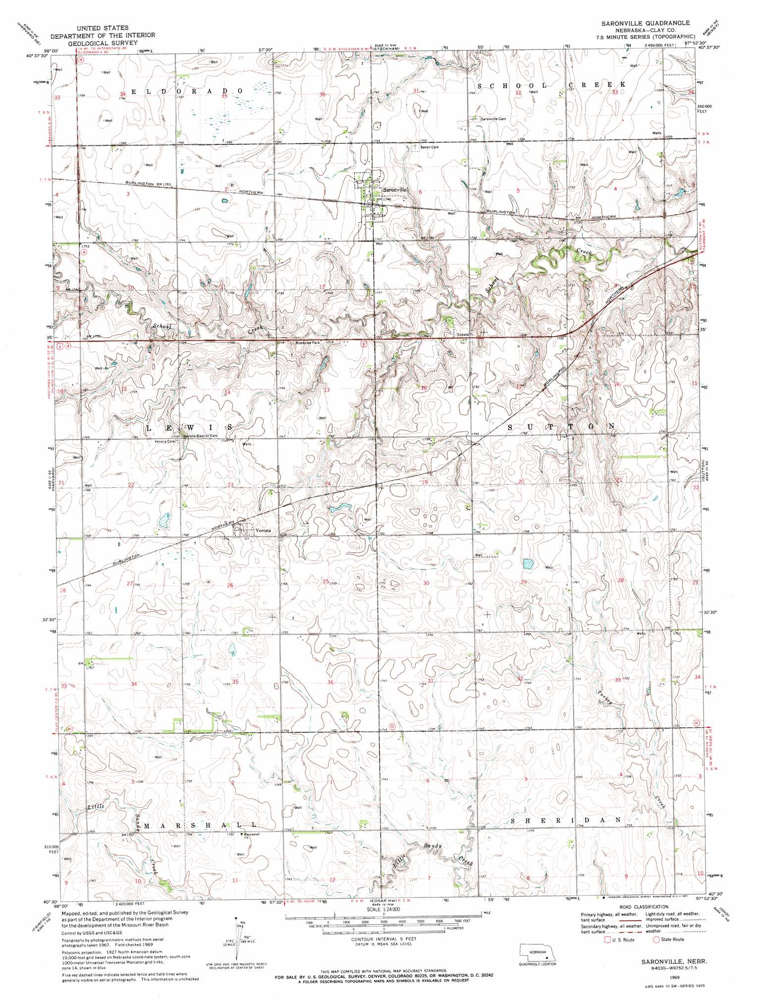
Saronville Topo Map Nebraska
To zoom in, hover over the map of Saronville
USGS Topo Quad 40097e8 - 1:24,000 scale
| Topo Map Name: | Saronville |
| USGS Topo Quad ID: | 40097e8 |
| Print Size: | ca. 21 1/4" wide x 27" high |
| Southeast Coordinates: | 40.5° N latitude / 97.875° W longitude |
| Map Center Coordinates: | 40.5625° N latitude / 97.9375° W longitude |
| U.S. State: | NE |
| Filename: | O40097e8.jpg |
| Download Map JPG Image: | Saronville topo map 1:24,000 scale |
| Map Type: | Topographic |
| Topo Series: | 7.5´ |
| Map Scale: | 1:24,000 |
| Source of Map Images: | United States Geological Survey (USGS) |
| Alternate Map Versions: |
Saronville NE 1969, updated 1971 Download PDF Buy paper map Saronville NE 2011 Download PDF Buy paper map Saronville NE 2014 Download PDF Buy paper map |
1:24,000 Topo Quads surrounding Saronville
Giltner |
Aurora West |
Aurora East |
Henderson |
York Sw |
Harvard Nw |
Harvard Ne |
Stockham |
Bixby |
Grafton |
Inland |
Harvard |
Saronville |
Sutton |
Geneva Sw |
Fairfield Nw |
Fairfield |
Edgar Nw |
Ong |
Shickley |
Deweese |
Fairfield Se |
Edgar |
Davenport |
Carleton |
> Back to 40097e1 at 1:100,000 scale
> Back to 40096a1 at 1:250,000 scale
> Back to U.S. Topo Maps home
Saronville topo map: Gazetteer
Saronville: Dams
Percival-Erickson Dam elevation 524m 1719′Schmer Dam elevation 532m 1745′
Saronville: Parks
Hultine Federal Waterfowl Production Area elevation 534m 1751′Saronville: Populated Places
Saronville elevation 534m 1751′Verona elevation 540m 1771′
Saronville: Post Offices
Saronville Post Office elevation 534m 1751′Verona Post Office (historical) elevation 540m 1771′
Saronville: Reservoirs
Percival-Erickson Reservoir elevation 524m 1719′Schmer Reservoir elevation 532m 1745′
Saronville digital topo map on disk
Buy this Saronville topo map showing relief, roads, GPS coordinates and other geographical features, as a high-resolution digital map file on DVD: