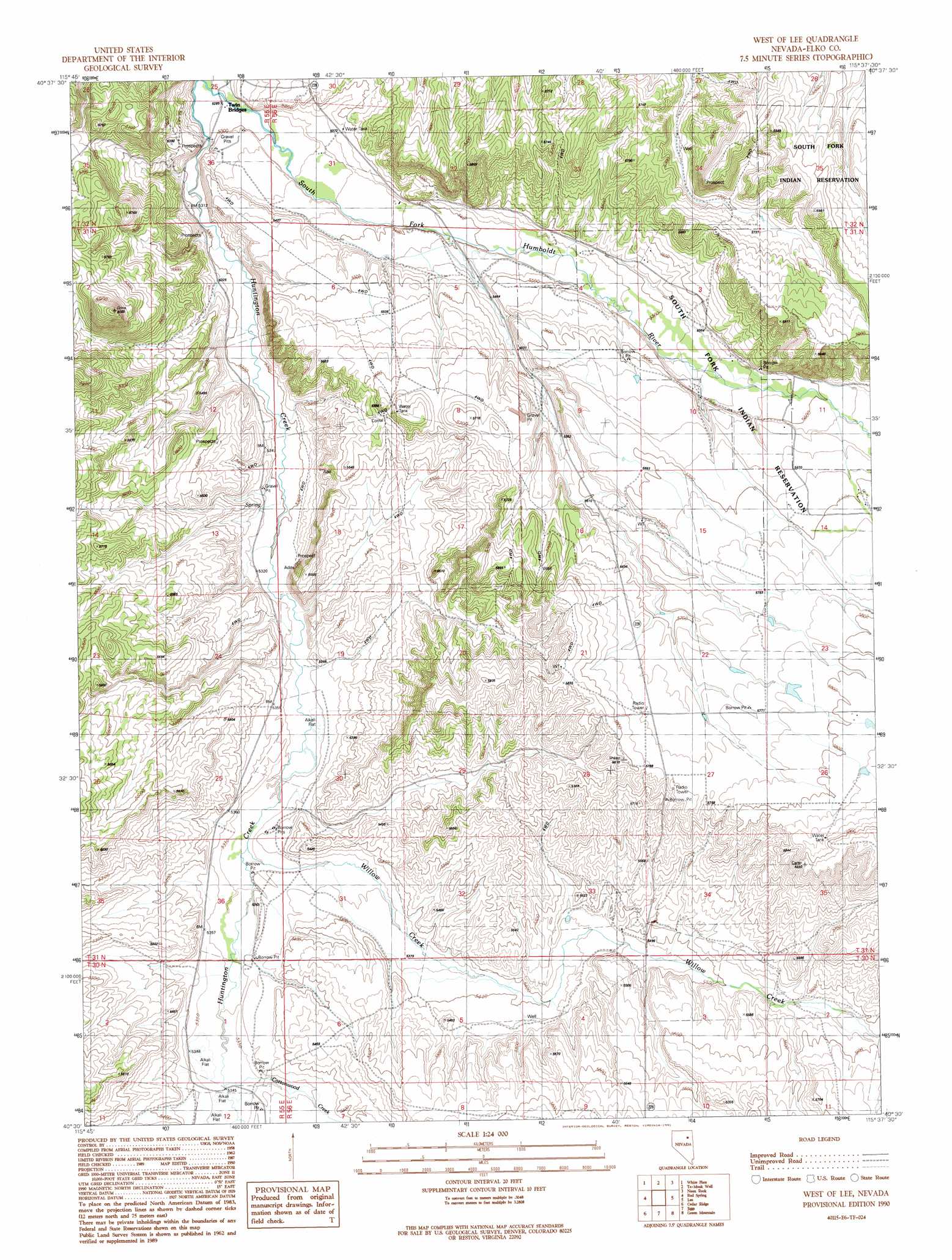
West Of Lee Topo Map Nevada
To zoom in, hover over the map of West Of Lee
USGS Topo Quad 40115e6 - 1:24,000 scale
| Topo Map Name: | West Of Lee |
| USGS Topo Quad ID: | 40115e6 |
| Print Size: | ca. 21 1/4" wide x 27" high |
| Southeast Coordinates: | 40.5° N latitude / 115.625° W longitude |
| Map Center Coordinates: | 40.5625° N latitude / 115.6875° W longitude |
| U.S. State: | NV |
| Filename: | o40115e6.jpg |
| Download Map JPG Image: | West Of Lee topo map 1:24,000 scale |
| Map Type: | Topographic |
| Topo Series: | 7.5´ |
| Map Scale: | 1:24,000 |
| Source of Map Images: | United States Geological Survey (USGS) |
| Alternate Map Versions: |
West of Lee NV 1990, updated 1991 Download PDF Buy paper map West of Lee NV 2012 Download PDF Buy paper map West of Lee NV 2014 Download PDF Buy paper map |
1:24,000 Topo Quads surrounding West Of Lee
Hunter |
Elko West |
Elko East |
Boyd Reservoir |
Halleck Sw |
Grindstone Mountain |
White Flats |
Te-Moak Well |
Noon Rock |
Lamoille |
Bullion |
Red Spring |
West Of Lee |
Lee |
Ruby Dome |
Robinson Mountain |
Cedar Ridge |
Jiggs |
Green Mountain |
Franklin Lake Nw |
Bailey Mountain |
East Of Bailey Mountain |
Frost Creek |
Harrison Pass |
Franklin Lake Sw |
> Back to 40115e1 at 1:100,000 scale
> Back to 40114a1 at 1:250,000 scale
> Back to U.S. Topo Maps home
West Of Lee topo map: Gazetteer
West Of Lee: Canals
Hankins Bellinger Ditch elevation 1656m 5433′West Of Lee: Reservoirs
Sleeman Pond elevation 1773m 5816′West Of Lee: Springs
Red Spring Number Ten elevation 1687m 5534′West Of Lee: Streams
Cottonwood Creek elevation 1629m 5344′Willow Creek elevation 1624m 5328′
West Of Lee: Wells
Smith Creek Well Number Fifty Six elevation 1630m 5347′West Of Lee digital topo map on disk
Buy this West Of Lee topo map showing relief, roads, GPS coordinates and other geographical features, as a high-resolution digital map file on DVD: