China Mountain Se Topo Map Nevada
To zoom in, hover over the map of China Mountain Se
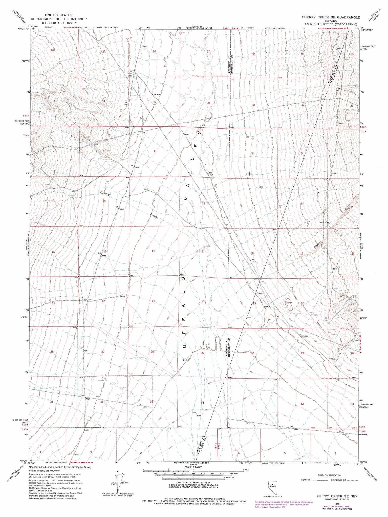
USGS Topo Quad 40117e3 - 1:24,000 scale
| Topo Map Name: | China Mountain Se |
| USGS Topo Quad ID: | 40117e3 |
| Print Size: | ca. 21 1/4" wide x 27" high |
| Southeast Coordinates: | 40.5° N latitude / 117.25° W longitude |
| Map Center Coordinates: | 40.5625° N latitude / 117.3125° W longitude |
| U.S. State: | NV |
| Filename: | o40117e3.jpg |
| Download Map JPG Image: | China Mountain Se topo map 1:24,000 scale |
| Map Type: | Topographic |
| Topo Series: | 7.5´ |
| Map Scale: | 1:24,000 |
| Source of Map Images: | United States Geological Survey (USGS) |
| Alternate Map Versions: |
Cherry Creek SE NV 1965, updated 1967 Download PDF Buy paper map Cherry Creek SE NV 1965, updated 1981 Download PDF Buy paper map Cherry Creek SE NV 2011 Download PDF Buy paper map Cherry Creek SE NV 2014 Download PDF Buy paper map |
1:24,000 Topo Quads surrounding China Mountain Se
Adelaide |
Goldrun Creek |
Brooks Spring |
Valmy |
Ellison |
Sheep Ranch Canyon |
Smelser Pass |
China Mountain Ne |
North Peak |
Snow Gulch |
Panther Canyon |
China Mountain |
China Mountain Se |
Antler Peak |
Galena |
Mount Tobin |
Buffalo Springs |
Buffalo Springs Ne |
Mccoy Nw |
Mccoy Ne |
Needle Peak |
Jersey Summit |
Wild Range Canyon |
Mccoy |
Redrock Spring |
> Back to 40117e1 at 1:100,000 scale
> Back to 40116a1 at 1:250,000 scale
> Back to U.S. Topo Maps home
China Mountain Se topo map: Gazetteer
China Mountain Se: Basins
Buffalo Valley elevation 1477m 4845′China Mountain Se: Mines
Honeycomb Mine elevation 1675m 5495′China Mountain Se: Streams
Cherry Creek elevation 1444m 4737′Timber Creek elevation 1440m 4724′
China Mountain Se digital topo map on disk
Buy this China Mountain Se topo map showing relief, roads, GPS coordinates and other geographical features, as a high-resolution digital map file on DVD: