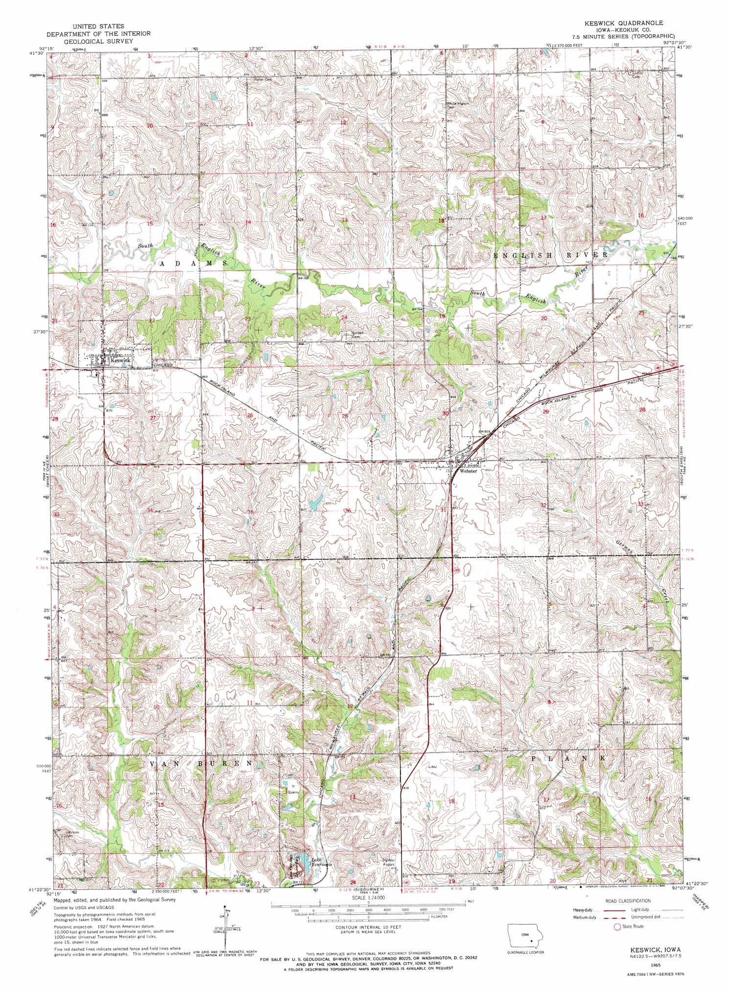
Keswick Topo Map Iowa
To zoom in, hover over the map of Keswick
USGS Topo Quad 41092d2 - 1:24,000 scale
| Topo Map Name: | Keswick |
| USGS Topo Quad ID: | 41092d2 |
| Print Size: | ca. 21 1/4" wide x 27" high |
| Southeast Coordinates: | 41.375° N latitude / 92.125° W longitude |
| Map Center Coordinates: | 41.4375° N latitude / 92.1875° W longitude |
| U.S. State: | IA |
| Filename: | o41092d2.jpg |
| Download Map JPG Image: | Keswick topo map 1:24,000 scale |
| Map Type: | Topographic |
| Topo Series: | 7.5´ |
| Map Scale: | 1:24,000 |
| Source of Map Images: | United States Geological Survey (USGS) |
| Alternate Map Versions: |
Keswick IA 1965, updated 1966 Download PDF Buy paper map Keswick IA 2010 Download PDF Buy paper map Keswick IA 2013 Download PDF Buy paper map Keswick IA 2015 Download PDF Buy paper map |
1:24,000 Topo Quads surrounding Keswick
Brooklyn |
Victor |
Williamsburg Nw |
Williamsburg |
Conroy |
Barnes City |
Deep River |
Millersburg |
North English |
Holbrook |
Gibson |
What Cheer |
Keswick |
South English |
Kinross |
Rose Hill |
Delta |
Sigourney |
Harper |
Keota |
Fremont |
Hedrick |
Pekin |
Ollie |
Richland |
> Back to 41092a1 at 1:100,000 scale
> Back to 41092a1 at 1:250,000 scale
> Back to U.S. Topo Maps home
Keswick topo map: Gazetteer
Keswick: Airports
Sig-Nor Airport elevation 248m 813′Keswick: Lakes
Lake Yenruogis elevation 226m 741′Keswick: Parks
Belva-Deer Recreation Area elevation 243m 797′Lake Yenruogis County Park elevation 234m 767′
Keswick: Populated Places
Aurora elevation 269m 882′Keswick elevation 264m 866′
Webster elevation 260m 853′
Keswick: Post Offices
Keswick Post Office elevation 266m 872′Webster Post Office elevation 260m 853′
White Pigeon Post Office (historical) elevation 265m 869′
Keswick digital topo map on disk
Buy this Keswick topo map showing relief, roads, GPS coordinates and other geographical features, as a high-resolution digital map file on DVD: