Kinross Topo Map Iowa
To zoom in, hover over the map of Kinross
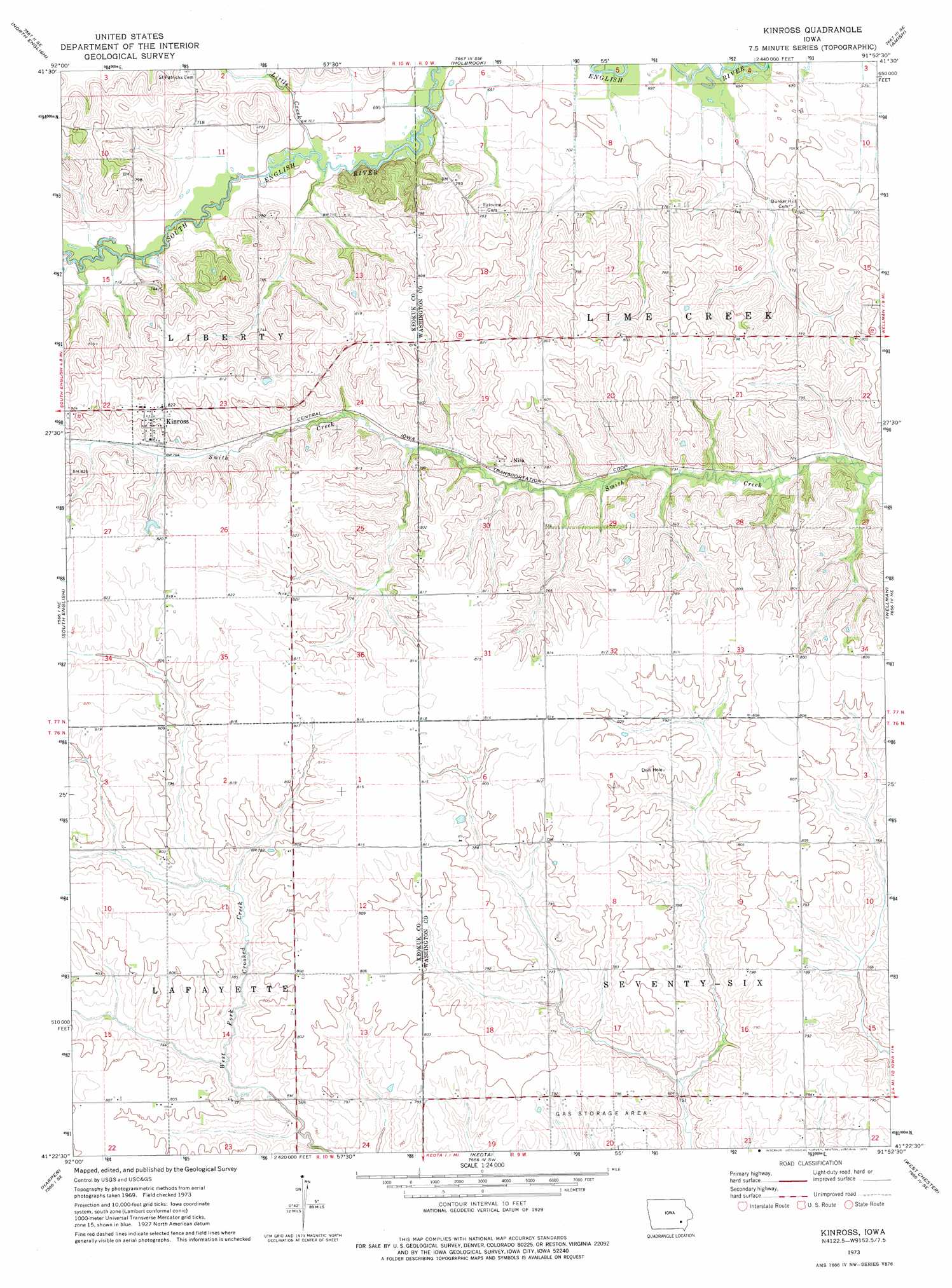
USGS Topo Quad 41091d8 - 1:24,000 scale
| Topo Map Name: | Kinross |
| USGS Topo Quad ID: | 41091d8 |
| Print Size: | ca. 21 1/4" wide x 27" high |
| Southeast Coordinates: | 41.375° N latitude / 91.875° W longitude |
| Map Center Coordinates: | 41.4375° N latitude / 91.9375° W longitude |
| U.S. State: | IA |
| Filename: | o41091d8.jpg |
| Download Map JPG Image: | Kinross topo map 1:24,000 scale |
| Map Type: | Topographic |
| Topo Series: | 7.5´ |
| Map Scale: | 1:24,000 |
| Source of Map Images: | United States Geological Survey (USGS) |
| Alternate Map Versions: |
Kinross IA 1973, updated 1975 Download PDF Buy paper map Kinross IA 2010 Download PDF Buy paper map Kinross IA 2013 Download PDF Buy paper map Kinross IA 2015 Download PDF Buy paper map |
1:24,000 Topo Quads surrounding Kinross
Williamsburg Nw |
Williamsburg |
Conroy |
Oxford |
Tiffin |
Millersburg |
North English |
Holbrook |
Amish |
Williamstown |
Keswick |
South English |
Kinross |
Wellman |
Kalona |
Sigourney |
Harper |
Keota |
West Chester |
Washington |
Pekin |
Ollie |
Richland |
Brighton |
Wayland |
> Back to 41091a1 at 1:100,000 scale
> Back to 41090a1 at 1:250,000 scale
> Back to U.S. Topo Maps home
Kinross topo map: Gazetteer
Kinross: Populated Places
Kinross elevation 251m 823′Nira elevation 239m 784′
Wassonville (historical) elevation 209m 685′
Kinross: Post Offices
Chandler Post Office (historical) elevation 246m 807′Kinross Post Office elevation 251m 823′
Nira Post Office (historical) elevation 239m 784′
Seventy Six Centre Post Office (historical) elevation 241m 790′
Kinross: Streams
Little Creek elevation 212m 695′Kinross digital topo map on disk
Buy this Kinross topo map showing relief, roads, GPS coordinates and other geographical features, as a high-resolution digital map file on DVD: