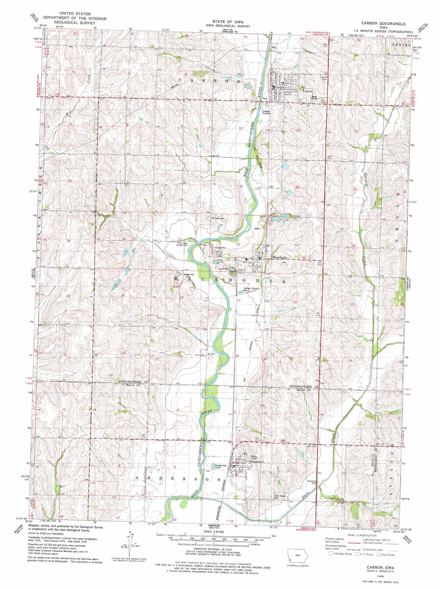
Carson Topo Map Iowa
To zoom in, hover over the map of Carson
USGS Topo Quad 41095b4 - 1:24,000 scale
| Topo Map Name: | Carson |
| USGS Topo Quad ID: | 41095b4 |
| Print Size: | ca. 21 1/4" wide x 27" high |
| Southeast Coordinates: | 41.125° N latitude / 95.375° W longitude |
| Map Center Coordinates: | 41.1875° N latitude / 95.4375° W longitude |
| U.S. State: | IA |
| Filename: | o41095b4.jpg |
| Download Map JPG Image: | Carson topo map 1:24,000 scale |
| Map Type: | Topographic |
| Topo Series: | 7.5´ |
| Map Scale: | 1:24,000 |
| Source of Map Images: | United States Geological Survey (USGS) |
| Alternate Map Versions: |
Carson IA 1978, updated 1978 Download PDF Buy paper map Carson IA 2010 Download PDF Buy paper map Carson IA 2013 Download PDF Buy paper map Carson IA 2015 Download PDF Buy paper map |
1:24,000 Topo Quads surrounding Carson
Underwood |
Neola |
Avoca Nw |
Avoca |
Walnut |
Mcclelland |
Taylor |
Oakland |
Avoca Se |
Atlantic Sw |
Mineola |
Treynor |
Carson |
Carson Ne |
Griswold |
Glenwood |
Malvern |
Emerson |
Walles |
Red Oak North |
Tabor |
Tabor Ne |
Imogene |
Coburg |
Red Oak South |
> Back to 41095a1 at 1:100,000 scale
> Back to 41094a1 at 1:250,000 scale
> Back to U.S. Topo Maps home
Carson topo map: Gazetteer
Carson: Mines
Macedonia Quarry elevation 328m 1076′Carson: Parks
Olde Town County Park elevation 318m 1043′Carson: Populated Places
Carson elevation 351m 1151′Henderson elevation 318m 1043′
Macedonia elevation 340m 1115′
Carson: Post Offices
Carson Post Office elevation 351m 1151′Henderson Post Office elevation 320m 1049′
Macedonia Post Office (historical) elevation 329m 1079′
Carson: Streams
Farm Creek elevation 311m 1020′Graybill Creek elevation 321m 1053′
Carson digital topo map on disk
Buy this Carson topo map showing relief, roads, GPS coordinates and other geographical features, as a high-resolution digital map file on DVD: