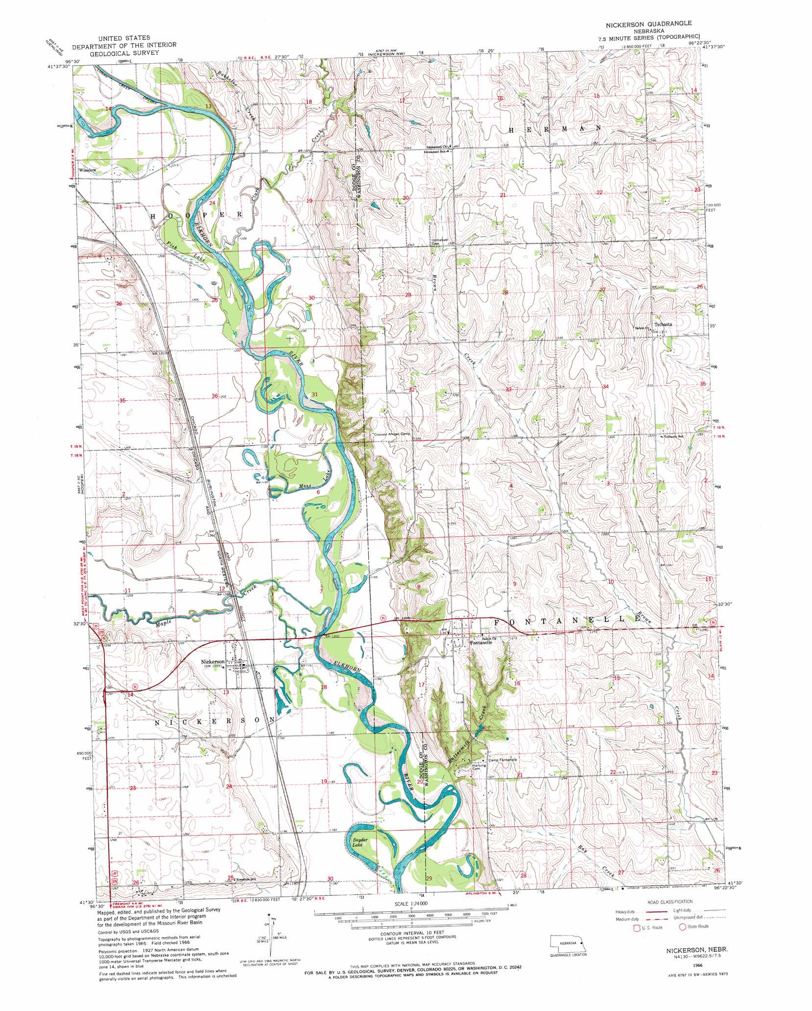
Nickerson Topo Map Nebraska
To zoom in, hover over the map of Nickerson
USGS Topo Quad 41096e4 - 1:24,000 scale
| Topo Map Name: | Nickerson |
| USGS Topo Quad ID: | 41096e4 |
| Print Size: | ca. 21 1/4" wide x 27" high |
| Southeast Coordinates: | 41.5° N latitude / 96.375° W longitude |
| Map Center Coordinates: | 41.5625° N latitude / 96.4375° W longitude |
| U.S. State: | NE |
| Filename: | O41096E4.jpg |
| Download Map JPG Image: | Nickerson topo map 1:24,000 scale |
| Map Type: | Topographic |
| Topo Series: | 7.5´ |
| Map Scale: | 1:24,000 |
| Source of Map Images: | United States Geological Survey (USGS) |
| Alternate Map Versions: |
Nickerson NE 1966, updated 1967 Download PDF Buy paper map Nickerson NE 2011 Download PDF Buy paper map Nickerson NE 2014 Download PDF Buy paper map |
1:24,000 Topo Quads surrounding Nickerson
West Point |
West Point Se |
Oakland |
Craig |
Tekamah |
Scribner |
Uehling |
Nickerson Nw |
Nickerson Ne |
Herman |
Scribner Sw |
Hooper |
Nickerson |
Orum |
Blair |
Malmo Nw |
Fremont West |
Fremont East |
Arlington |
Kennard |
Malmo |
Colon |
Leshara |
Valley |
Elkhorn |
> Back to 41096e1 at 1:100,000 scale
> Back to 41096a1 at 1:250,000 scale
> Back to U.S. Topo Maps home
Nickerson topo map: Gazetteer
Nickerson: Lakes
Fish Lake elevation 366m 1200′Moss Lake elevation 363m 1190′
Snyder Lake elevation 358m 1174′
Nickerson: Populated Places
Fontanelle elevation 410m 1345′Green Acres Mobile Home Community elevation 366m 1200′
Nickerson elevation 366m 1200′
Telbasta elevation 401m 1315′
Nickerson: Post Offices
Fontanelle Post Office (historical) elevation 410m 1345′Nickerson Post Office elevation 366m 1200′
Telbasta Post Office (historical) elevation 401m 1315′
Nickerson: Streams
Bachelor Creek elevation 370m 1213′Buttermilk Creek elevation 360m 1181′
Clark Creek elevation 363m 1190′
Maple Creek elevation 359m 1177′
Nickerson digital topo map on disk
Buy this Nickerson topo map showing relief, roads, GPS coordinates and other geographical features, as a high-resolution digital map file on DVD: