Nickerson Ne Topo Map Nebraska
To zoom in, hover over the map of Nickerson Ne
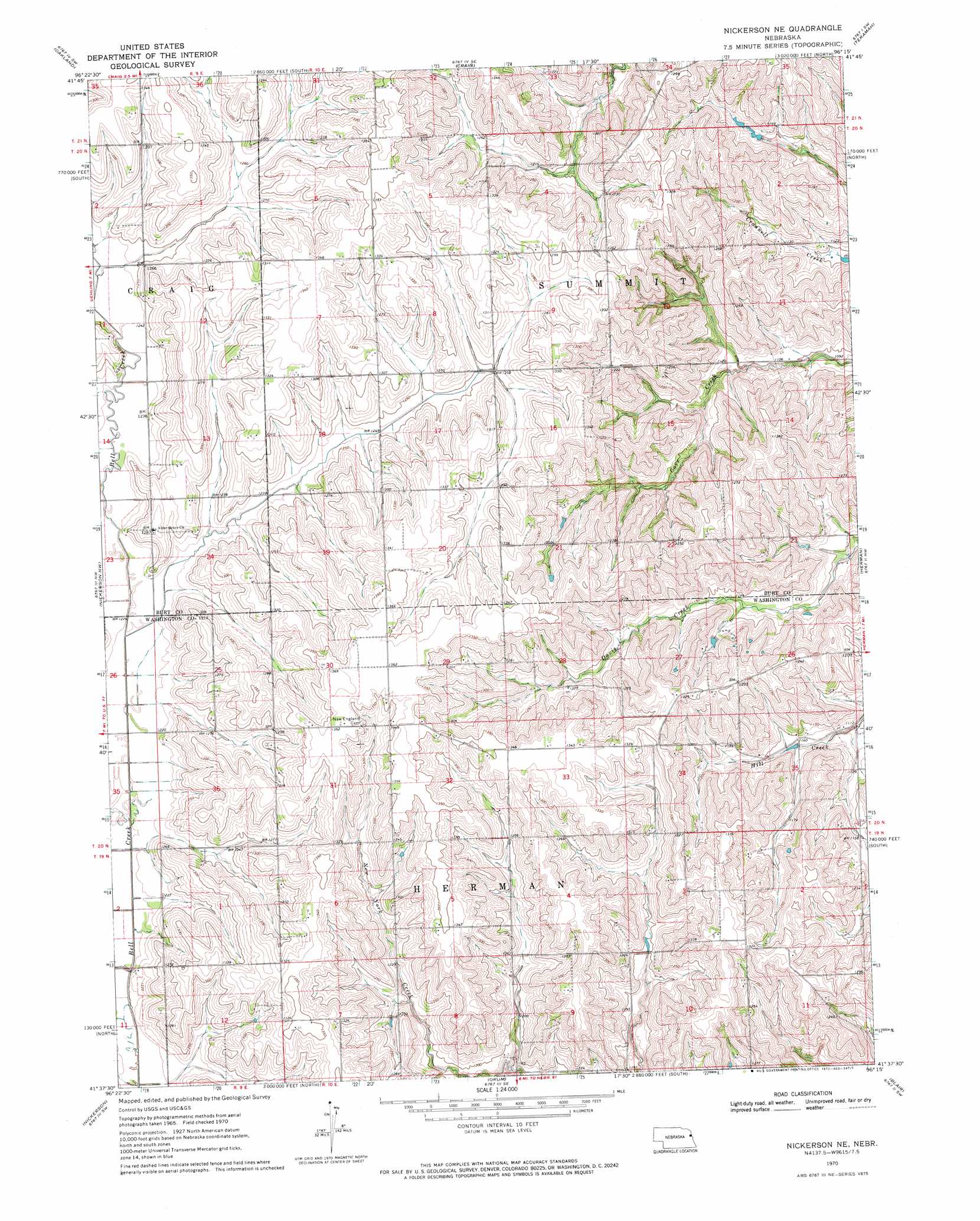
USGS Topo Quad 41096f3 - 1:24,000 scale
| Topo Map Name: | Nickerson Ne |
| USGS Topo Quad ID: | 41096f3 |
| Print Size: | ca. 21 1/4" wide x 27" high |
| Southeast Coordinates: | 41.625° N latitude / 96.25° W longitude |
| Map Center Coordinates: | 41.6875° N latitude / 96.3125° W longitude |
| U.S. State: | NE |
| Filename: | O41096F3.jpg |
| Download Map JPG Image: | Nickerson Ne topo map 1:24,000 scale |
| Map Type: | Topographic |
| Topo Series: | 7.5´ |
| Map Scale: | 1:24,000 |
| Source of Map Images: | United States Geological Survey (USGS) |
| Alternate Map Versions: |
Nickerson NE NE 1970, updated 1972 Download PDF Buy paper map Nickerson NE NE 2011 Download PDF Buy paper map Nickerson NE NE 2014 Download PDF Buy paper map |
1:24,000 Topo Quads surrounding Nickerson Ne
West Point Ne |
Lyons |
Bertha |
Tekamah Nw |
Blencoe |
West Point Se |
Oakland |
Craig |
Tekamah |
Little Sioux |
Uehling |
Nickerson Nw |
Nickerson Ne |
Herman |
Mondamin |
Hooper |
Nickerson |
Orum |
Blair |
Modale |
Fremont West |
Fremont East |
Arlington |
Kennard |
Fort Calhoun |
> Back to 41096e1 at 1:100,000 scale
> Back to 41096a1 at 1:250,000 scale
> Back to U.S. Topo Maps home
Nickerson Ne topo map: Gazetteer
Nickerson Ne: Dams
Behrendt Dam elevation 364m 1194′Skinner Dam elevation 344m 1128′
Nickerson Ne: Post Offices
Alder Grove Post Office (historical) elevation 391m 1282′Nickerson Ne: Reservoirs
Behrendt Reservoir elevation 364m 1194′Skinner Reservoir elevation 344m 1128′
Nickerson Ne digital topo map on disk
Buy this Nickerson Ne topo map showing relief, roads, GPS coordinates and other geographical features, as a high-resolution digital map file on DVD: