Genoa Topo Map Nebraska
To zoom in, hover over the map of Genoa
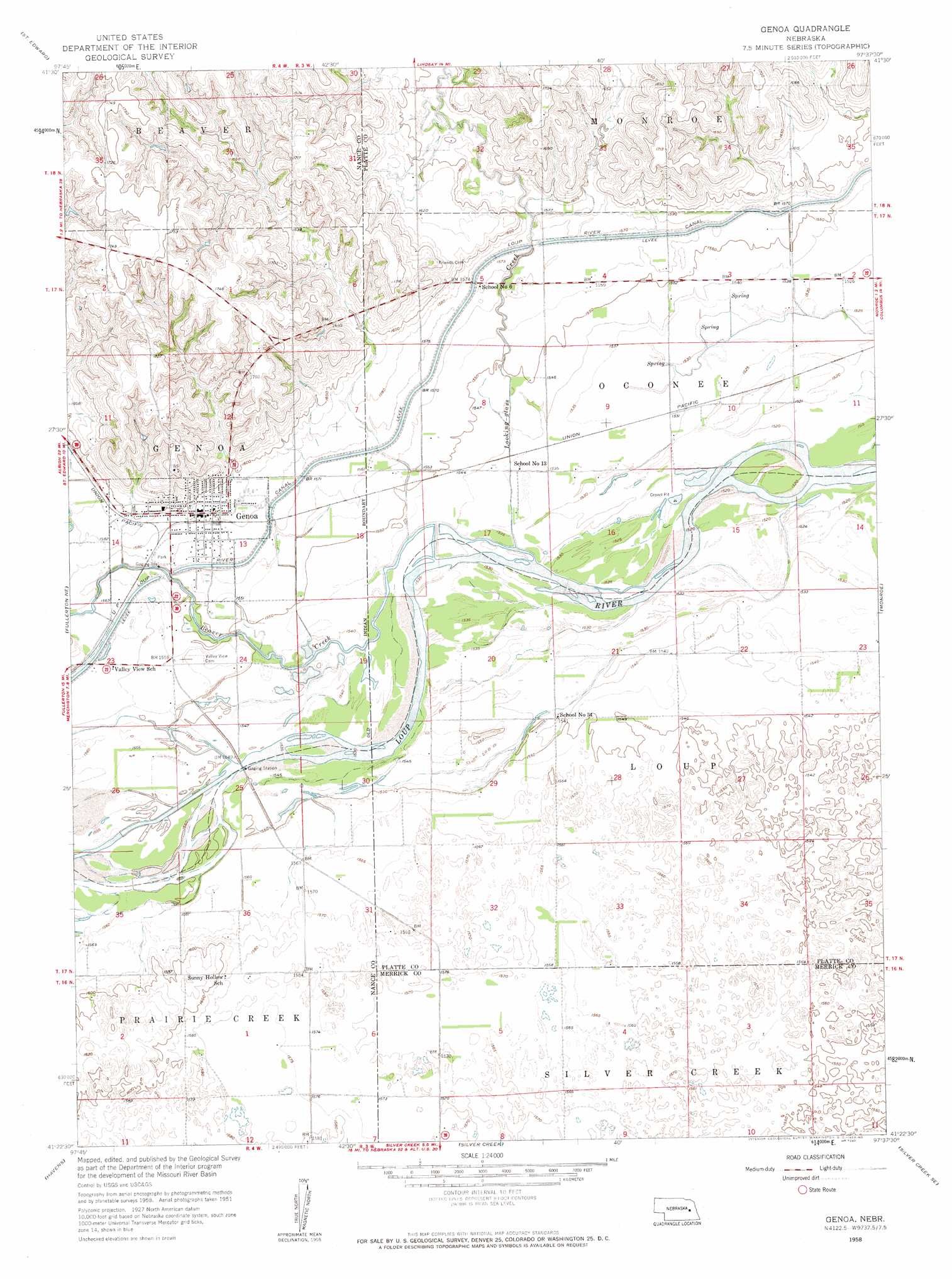
USGS Topo Quad 41097d6 - 1:24,000 scale
| Topo Map Name: | Genoa |
| USGS Topo Quad ID: | 41097d6 |
| Print Size: | ca. 21 1/4" wide x 27" high |
| Southeast Coordinates: | 41.375° N latitude / 97.625° W longitude |
| Map Center Coordinates: | 41.4375° N latitude / 97.6875° W longitude |
| U.S. State: | NE |
| Filename: | O41097D6.jpg |
| Download Map JPG Image: | Genoa topo map 1:24,000 scale |
| Map Type: | Topographic |
| Topo Series: | 7.5´ |
| Map Scale: | 1:24,000 |
| Source of Map Images: | United States Geological Survey (USGS) |
| Alternate Map Versions: |
Genoa NE 1958, updated 1959 Download PDF Buy paper map Genoa NE 2011 Download PDF Buy paper map Genoa NE 2014 Download PDF Buy paper map |
1:24,000 Topo Quads surrounding Genoa
Albion East |
Newman Grove |
Lindsay |
Cornlea |
Humphrey |
Saint Edward Sw |
Saint Edward |
Lindsay Sw |
Tarnov |
Platte Center |
Merchiston |
Fullerton Ne |
Genoa |
Monroe |
Duncan |
Fullerton |
Havens |
Silver Creek |
Silver Creek Se |
Columbus Sw |
Polk Nw |
Clarks |
Swedehome |
Osceola |
Shelby |
> Back to 41097a1 at 1:100,000 scale
> Back to 41096a1 at 1:250,000 scale
> Back to U.S. Topo Maps home
Genoa topo map: Gazetteer
Genoa: Airports
Genoa Municipal Airport elevation 478m 1568′Genoa: Parks
Genoa City Park elevation 480m 1574′Genoa Mormon Colony 1857-1859 Historical Marker elevation 480m 1574′
George Syas State Wildlife Management Area elevation 467m 1532′
Pawnee Historical Marker elevation 480m 1574′
Prairie Wolf State Wildlife Management Area elevation 475m 1558′
Genoa: Populated Places
Genoa elevation 483m 1584′Genoa: Post Offices
Genoa Post Office elevation 484m 1587′Genoa: Streams
Beaver Creek elevation 467m 1532′Looking Glass Creek elevation 467m 1532′
Genoa digital topo map on disk
Buy this Genoa topo map showing relief, roads, GPS coordinates and other geographical features, as a high-resolution digital map file on DVD: