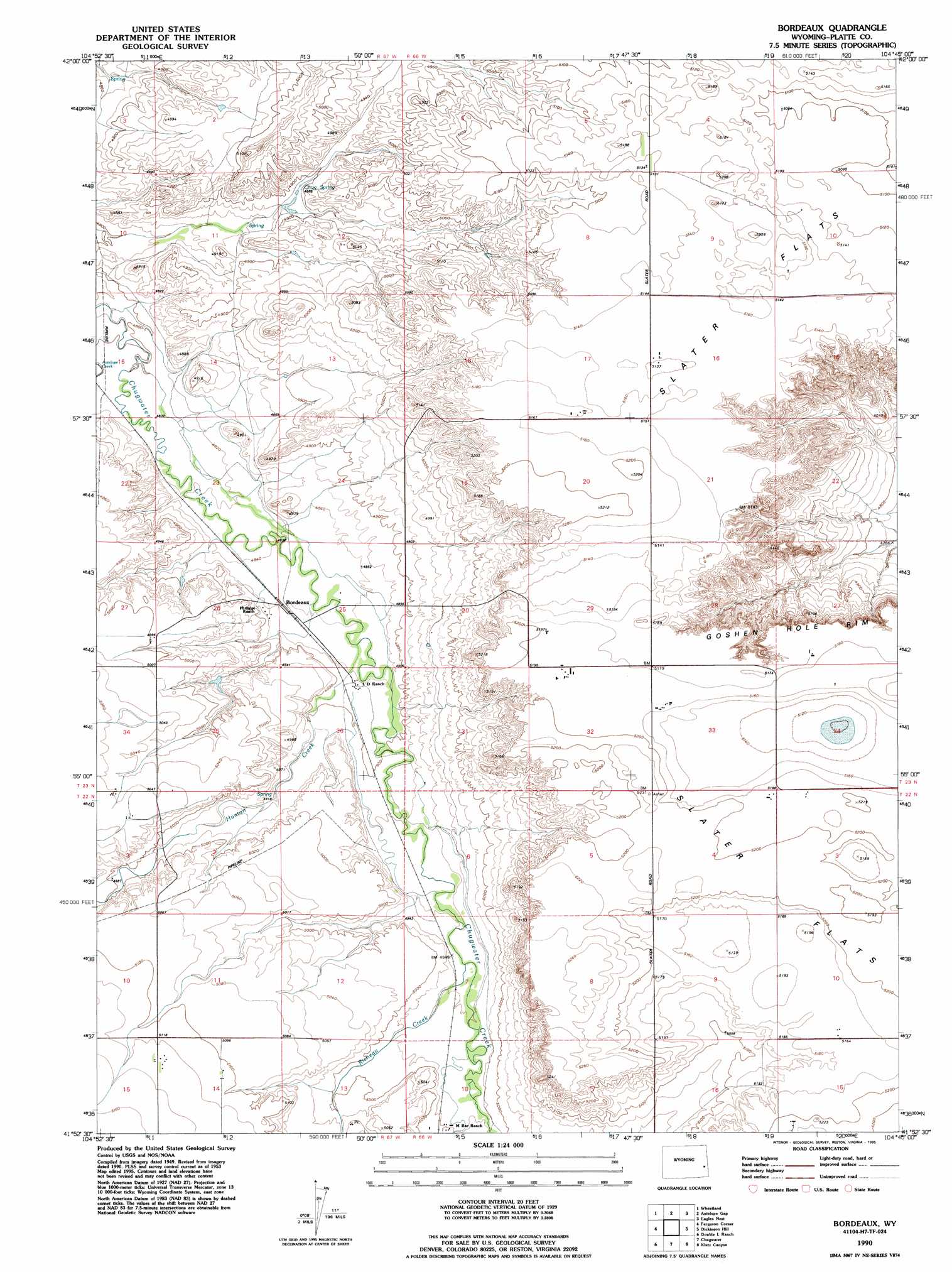
Bordeaux Topo Map Wyoming
To zoom in, hover over the map of Bordeaux
USGS Topo Quad 41104h7 - 1:24,000 scale
| Topo Map Name: | Bordeaux |
| USGS Topo Quad ID: | 41104h7 |
| Print Size: | ca. 21 1/4" wide x 27" high |
| Southeast Coordinates: | 41.875° N latitude / 104.75° W longitude |
| Map Center Coordinates: | 41.9375° N latitude / 104.8125° W longitude |
| U.S. State: | WY |
| Filename: | o41104h7.jpg |
| Download Map JPG Image: | Bordeaux topo map 1:24,000 scale |
| Map Type: | Topographic |
| Topo Series: | 7.5´ |
| Map Scale: | 1:24,000 |
| Source of Map Images: | United States Geological Survey (USGS) |
| Alternate Map Versions: |
Bordeaux WY 1953, updated 1954 Download PDF Buy paper map Bordeaux WY 1953, updated 1977 Download PDF Buy paper map Bordeaux WY 1990, updated 1995 Download PDF Buy paper map Bordeaux WY 2012 Download PDF Buy paper map Bordeaux WY 2015 Download PDF Buy paper map |
1:24,000 Topo Quads surrounding Bordeaux
Lewis Flat |
Dwyer |
Wheatland Ne |
Register Cliff |
Fort Laramie |
Hightower |
Wheatland |
Antelope Gap |
Eagles Nest |
Rock Eagle |
Natwick |
Ferguson Corner |
Bordeaux |
Dickinson Hill |
Glomill Reservoir |
Richeau Hills |
Double L Ranch |
Chugwater |
Klutz Canyon |
Y B O Ranch |
Mcdonald Ranch |
Whitcomb Hill |
Bristol Ridge Ne |
C S Ranch |
Cattail Ranch Ne |
> Back to 41104e1 at 1:100,000 scale
> Back to 41104a1 at 1:250,000 scale
> Back to U.S. Topo Maps home
Bordeaux topo map: Gazetteer
Bordeaux: Canals
Big Meadow Ditch elevation 1499m 4917′Bordeaux Ditch elevation 1514m 4967′
Bordeaux: Dams
Clearwater Dam elevation 1510m 4954′Hal Dam elevation 1508m 4947′
Hal Number 2 Dam elevation 1525m 5003′
Ken Number 1 Dam elevation 1525m 5003′
Pump Dam elevation 1508m 4947′
Wyatt Number 2 Dam elevation 1571m 5154′
Bordeaux: Flats
Slater Flats elevation 1585m 5200′Bordeaux: Populated Places
Bordeaux elevation 1482m 4862′Bordeaux: Reservoirs
Clearwater Reservoir elevation 1510m 4954′Hal Number 2 Reservoir elevation 1525m 5003′
Hal Reservoir elevation 1508m 4947′
Ken Number 1 Reservoir elevation 1525m 5003′
Pump Reservoir elevation 1508m 4947′
Wyatt Reservoir Number 2 elevation 1571m 5154′
Bordeaux: Springs
Chug Spring elevation 1492m 4895′Bordeaux: Streams
Hunton Creek elevation 1484m 4868′Richeau Creek elevation 1509m 4950′
Bordeaux digital topo map on disk
Buy this Bordeaux topo map showing relief, roads, GPS coordinates and other geographical features, as a high-resolution digital map file on DVD:
Eastern Wyoming & Western South Dakota
Buy digital topo maps: Eastern Wyoming & Western South Dakota