Opal Topo Map Wyoming
To zoom in, hover over the map of Opal
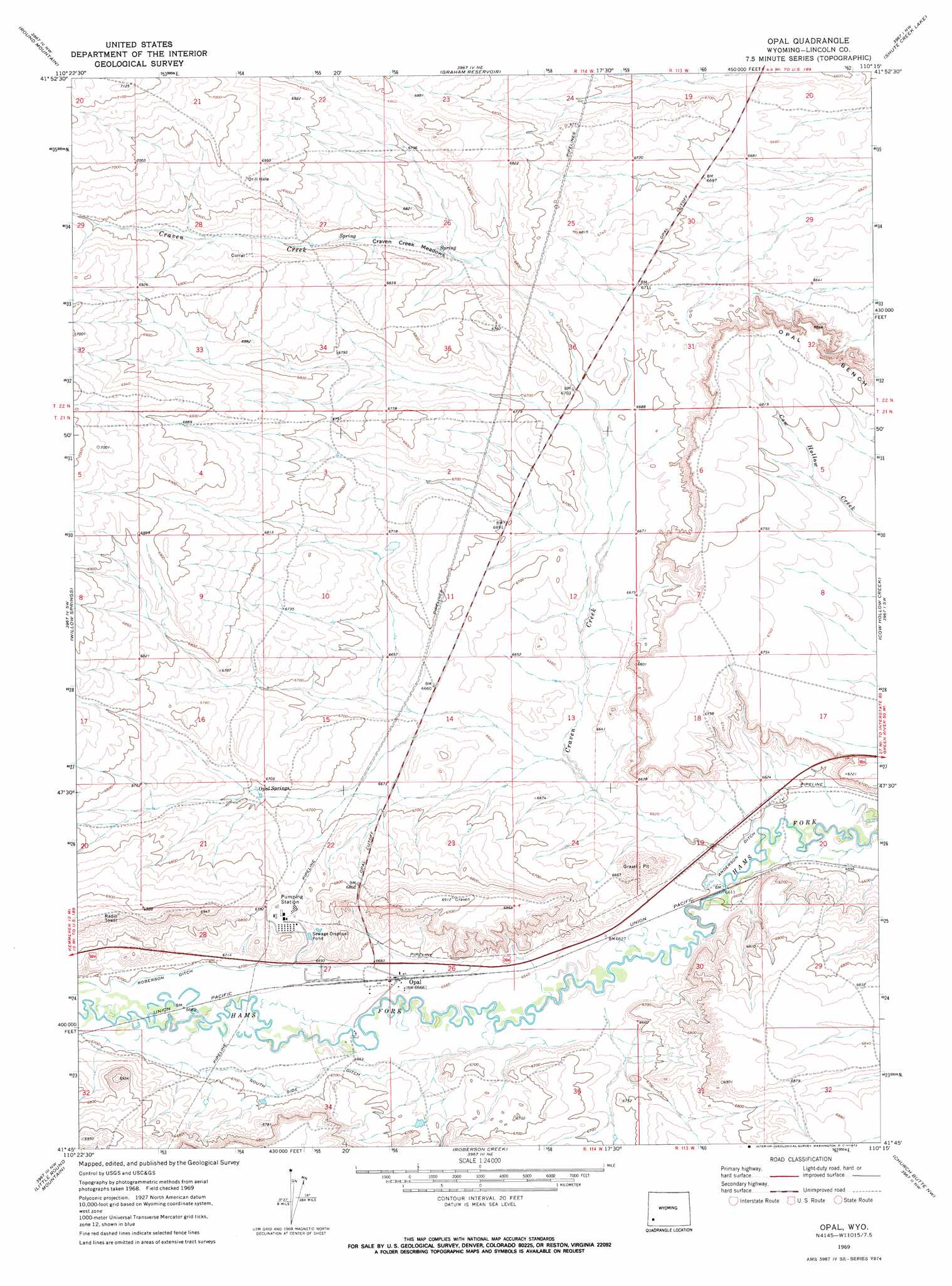
USGS Topo Quad 41110g3 - 1:24,000 scale
| Topo Map Name: | Opal |
| USGS Topo Quad ID: | 41110g3 |
| Print Size: | ca. 21 1/4" wide x 27" high |
| Southeast Coordinates: | 41.75° N latitude / 110.25° W longitude |
| Map Center Coordinates: | 41.8125° N latitude / 110.3125° W longitude |
| U.S. State: | WY |
| Filename: | o41110g3.jpg |
| Download Map JPG Image: | Opal topo map 1:24,000 scale |
| Map Type: | Topographic |
| Topo Series: | 7.5´ |
| Map Scale: | 1:24,000 |
| Source of Map Images: | United States Geological Survey (USGS) |
| Alternate Map Versions: |
Opal WY 1969, updated 1972 Download PDF Buy paper map Opal WY 1969, updated 1972 Download PDF Buy paper map Opal WY 2012 Download PDF Buy paper map Opal WY 2015 Download PDF Buy paper map |
1:24,000 Topo Quads surrounding Opal
South Fork Mountain |
Fontenelle Gap |
The Palisades |
Fontenelle Reservoir Sw |
Fontenelle Reservoir Se |
Sublet |
Round Mountain |
Graham Reservoir |
Shute Creek Lake |
Fontenelle |
Kemmerer |
Willow Springs |
Opal |
Cow Hollow Creek |
Fontenelle Se |
Elkol |
Little Round Mountain |
Roberson Creek |
Church Butte Nw |
Moxa |
Cumberland Gap |
Mulkay Spring |
Hampton |
Church Butte |
Verne |
> Back to 41110e1 at 1:100,000 scale
> Back to 41110a1 at 1:250,000 scale
> Back to U.S. Topo Maps home
Opal topo map: Gazetteer
Opal: Canals
Anderson Ditch elevation 2012m 6601′Kidman Well Canal elevation 2032m 6666′
Roberson Ditch elevation 2043m 6702′
South Side Ditch elevation 2041m 6696′
Opal: Flats
Craven Creek Meadows elevation 2062m 6765′Opal: Populated Places
Opal elevation 2033m 6669′Opal: Springs
Opal Springs elevation 2042m 6699′Opal: Streams
Craven Creek elevation 2012m 6601′Opal digital topo map on disk
Buy this Opal topo map showing relief, roads, GPS coordinates and other geographical features, as a high-resolution digital map file on DVD: