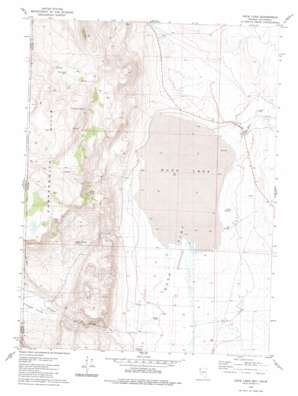
Duck Lake Topo Map Nevada
To zoom in, hover over the map of Duck Lake
USGS Topo Quad 41119a8 - 1:24,000 scale
| Topo Map Name: | Duck Lake |
| USGS Topo Quad ID: | 41119a8 |
| Print Size: | ca. 21 1/4" wide x 27" high |
| Southeast Coordinates: | 41° N latitude / 119.875° W longitude |
| Map Center Coordinates: | 41.0625° N latitude / 119.9375° W longitude |
| U.S. States: | NV, CA |
| Filename: | o41119a8.jpg |
| Download Map JPG Image: | Duck Lake topo map 1:24,000 scale |
| Map Type: | Topographic |
| Topo Series: | 7.5´ |
| Map Scale: | 1:24,000 |
| Source of Map Images: | United States Geological Survey (USGS) |
| Alternate Map Versions: |
Duck Lake NV 1979, updated 1980 Download PDF Buy paper map Duck Lake NV 1979, updated 1980 Download PDF Buy paper map Duck Lake NV 2011 Download PDF Buy paper map Duck Lake NV 2015 Download PDF Buy paper map |
1:24,000 Topo Quads surrounding Duck Lake
> Back to 41119a1 at 1:100,000 scale
> Back to 41118a1 at 1:250,000 scale
> Back to U.S. Topo Maps home
Duck Lake topo map: Gazetteer
Duck Lake: Basins
Tuledad Valley elevation 1516m 4973′Duck Lake: Flats
Duck Flat elevation 1436m 4711′Duck Lake elevation 1429m 4688′
Duck Lake: Post Offices
Sunkist Post Office (historical) elevation 1436m 4711′Duck Lake: Springs
Apple Orchard Spring elevation 1581m 5187′Big Pothole elevation 1432m 4698′
Cocklebur Spring elevation 1805m 5921′
Little Potholes elevation 1432m 4698′
Mason Spring elevation 1646m 5400′
Willow Spring elevation 1506m 4940′
Duck Lake: Streams
Duck Flat Wash elevation 1430m 4691′Lost Creek elevation 1440m 4724′
Tuledad Creek elevation 1431m 4694′
Wall Creek elevation 1430m 4691′
Duck Lake: Valleys
Tuledad Valley elevation 1515m 4970′Duck Lake digital topo map on disk
Buy this Duck Lake topo map showing relief, roads, GPS coordinates and other geographical features, as a high-resolution digital map file on DVD:


