Dunkirk Topo Map New York
To zoom in, hover over the map of Dunkirk
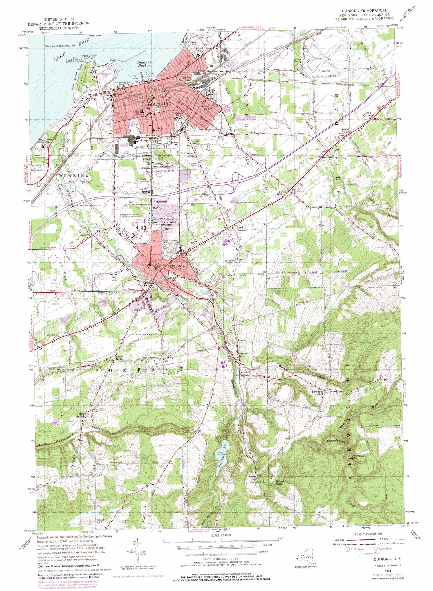
USGS Topo Quad 42079d3 - 1:24,000 scale
| Topo Map Name: | Dunkirk |
| USGS Topo Quad ID: | 42079d3 |
| Print Size: | ca. 21 1/4" wide x 27" high |
| Southeast Coordinates: | 42.375° N latitude / 79.25° W longitude |
| Map Center Coordinates: | 42.4375° N latitude / 79.3125° W longitude |
| U.S. State: | NY |
| Filename: | o42079d3.jpg |
| Download Map JPG Image: | Dunkirk topo map 1:24,000 scale |
| Map Type: | Topographic |
| Topo Series: | 7.5´ |
| Map Scale: | 1:24,000 |
| Source of Map Images: | United States Geological Survey (USGS) |
| Alternate Map Versions: |
Dunkirk NY 1954, updated 1956 Download PDF Buy paper map Dunkirk NY 1954, updated 1956 Download PDF Buy paper map Dunkirk NY 1954, updated 1979 Download PDF Buy paper map Dunkirk NY 2010 Download PDF Buy paper map Dunkirk NY 2013 Download PDF Buy paper map Dunkirk NY 2016 Download PDF Buy paper map |
1:24,000 Topo Quads surrounding Dunkirk
Angola |
||||
North Of Dunkirk |
Silver Creek |
Farnham |
||
Brocton |
Dunkirk |
Forestville |
Perrysburg |
|
Westfield |
Hartfield |
Cassadaga |
Hamlet |
Cherry Creek |
Sherman |
Chautauqua |
Ellery Center |
Gerry |
Kennedy |
> Back to 42079a1 at 1:100,000 scale
> Back to 42078a1 at 1:250,000 scale
> Back to U.S. Topo Maps home
Dunkirk topo map: Gazetteer
Dunkirk: Airports
Chautauqua County-Dunkirk Airport elevation 206m 675′Dunkirk: Beaches
Dunkirk Beach elevation 176m 577′Point Gratiot Beach elevation 176m 577′
Wright Park Beach elevation 174m 570′
Dunkirk: Capes
Point Gratiot elevation 177m 580′Dunkirk: Channels
Grace Lutheran Church elevation 191m 626′Dunkirk: Falls
Arkwright Falls elevation 363m 1190′Shumla Falls elevation 309m 1013′
Dunkirk: Harbors
Dunkirk Harbor elevation 174m 570′Dunkirk: Parks
Holton Park elevation 238m 780′Point Gratiot Park elevation 178m 583′
University Stadium elevation 204m 669′
Washington Park elevation 185m 606′
Wright Park elevation 180m 590′
Dunkirk: Populated Places
Cook Corners elevation 229m 751′Cordova elevation 201m 659′
Cowdens Corner elevation 387m 1269′
Dunkirk elevation 188m 616′
Fredonia elevation 220m 721′
Laona elevation 259m 849′
McCenithans Mobile Home Park elevation 230m 754′
Reed Corners elevation 232m 761′
Shumla elevation 299m 980′
Dunkirk: Reservoirs
Fredonia Reservoir elevation 316m 1036′Dunkirk: Streams
Beaver Creek elevation 180m 590′Canadaway Creek elevation 174m 570′
Crooked Brook elevation 174m 570′
Hyde Creek elevation 182m 597′
Dunkirk: Valleys
Ball Gulf elevation 348m 1141′Dutch Hollow elevation 250m 820′
Dunkirk digital topo map on disk
Buy this Dunkirk topo map showing relief, roads, GPS coordinates and other geographical features, as a high-resolution digital map file on DVD:
 map DVD")