Clarksville Topo Map Iowa
To zoom in, hover over the map of Clarksville
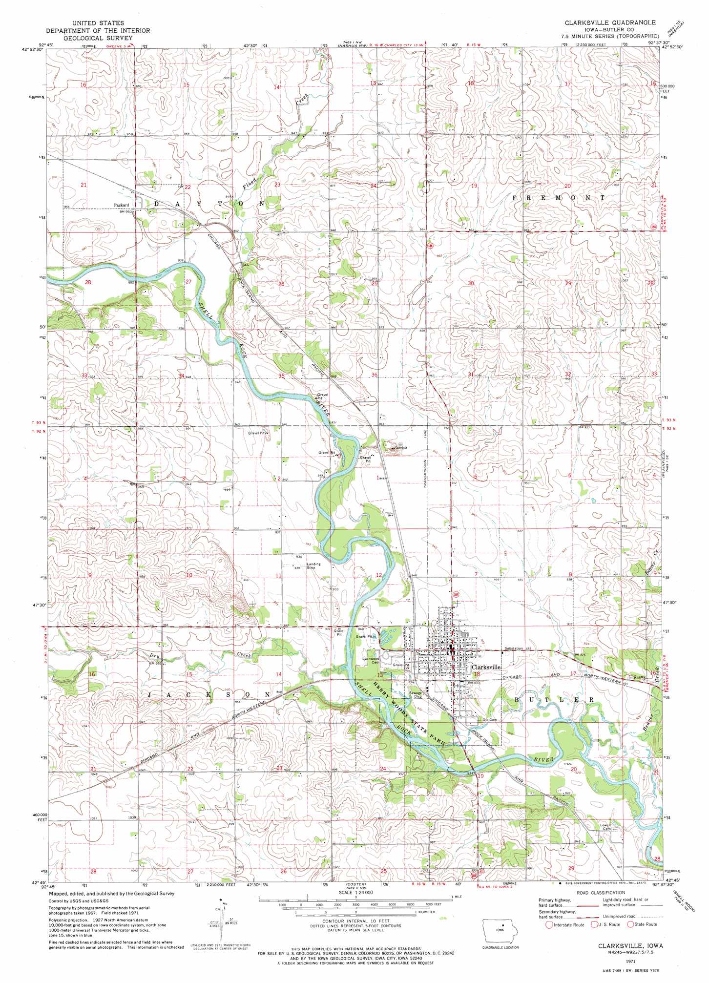
USGS Topo Quad 42092g6 - 1:24,000 scale
| Topo Map Name: | Clarksville |
| USGS Topo Quad ID: | 42092g6 |
| Print Size: | ca. 21 1/4" wide x 27" high |
| Southeast Coordinates: | 42.75° N latitude / 92.625° W longitude |
| Map Center Coordinates: | 42.8125° N latitude / 92.6875° W longitude |
| U.S. State: | IA |
| Filename: | o42092g6.jpg |
| Download Map JPG Image: | Clarksville topo map 1:24,000 scale |
| Map Type: | Topographic |
| Topo Series: | 7.5´ |
| Map Scale: | 1:24,000 |
| Source of Map Images: | United States Geological Survey (USGS) |
| Alternate Map Versions: |
Clarksville IA 1971, updated 1973 Download PDF Buy paper map Clarksville IA 2010 Download PDF Buy paper map Clarksville IA 2013 Download PDF Buy paper map Clarksville IA 2015 Download PDF Buy paper map |
1:24,000 Topo Quads surrounding Clarksville
Rockford |
Roseville |
Charles City |
Bassett |
Ionia |
Aureola |
Greene |
Nashua Nw |
Nashua |
Tripoli Nw |
Dumont North |
Allison |
Clarksville |
Plainfield |
Bremer |
Dumont South |
Butler Center |
Coster |
Shell Rock |
Waverly |
Aplington |
Parkersburg |
Stout |
New Hartford |
Cedar Falls |
> Back to 42092e1 at 1:100,000 scale
> Back to 42092a1 at 1:250,000 scale
> Back to U.S. Topo Maps home
Clarksville topo map: Gazetteer
Clarksville: Parks
Heery Woods State Park elevation 282m 925′Sportsmans Park elevation 284m 931′
Wolters Prairie Preserve elevation 293m 961′
Clarksville: Populated Places
Clarksville elevation 287m 941′Packard elevation 290m 951′
Clarksville: Post Offices
Clarksville Post Office elevation 287m 941′Packard Post Office (historical) elevation 290m 951′
Roots Siding Post Office (historical) elevation 292m 958′
Clarksville: Streams
Beaver Creek elevation 277m 908′Dry Creek elevation 280m 918′
Flood Creek elevation 283m 928′
Schuyler Creek elevation 290m 951′
Clarksville digital topo map on disk
Buy this Clarksville topo map showing relief, roads, GPS coordinates and other geographical features, as a high-resolution digital map file on DVD: