Sumner Topo Map Iowa
To zoom in, hover over the map of Sumner
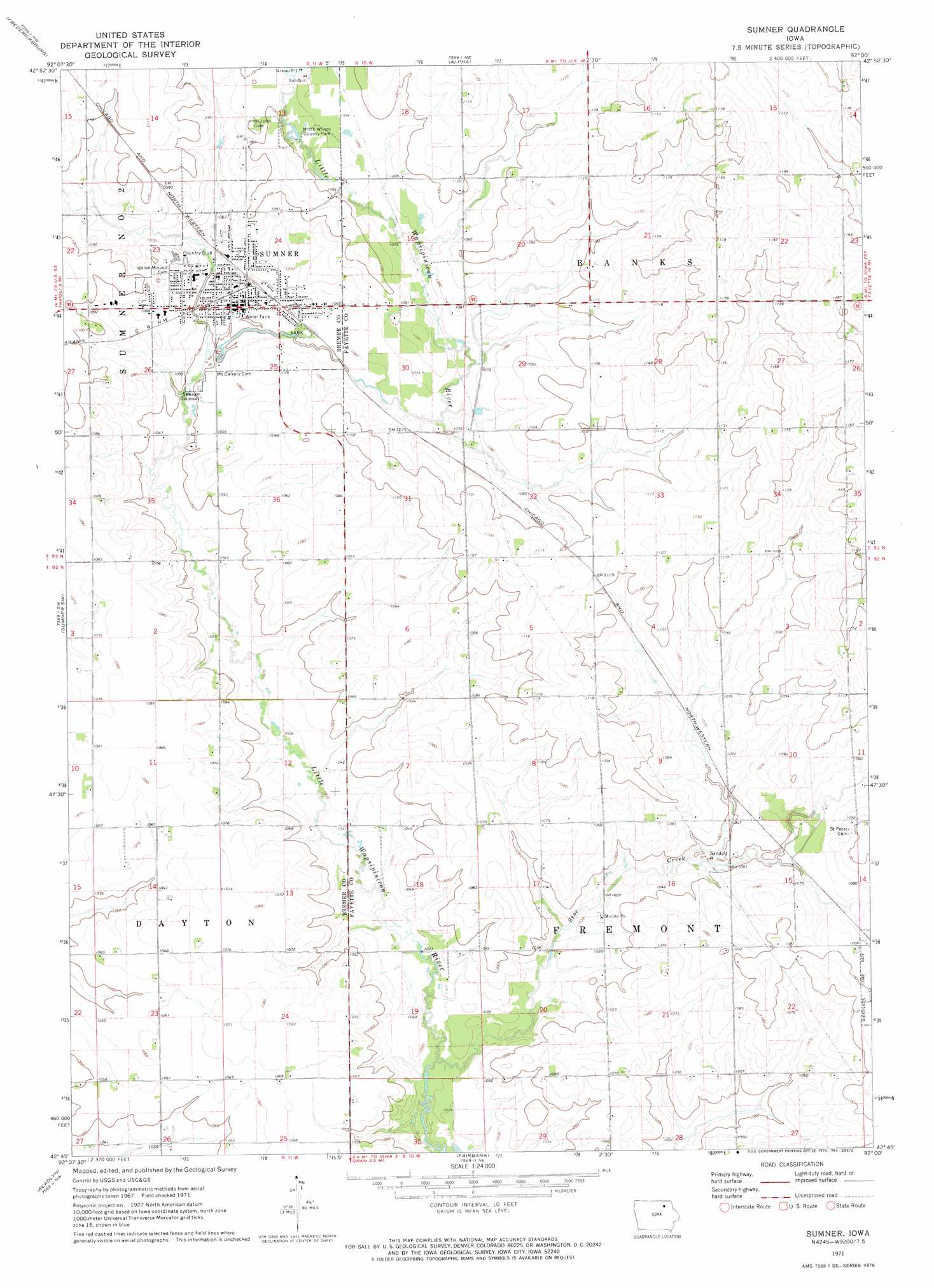
USGS Topo Quad 42092g1 - 1:24,000 scale
| Topo Map Name: | Sumner |
| USGS Topo Quad ID: | 42092g1 |
| Print Size: | ca. 21 1/4" wide x 27" high |
| Southeast Coordinates: | 42.75° N latitude / 92° W longitude |
| Map Center Coordinates: | 42.8125° N latitude / 92.0625° W longitude |
| U.S. State: | IA |
| Filename: | o42092g1.jpg |
| Download Map JPG Image: | Sumner topo map 1:24,000 scale |
| Map Type: | Topographic |
| Topo Series: | 7.5´ |
| Map Scale: | 1:24,000 |
| Source of Map Images: | United States Geological Survey (USGS) |
| Alternate Map Versions: |
Sumner IA 1971, updated 1973 Download PDF Buy paper map Sumner IA 2010 Download PDF Buy paper map Sumner IA 2013 Download PDF Buy paper map Sumner IA 2015 Download PDF Buy paper map |
1:24,000 Topo Quads surrounding Sumner
New Hampton |
Lawler |
Waucoma |
Saint Lucas |
Festina |
Frederika |
Fredericksburg |
Alpha |
Hawkeye |
West Union |
Tripoli |
Sumner Sw |
Sumner |
Maynard |
Fayette |
Denver |
Readlyn |
Fairbank |
Oelwein |
Stanley |
Waterloo North |
Dunkerton |
Littleton |
Hazleton |
Oelwein Se |
> Back to 42092e1 at 1:100,000 scale
> Back to 42092a1 at 1:250,000 scale
> Back to U.S. Topo Maps home
Sumner topo map: Gazetteer
Sumner: Bridges
Sumner Bridge elevation 329m 1079′Sumner: Parks
Cub Park elevation 320m 1049′Koeberle Park elevation 324m 1062′
Mary Winks Park elevation 324m 1062′
North Woods County Park elevation 331m 1085′
Sumner City Park elevation 322m 1056′
Water Tower Park elevation 324m 1062′
Sumner: Populated Places
Sumner elevation 323m 1059′Sumner: Post Offices
Mill Post Office (historical) elevation 336m 1102′Sumner Post Office elevation 321m 1053′
Sumner: Streams
Stoe Creek elevation 308m 1010′Sumner digital topo map on disk
Buy this Sumner topo map showing relief, roads, GPS coordinates and other geographical features, as a high-resolution digital map file on DVD: