Mapleton Topo Map Iowa
To zoom in, hover over the map of Mapleton
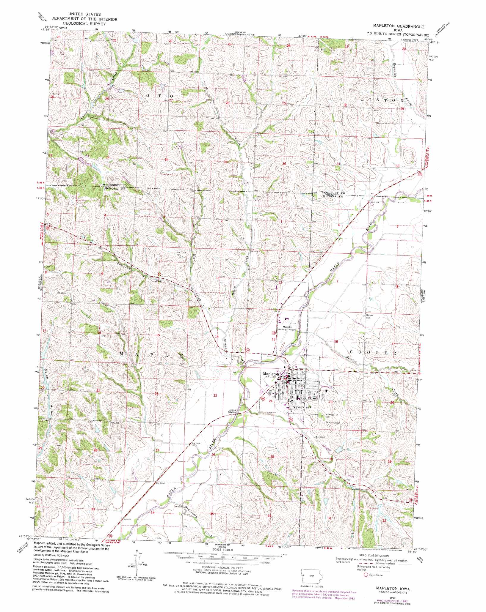
USGS Topo Quad 42095b7 - 1:24,000 scale
| Topo Map Name: | Mapleton |
| USGS Topo Quad ID: | 42095b7 |
| Print Size: | ca. 21 1/4" wide x 27" high |
| Southeast Coordinates: | 42.125° N latitude / 95.75° W longitude |
| Map Center Coordinates: | 42.1875° N latitude / 95.8125° W longitude |
| U.S. State: | IA |
| Filename: | o42095b7.jpg |
| Download Map JPG Image: | Mapleton topo map 1:24,000 scale |
| Map Type: | Topographic |
| Topo Series: | 7.5´ |
| Map Scale: | 1:24,000 |
| Source of Map Images: | United States Geological Survey (USGS) |
| Alternate Map Versions: |
Mapleton IA 1969, updated 1971 Download PDF Buy paper map Mapleton IA 1969, updated 1983 Download PDF Buy paper map Mapleton IA 2010 Download PDF Buy paper map Mapleton IA 2013 Download PDF Buy paper map Mapleton IA 2015 Download PDF Buy paper map |
1:24,000 Topo Quads surrounding Mapleton
Moville |
Correctionville Nw |
Correctionville |
Cushing |
Holstein |
Climbing Hill |
Oto |
Correctionville Se |
Holstein Sw |
Battle Creek |
Hornick |
Smithland |
Mapleton |
Danbury |
Ricketts |
Onawa |
Castana |
Mapleton Se |
Ute |
Charter Oak |
Blencoe |
Moorhead Nw |
Moorhead |
Dunlap Nw |
Dunlap Ne |
> Back to 42095a1 at 1:100,000 scale
> Back to 42094a1 at 1:250,000 scale
> Back to U.S. Topo Maps home
Mapleton topo map: Gazetteer
Mapleton: Airports
Mapleton Municipal Airport elevation 337m 1105′Mapleton: Parks
Schoenjahn Wildlife Preserve elevation 336m 1102′Mapleton: Populated Places
Mapleton elevation 347m 1138′Mapleton: Post Offices
Mapleton Post Office elevation 349m 1145′Mapleton: Streams
Dutch Creek elevation 341m 1118′Heisler Creek elevation 334m 1095′
McCleerey Creek elevation 329m 1079′
Pumpkin Run elevation 347m 1138′
Simmons Creek elevation 333m 1092′
Willow Creek elevation 341m 1118′
Mapleton digital topo map on disk
Buy this Mapleton topo map showing relief, roads, GPS coordinates and other geographical features, as a high-resolution digital map file on DVD: