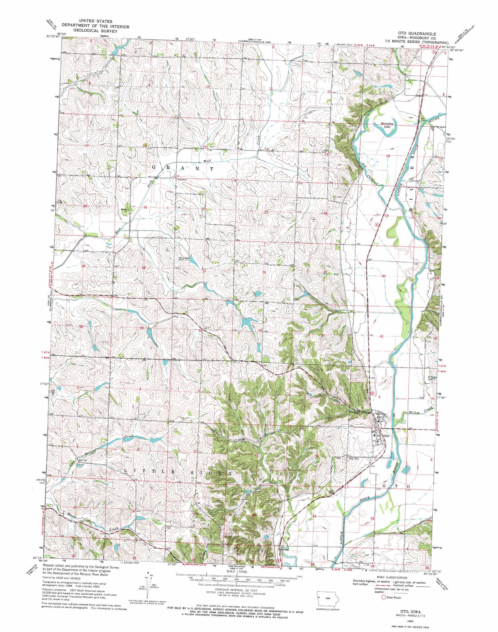
Oto Topo Map Iowa
To zoom in, hover over the map of Oto
USGS Topo Quad 42095c8 - 1:24,000 scale
| Topo Map Name: | Oto |
| USGS Topo Quad ID: | 42095c8 |
| Print Size: | ca. 21 1/4" wide x 27" high |
| Southeast Coordinates: | 42.25° N latitude / 95.875° W longitude |
| Map Center Coordinates: | 42.3125° N latitude / 95.9375° W longitude |
| U.S. State: | IA |
| Filename: | o42095c8.jpg |
| Download Map JPG Image: | Oto topo map 1:24,000 scale |
| Map Type: | Topographic |
| Topo Series: | 7.5´ |
| Map Scale: | 1:24,000 |
| Source of Map Images: | United States Geological Survey (USGS) |
| Alternate Map Versions: |
Oto IA 1969, updated 1971 Download PDF Buy paper map Oto IA 2010 Download PDF Buy paper map Oto IA 2013 Download PDF Buy paper map Oto IA 2015 Download PDF Buy paper map |
1:24,000 Topo Quads surrounding Oto
Union Center Sw |
Union Center Se |
Kingsley |
Pierson |
Washta |
Lawton |
Moville |
Correctionville Nw |
Correctionville |
Cushing |
Luton |
Climbing Hill |
Oto |
Correctionville Se |
Holstein Sw |
Sloan |
Hornick |
Smithland |
Mapleton |
Danbury |
Onawa Sw |
Onawa |
Castana |
Mapleton Se |
Ute |
> Back to 42095a1 at 1:100,000 scale
> Back to 42094a1 at 1:250,000 scale
> Back to U.S. Topo Maps home
Oto topo map: Gazetteer
Oto: Lakes
Horseshoe Lake elevation 332m 1089′Oto: Parks
Inkpaduta Historical Marker elevation 335m 1099′Oak Ridge Conservation Area elevation 427m 1400′
Oto: Populated Places
Oto elevation 334m 1095′Oto: Post Offices
Oto Post Office elevation 404m 1325′Piero Post Office (historical) elevation 347m 1138′
Oto: Streams
Fern Creek elevation 325m 1066′Miller Creek elevation 326m 1069′
Old Channel Little Sioux River elevation 329m 1079′
Oto digital topo map on disk
Buy this Oto topo map showing relief, roads, GPS coordinates and other geographical features, as a high-resolution digital map file on DVD: