Jefferson Topo Map South Dakota
To zoom in, hover over the map of Jefferson
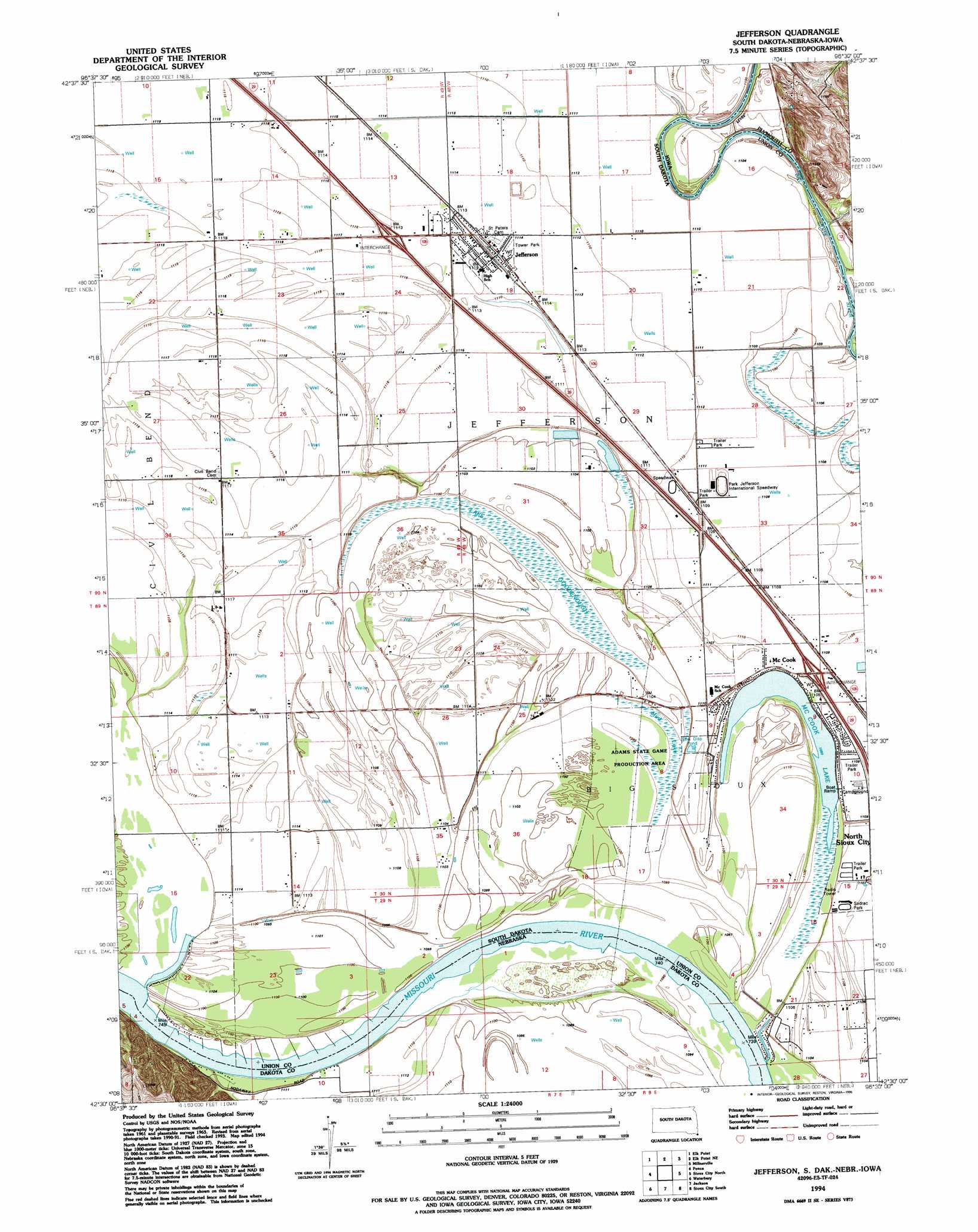
USGS Topo Quad 42096e5 - 1:24,000 scale
| Topo Map Name: | Jefferson |
| USGS Topo Quad ID: | 42096e5 |
| Print Size: | ca. 21 1/4" wide x 27" high |
| Southeast Coordinates: | 42.5° N latitude / 96.5° W longitude |
| Map Center Coordinates: | 42.5625° N latitude / 96.5625° W longitude |
| U.S. States: | SD, NE, IA |
| Filename: | o42096e5.jpg |
| Download Map JPG Image: | Jefferson topo map 1:24,000 scale |
| Map Type: | Topographic |
| Topo Series: | 7.5´ |
| Map Scale: | 1:24,000 |
| Source of Map Images: | United States Geological Survey (USGS) |
| Alternate Map Versions: |
Jefferson SD 1963, updated 1964 Download PDF Buy paper map Jefferson SD 1963, updated 1971 Download PDF Buy paper map Jefferson SD 1963, updated 1972 Download PDF Buy paper map Jefferson SD 1963, updated 1977 Download PDF Buy paper map Jefferson SD 1994, updated 1995 Download PDF Buy paper map Jefferson SD 2011 Download PDF Buy paper map Jefferson SD 2012 Download PDF Buy paper map Jefferson SD 2015 Download PDF Buy paper map |
1:24,000 Topo Quads surrounding Jefferson
Vermillon Se |
Richland |
Akron |
Ireton Sw |
Brunsville |
Burbank |
Elk Point |
Elk Point Ne |
Millnerville |
Hinton |
Martinsburg |
Ponca |
Jefferson |
Sioux City North |
James |
Allen |
Waterbury |
Jackson |
Sioux City South |
Sergeant Bluff |
Wakefield |
Emerson |
Emerson Se |
Homer |
Salix |
> Back to 42096e1 at 1:100,000 scale
> Back to 42096a1 at 1:250,000 scale
> Back to U.S. Topo Maps home
Jefferson topo map: Gazetteer
Jefferson: Bends
Kenslers Bend (historical) elevation 331m 1085′Jefferson: Lakes
McCook Lake elevation 331m 1085′Jefferson: Parks
Sodrac Park elevation 337m 1105′Jefferson: Populated Places
Jefferson elevation 340m 1115′McCook Lake elevation 331m 1085′
Jefferson: Swamps
Lake Goodenough elevation 333m 1092′Mud Lake elevation 334m 1095′
Jefferson digital topo map on disk
Buy this Jefferson topo map showing relief, roads, GPS coordinates and other geographical features, as a high-resolution digital map file on DVD: