Martinsburg Topo Map Nebraska
To zoom in, hover over the map of Martinsburg
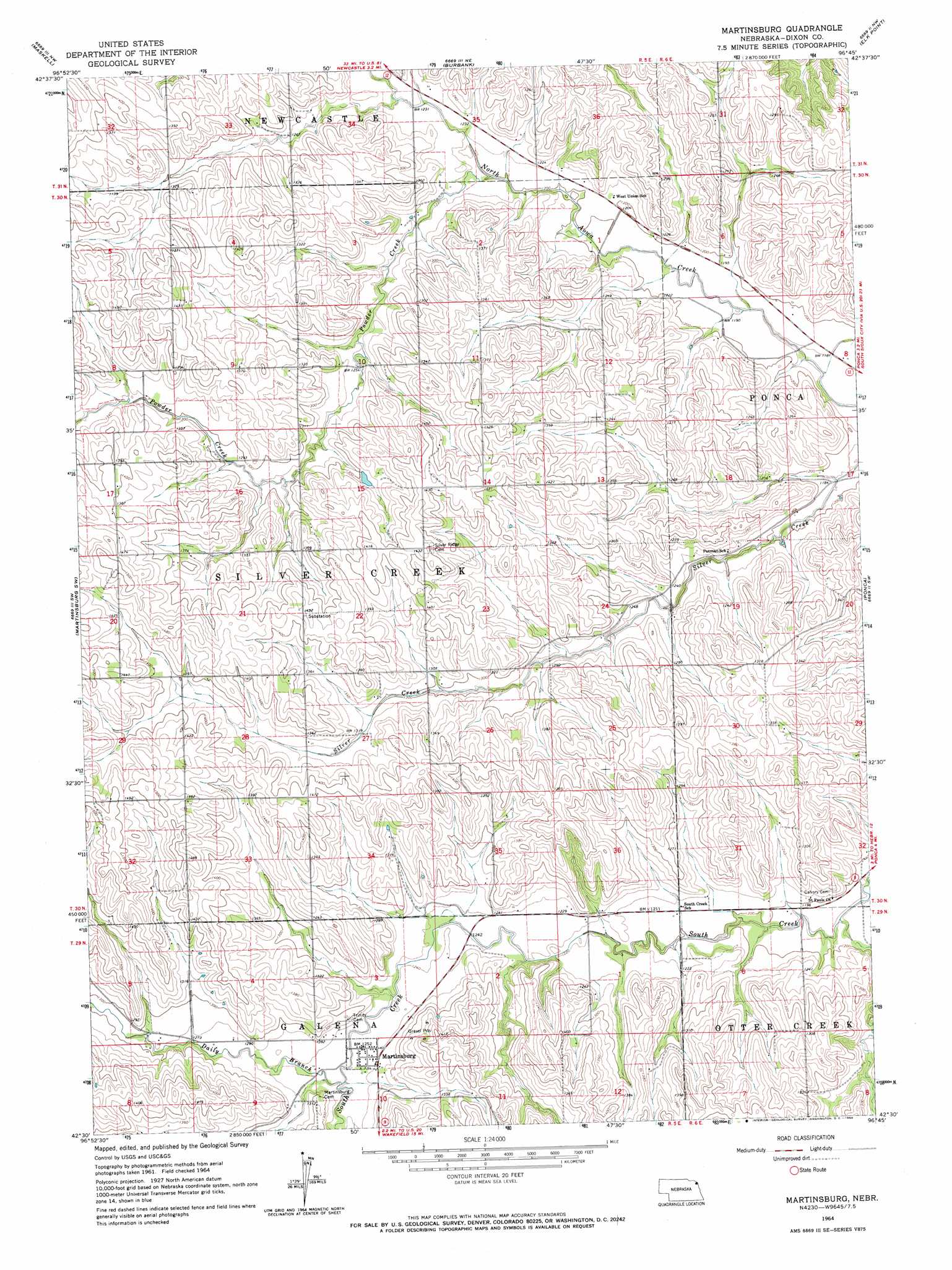
USGS Topo Quad 42096e7 - 1:24,000 scale
| Topo Map Name: | Martinsburg |
| USGS Topo Quad ID: | 42096e7 |
| Print Size: | ca. 21 1/4" wide x 27" high |
| Southeast Coordinates: | 42.5° N latitude / 96.75° W longitude |
| Map Center Coordinates: | 42.5625° N latitude / 96.8125° W longitude |
| U.S. State: | NE |
| Filename: | O42096E7.jpg |
| Download Map JPG Image: | Martinsburg topo map 1:24,000 scale |
| Map Type: | Topographic |
| Topo Series: | 7.5´ |
| Map Scale: | 1:24,000 |
| Source of Map Images: | United States Geological Survey (USGS) |
| Alternate Map Versions: |
Martinsburg NE 1964, updated 1966 Download PDF Buy paper map Martinsburg NE 2011 Download PDF Buy paper map Martinsburg NE 2014 Download PDF Buy paper map |
1:24,000 Topo Quads surrounding Martinsburg
Meckling |
Vermillon |
Vermillon Se |
Richland |
Akron |
Obert |
Maskell |
Burbank |
Elk Point |
Elk Point Ne |
Coleridge Se |
Martinsburg Sw |
Martinsburg |
Ponca |
Jefferson |
Laurel |
Concord |
Allen |
Waterbury |
Jackson |
Laurel Se |
Wakefield Sw |
Wakefield |
Emerson |
Emerson Se |
> Back to 42096e1 at 1:100,000 scale
> Back to 42096a1 at 1:250,000 scale
> Back to U.S. Topo Maps home
Martinsburg topo map: Gazetteer
Martinsburg: Dams
Aowa Creek Dam 12-8 elevation 400m 1312′Aowa Creek Dam 31-1 elevation 397m 1302′
Curry Dam elevation 401m 1315′
Martinsburg: Populated Places
Martinsburg elevation 382m 1253′Martinsburg: Post Offices
Martinsburg Post Office (historical) elevation 382m 1253′Silver Ridge Post Office (historical) elevation 434m 1423′
Martinsburg: Reservoirs
Aowa Creek Reservoir 12-8 elevation 400m 1312′Aowa Creek Reservoir 31-1 elevation 397m 1302′
Martinsburg: Streams
Daily Branch elevation 378m 1240′Powder Creek elevation 366m 1200′
Sand Creek elevation 378m 1240′
Martinsburg digital topo map on disk
Buy this Martinsburg topo map showing relief, roads, GPS coordinates and other geographical features, as a high-resolution digital map file on DVD: