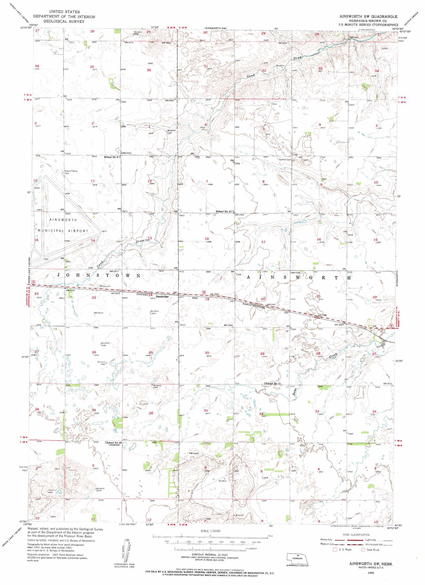
Ainsworth Sw Topo Map Nebraska
To zoom in, hover over the map of Ainsworth Sw
USGS Topo Quad 42099e8 - 1:24,000 scale
| Topo Map Name: | Ainsworth Sw |
| USGS Topo Quad ID: | 42099e8 |
| Print Size: | ca. 21 1/4" wide x 27" high |
| Southeast Coordinates: | 42.5° N latitude / 99.875° W longitude |
| Map Center Coordinates: | 42.5625° N latitude / 99.9375° W longitude |
| U.S. State: | NE |
| Filename: | O42099E8.jpg |
| Download Map JPG Image: | Ainsworth Sw topo map 1:24,000 scale |
| Map Type: | Topographic |
| Topo Series: | 7.5´ |
| Map Scale: | 1:24,000 |
| Source of Map Images: | United States Geological Survey (USGS) |
| Alternate Map Versions: |
Ainsworth SW NE 1954, updated 1955 Download PDF Buy paper map Ainsworth SW NE 2011 Download PDF Buy paper map Ainsworth SW NE 2014 Download PDF Buy paper map |
1:24,000 Topo Quads surrounding Ainsworth Sw
Muleshoe Creek |
Norden |
Huddle Table |
Meadville |
Springview |
Wood Lake |
Wood Lake Ne |
Ainsworth Nw |
Dutch Creek |
Bassett Nw |
Brush Creek |
Johnstown |
Ainsworth Sw |
Ainsworth |
Long Pine |
Harr Valley |
White Cap Hill |
Lost Lake Ranch |
Hofeld Lake |
Hagan Lake Nw |
Skull Lake |
Philbrick Lake |
Raven Sw |
Raven |
Hagan Lake |
> Back to 42099e1 at 1:100,000 scale
> Back to 42098a1 at 1:250,000 scale
> Back to U.S. Topo Maps home
Ainsworth Sw topo map: Gazetteer
Ainsworth Sw: Airports
Ainsworth Municipal Airport elevation 787m 2582′Ainsworth Sw: Dams
Budde and Brown County Detention Dam elevation 768m 2519′Snyder Group Dam elevation 770m 2526′
Ainsworth Sw: Parks
Ainsworth Army Air Field Historical Marker elevation 787m 2582′Ainsworth Sw: Populated Places
Sandridge elevation 784m 2572′Ainsworth Sw: Reservoirs
Budde Reservoir elevation 768m 2519′Snyder Group Reservoir elevation 770m 2526′
Ainsworth Sw digital topo map on disk
Buy this Ainsworth Sw topo map showing relief, roads, GPS coordinates and other geographical features, as a high-resolution digital map file on DVD: