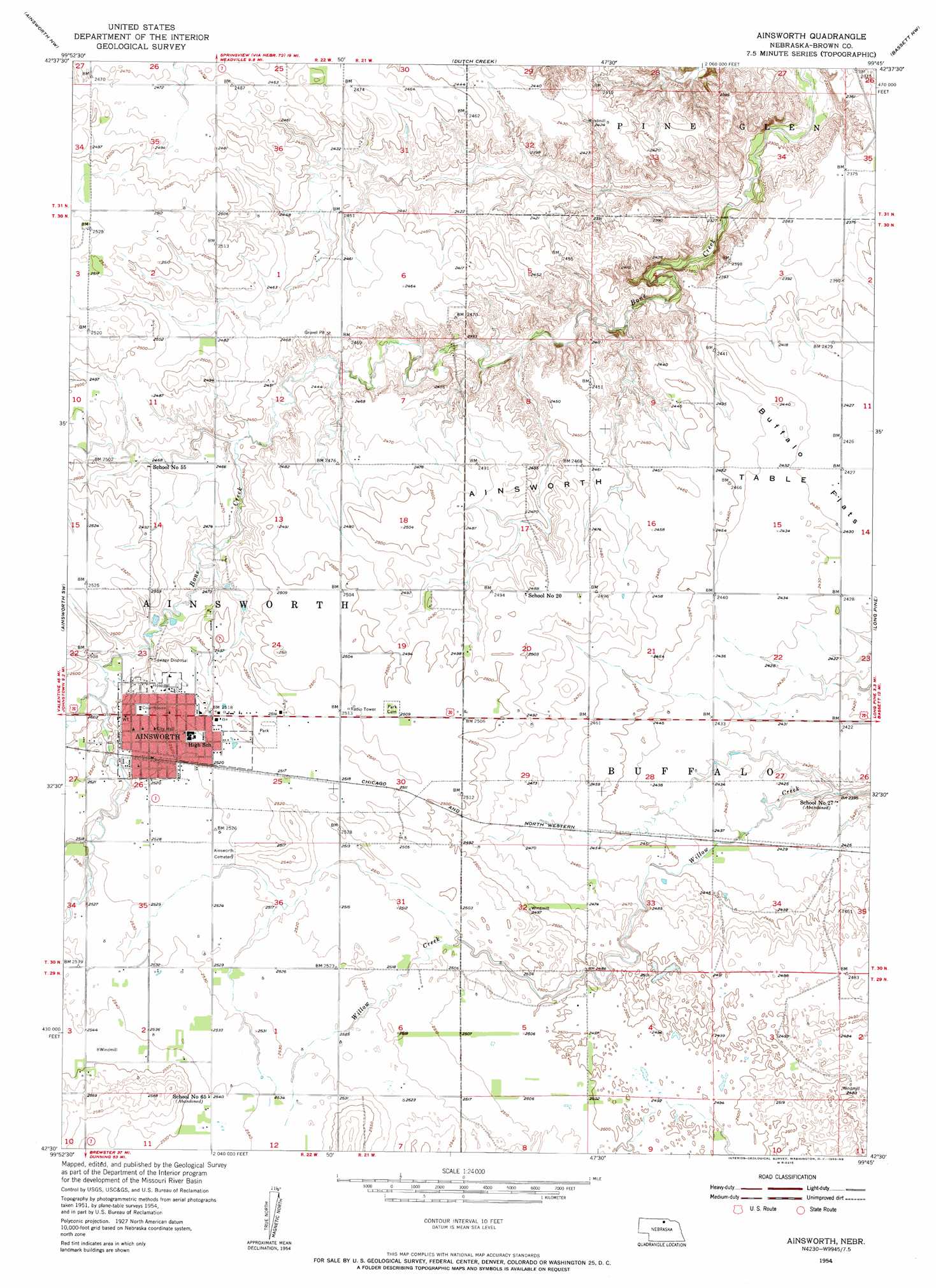
Ainsworth Topo Map Nebraska
To zoom in, hover over the map of Ainsworth
USGS Topo Quad 42099e7 - 1:24,000 scale
| Topo Map Name: | Ainsworth |
| USGS Topo Quad ID: | 42099e7 |
| Print Size: | ca. 21 1/4" wide x 27" high |
| Southeast Coordinates: | 42.5° N latitude / 99.75° W longitude |
| Map Center Coordinates: | 42.5625° N latitude / 99.8125° W longitude |
| U.S. State: | NE |
| Filename: | O42099E7.jpg |
| Download Map JPG Image: | Ainsworth topo map 1:24,000 scale |
| Map Type: | Topographic |
| Topo Series: | 7.5´ |
| Map Scale: | 1:24,000 |
| Source of Map Images: | United States Geological Survey (USGS) |
| Alternate Map Versions: |
Ainsworth NE 1954, updated 1955 Download PDF Buy paper map Ainsworth NE 2011 Download PDF Buy paper map Ainsworth NE 2014 Download PDF Buy paper map |
1:24,000 Topo Quads surrounding Ainsworth
Norden |
Huddle Table |
Meadville |
Springview |
Springview Se |
Wood Lake Ne |
Ainsworth Nw |
Dutch Creek |
Bassett Nw |
Riverview |
Johnstown |
Ainsworth Sw |
Ainsworth |
Long Pine |
Bassett |
White Cap Hill |
Lost Lake Ranch |
Hofeld Lake |
Hagan Lake Nw |
Hagan Lake Ne |
Philbrick Lake |
Raven Sw |
Raven |
Hagan Lake |
Lake George |
> Back to 42099e1 at 1:100,000 scale
> Back to 42098a1 at 1:250,000 scale
> Back to U.S. Topo Maps home
Ainsworth topo map: Gazetteer
Ainsworth: Dams
Moody Group Dam elevation 741m 2431′Ainsworth: Flats
Buffalo Flats elevation 740m 2427′Ainsworth: Parks
East City Park elevation 767m 2516′Ainsworth: Populated Places
Ainsworth elevation 768m 2519′Ainsworth: Post Offices
Ainsworth Post Office elevation 768m 2519′Ainsworth: Reservoirs
Moody Group Reservoir elevation 741m 2431′Ainsworth: Summits
Ainsworth Table elevation 750m 2460′Ainsworth digital topo map on disk
Buy this Ainsworth topo map showing relief, roads, GPS coordinates and other geographical features, as a high-resolution digital map file on DVD: