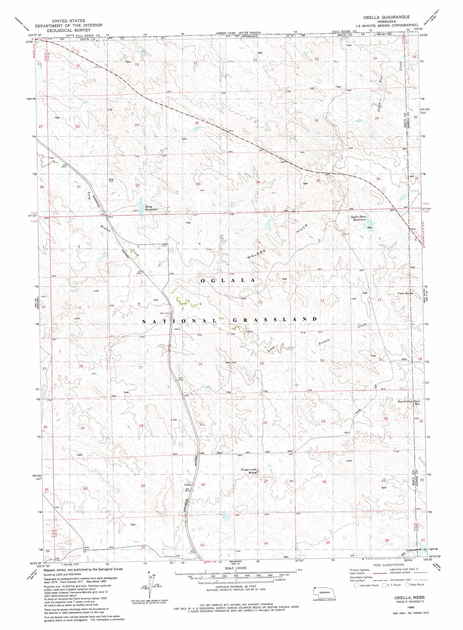
Orella Topo Map Nebraska
To zoom in, hover over the map of Orella
USGS Topo Quad 42103h5 - 1:24,000 scale
| Topo Map Name: | Orella |
| USGS Topo Quad ID: | 42103h5 |
| Print Size: | ca. 21 1/4" wide x 27" high |
| Southeast Coordinates: | 42.875° N latitude / 103.5° W longitude |
| Map Center Coordinates: | 42.9375° N latitude / 103.5625° W longitude |
| U.S. State: | NE |
| Filename: | O42103H5.jpg |
| Download Map JPG Image: | Orella topo map 1:24,000 scale |
| Map Type: | Topographic |
| Topo Series: | 7.5´ |
| Map Scale: | 1:24,000 |
| Source of Map Images: | United States Geological Survey (USGS) |
| Alternate Map Versions: |
Orella NE 1980, updated 1981 Download PDF Buy paper map Orella NE 2011 Download PDF Buy paper map Orella NE 2014 Download PDF Buy paper map |
| FStopo: | US Forest Service topo Orella is available: Download FStopo PDF Download FStopo TIF |
1:24,000 Topo Quads surrounding Orella
Provo |
Rumford |
Heppner |
Lone Well Creek West |
Lone Well Creek East |
Crowe Dam |
Ardmore |
Ardmore Se |
Black Banks Creek West |
Black Banks Creek East |
Story Ne |
Montrose |
Orella |
Wolf Butte |
Lone Tree Ranch |
Bodarc |
Five Points |
Roundtop |
Horn |
Whitney |
Harrison East |
Andrews |
Smiley Canyon |
Crawford |
Crow Butte |
> Back to 42103e1 at 1:100,000 scale
> Back to 42102a1 at 1:250,000 scale
> Back to U.S. Topo Maps home
Orella topo map: Gazetteer
Orella: Populated Places
Orella elevation 1135m 3723′Orella: Post Offices
Orella Post Office (historical) elevation 1135m 3723′Orella: Reservoirs
Agate Dam Reservoir elevation 1179m 3868′Meng Reservoir elevation 1184m 3884′
Orella: Ridges
Waldon Hills elevation 1172m 3845′Orella: Summits
Sugar Loaf Butte elevation 1128m 3700′Twin Butte elevation 1168m 3832′
Orella digital topo map on disk
Buy this Orella topo map showing relief, roads, GPS coordinates and other geographical features, as a high-resolution digital map file on DVD:
Eastern Wyoming & Western South Dakota
Buy digital topo maps: Eastern Wyoming & Western South Dakota