Flat Top Mountain Se Topo Map Oregon
To zoom in, hover over the map of Flat Top Mountain Se
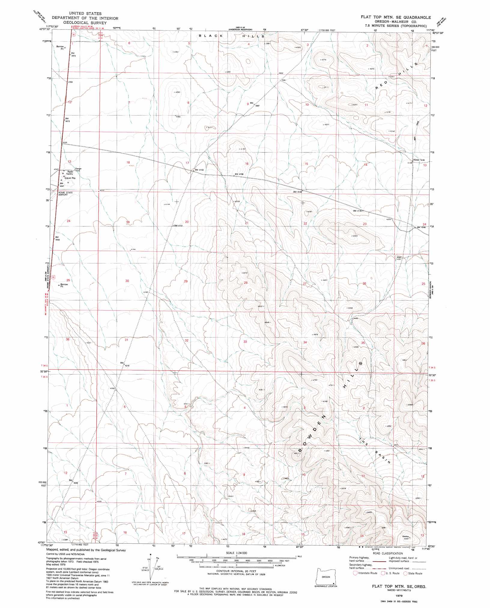
USGS Topo Quad 42117e7 - 1:24,000 scale
| Topo Map Name: | Flat Top Mountain Se |
| USGS Topo Quad ID: | 42117e7 |
| Print Size: | ca. 21 1/4" wide x 27" high |
| Southeast Coordinates: | 42.5° N latitude / 117.75° W longitude |
| Map Center Coordinates: | 42.5625° N latitude / 117.8125° W longitude |
| U.S. State: | OR |
| Filename: | o42117e7.jpg |
| Download Map JPG Image: | Flat Top Mountain Se topo map 1:24,000 scale |
| Map Type: | Topographic |
| Topo Series: | 7.5´ |
| Map Scale: | 1:24,000 |
| Source of Map Images: | United States Geological Survey (USGS) |
| Alternate Map Versions: |
Flat Top Mtn SE OR 1979, updated 1980 Download PDF Buy paper map Flat Top Mountain SE OR 2011 Download PDF Buy paper map Flat Top Mountain SE OR 2014 Download PDF Buy paper map |
1:24,000 Topo Quads surrounding Flat Top Mountain Se
Groan Canyon |
Palomino Hills |
Burns Junction |
Rome |
Scott Reservoir |
Grassy Ridge Well |
Flat Top Mountain |
Anderson Reservoir |
The Basin |
Rockhouse Reservoir |
Coyote Lake East |
Rome State Airport |
Flat Top Mountain Se |
Bowden Ranch |
Jackies Butte |
Twelvemile Ridge |
Three Man Butte Well |
Basque |
Battle Creek Ranch |
Rattlesnake Canyon |
Dry Creek Bench |
Blue Mountain Basin |
Blue Mountain Pass |
Battle Mountain |
Grasshopper Flat North |
> Back to 42117e1 at 1:100,000 scale
> Back to 42116a1 at 1:250,000 scale
> Back to U.S. Topo Maps home
Flat Top Mountain Se topo map: Gazetteer
Flat Top Mountain Se: Basins
The Basin elevation 1466m 4809′Flat Top Mountain Se: Reservoirs
Bowden Guzzler elevation 1258m 4127′Flat Top Mountain Se digital topo map on disk
Buy this Flat Top Mountain Se topo map showing relief, roads, GPS coordinates and other geographical features, as a high-resolution digital map file on DVD: