Neshkoro Topo Map Wisconsin
To zoom in, hover over the map of Neshkoro
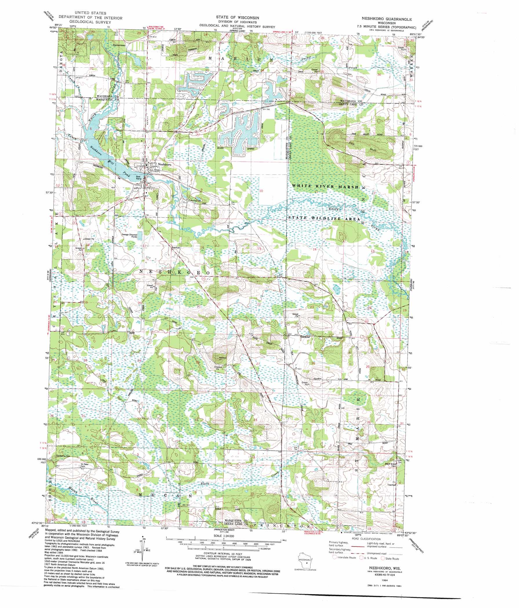
USGS Topo Quad 43089h2 - 1:24,000 scale
| Topo Map Name: | Neshkoro |
| USGS Topo Quad ID: | 43089h2 |
| Print Size: | ca. 21 1/4" wide x 27" high |
| Southeast Coordinates: | 43.875° N latitude / 89.125° W longitude |
| Map Center Coordinates: | 43.9375° N latitude / 89.1875° W longitude |
| U.S. State: | WI |
| Filename: | o43089h2.jpg |
| Download Map JPG Image: | Neshkoro topo map 1:24,000 scale |
| Map Type: | Topographic |
| Topo Series: | 7.5´ |
| Map Scale: | 1:24,000 |
| Source of Map Images: | United States Geological Survey (USGS) |
| Alternate Map Versions: |
Neshkoro WI 1984, updated 1984 Download PDF Buy paper map Neshkoro WI 2010 Download PDF Buy paper map Neshkoro WI 2013 Download PDF Buy paper map Neshkoro WI 2016 Download PDF Buy paper map |
1:24,000 Topo Quads surrounding Neshkoro
Plainfield |
Wautoma Ne |
Wild Rose |
Saxeville |
Poy Sippi |
Richford |
Wautoma |
Spring Lake |
Redgranite |
Auroraville |
Westfield East |
Germania |
Neshkoro |
Fairburn |
Berlin |
Packwaukee |
Montello |
Princeton West |
Princeton East |
Green Lake |
Endeavor |
Observatory Hill |
Marquette |
Manchester |
Markesan |
> Back to 43089e1 at 1:100,000 scale
> Back to 43088a1 at 1:250,000 scale
> Back to U.S. Topo Maps home
Neshkoro topo map: Gazetteer
Neshkoro: Cliffs
Pine Bluff elevation 281m 921′Neshkoro: Dams
Neshkoro Dam elevation 243m 797′Neshkoro: Parks
White River Prairie-Tamaracks State Natural Area elevation 237m 777′Neshkoro: Populated Places
Bannerman elevation 250m 820′Neshkoro elevation 254m 833′
Rodney (historical) elevation 245m 803′
Neshkoro: Reservoirs
Neshkoro Millpond 120 elevation 243m 797′Neshkoro: Streams
Little Lunch Creek elevation 244m 800′Lunch Creek elevation 242m 793′
Neshkoro digital topo map on disk
Buy this Neshkoro topo map showing relief, roads, GPS coordinates and other geographical features, as a high-resolution digital map file on DVD: