Stickney Topo Map South Dakota
To zoom in, hover over the map of Stickney
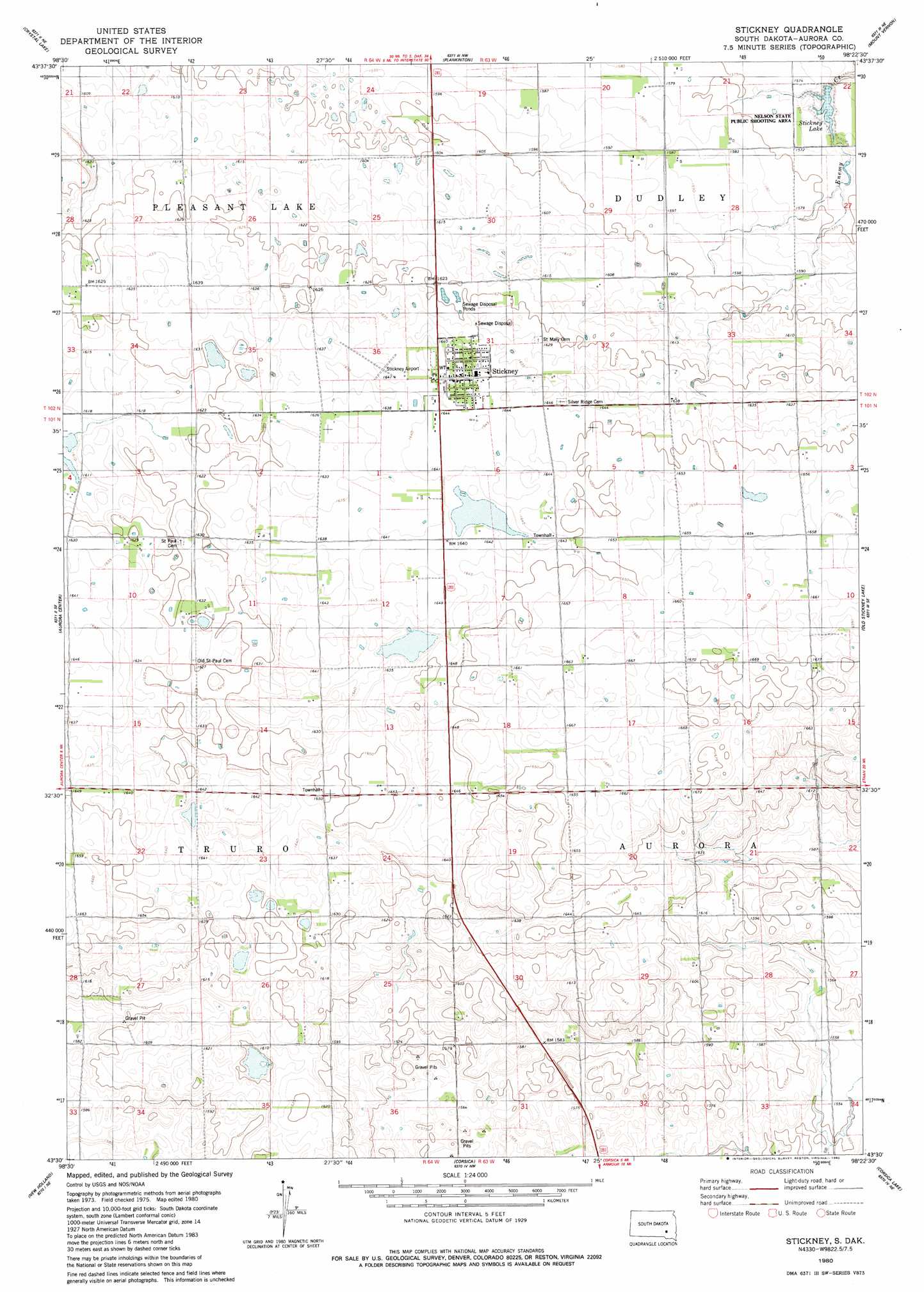
USGS Topo Quad 43098e4 - 1:24,000 scale
| Topo Map Name: | Stickney |
| USGS Topo Quad ID: | 43098e4 |
| Print Size: | ca. 21 1/4" wide x 27" high |
| Southeast Coordinates: | 43.5° N latitude / 98.375° W longitude |
| Map Center Coordinates: | 43.5625° N latitude / 98.4375° W longitude |
| U.S. State: | SD |
| Filename: | o43098e4.jpg |
| Download Map JPG Image: | Stickney topo map 1:24,000 scale |
| Map Type: | Topographic |
| Topo Series: | 7.5´ |
| Map Scale: | 1:24,000 |
| Source of Map Images: | United States Geological Survey (USGS) |
| Alternate Map Versions: |
Stickney SD 1980, updated 1980 Download PDF Buy paper map Stickney SD 2012 Download PDF Buy paper map Stickney SD 2015 Download PDF Buy paper map |
1:24,000 Topo Quads surrounding Stickney
Wilmarth Lake |
Storla Sw |
Storla |
Letcher Sw |
|
White Lake |
Crystal Lake |
Plankinton |
Mount Vernon |
Betts |
Laffey Lake |
Aurora Center |
Stickney |
Old Stickney Lake |
Mitchell Sw |
Joubert |
New Holland |
Corsica |
Corsica Lake |
Hillside |
Geddes |
Geddes Se |
Armour Sw |
Armour |
Delmont |
> Back to 43098e1 at 1:100,000 scale
> Back to 43098a1 at 1:250,000 scale
> Back to U.S. Topo Maps home
Stickney topo map: Gazetteer
Stickney: Airports
Stickney Airport elevation 499m 1637′Stickney: Parks
Nelson State Public Shooting Area elevation 475m 1558′Stickney: Populated Places
Stickney elevation 501m 1643′Stickney: Reservoirs
Stickney Lake elevation 476m 1561′Stickney digital topo map on disk
Buy this Stickney topo map showing relief, roads, GPS coordinates and other geographical features, as a high-resolution digital map file on DVD:
Eastern North Dakota & Eastern South Dakota
Buy digital topo maps: Eastern North Dakota & Eastern South Dakota