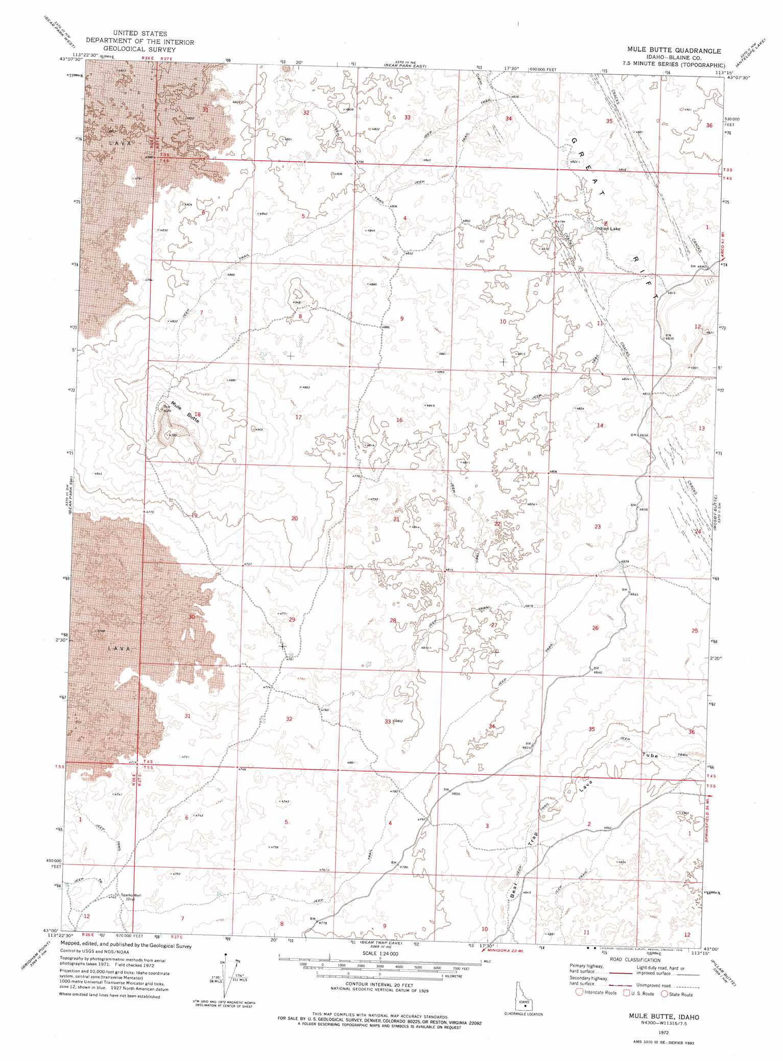
Mule Butte Topo Map Idaho
To zoom in, hover over the map of Mule Butte
USGS Topo Quad 43113a3 - 1:24,000 scale
| Topo Map Name: | Mule Butte |
| USGS Topo Quad ID: | 43113a3 |
| Print Size: | ca. 21 1/4" wide x 27" high |
| Southeast Coordinates: | 43° N latitude / 113.25° W longitude |
| Map Center Coordinates: | 43.0625° N latitude / 113.3125° W longitude |
| U.S. State: | ID |
| Filename: | o43113a3.jpg |
| Download Map JPG Image: | Mule Butte topo map 1:24,000 scale |
| Map Type: | Topographic |
| Topo Series: | 7.5´ |
| Map Scale: | 1:24,000 |
| Source of Map Images: | United States Geological Survey (USGS) |
| Alternate Map Versions: |
Mule Butte ID 1972, updated 1976 Download PDF Buy paper map Mule Butte ID 2010 Download PDF Buy paper map Mule Butte ID 2013 Download PDF Buy paper map |
1:24,000 Topo Quads surrounding Mule Butte
North Laidlaw Butte |
Fissure Butte |
Pratt Butte |
Serviceberry Butte |
Sunset Lake |
Bear Den Butte |
Bear Park West |
Bear Park East |
Antelope Lake |
Split Top |
Bottleneck Lake |
Bear Park Sw |
Mule Butte |
Mosby Butte |
Mosby Well |
Larkspur Park |
Brigham Point |
Bear Trap Cave |
Pillar Butte |
Pillar Butte Ne |
Max |
Minidoka |
Schodde Well |
Rattlesnake Butte |
Pillar Butte Se |
> Back to 43113a1 at 1:100,000 scale
> Back to 43112a1 at 1:250,000 scale
> Back to U.S. Topo Maps home
Mule Butte topo map: Gazetteer
Mule Butte: Lakes
Indian Lake elevation 1464m 4803′Mule Butte: Summits
Mule Butte elevation 1529m 5016′Mule Butte: Wells
Sparks Well elevation 1446m 4744′Mule Butte digital topo map on disk
Buy this Mule Butte topo map showing relief, roads, GPS coordinates and other geographical features, as a high-resolution digital map file on DVD: