Big Owl Creek Topo Map Idaho
To zoom in, hover over the map of Big Owl Creek
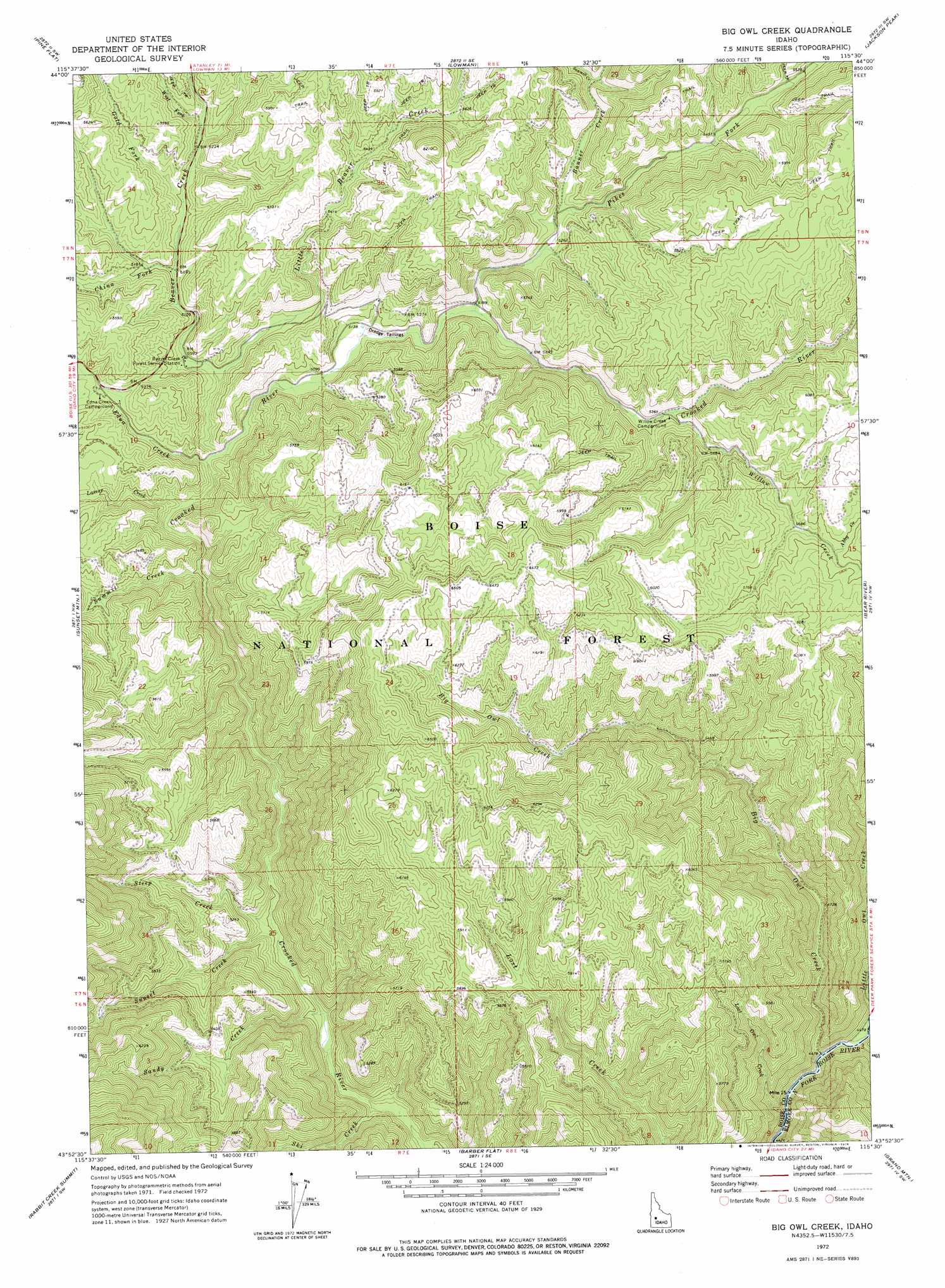
USGS Topo Quad 43115h5 - 1:24,000 scale
| Topo Map Name: | Big Owl Creek |
| USGS Topo Quad ID: | 43115h5 |
| Print Size: | ca. 21 1/4" wide x 27" high |
| Southeast Coordinates: | 43.875° N latitude / 115.5° W longitude |
| Map Center Coordinates: | 43.9375° N latitude / 115.5625° W longitude |
| U.S. State: | ID |
| Filename: | o43115h5.jpg |
| Download Map JPG Image: | Big Owl Creek topo map 1:24,000 scale |
| Map Type: | Topographic |
| Topo Series: | 7.5´ |
| Map Scale: | 1:24,000 |
| Source of Map Images: | United States Geological Survey (USGS) |
| Alternate Map Versions: |
Big Owl Creek ID 1972, updated 1976 Download PDF Buy paper map Big Owl Creek ID 2011 Download PDF Buy paper map Big Owl Creek ID 2013 Download PDF Buy paper map |
| FStopo: | US Forest Service topo Big Owl Creek is available: Download FStopo PDF Download FStopo TIF |
1:24,000 Topo Quads surrounding Big Owl Creek
Lightning Ridge |
Scott Creek |
Miller Mountain West |
Miller Mountain East |
Eightmile Mountain |
Grimes Pass |
Pine Flat |
Lowman |
Jackson Peak |
Tyee Mountain |
Pioneerville |
Sunset Mountain |
Big Owl Creek |
Bear River |
Swanholm Peak |
Idaho City |
Rabbit Creek Summit |
Barber Flat |
Grand Mountain |
Phifer Creek |
Arrowrock Reservoir Ne |
Twin Springs |
Sheep Creek |
Little Trinity Lake |
Rocky Bar |
> Back to 43115e1 at 1:100,000 scale
> Back to 43114a1 at 1:250,000 scale
> Back to U.S. Topo Maps home
Big Owl Creek topo map: Gazetteer
Big Owl Creek: Flats
Hurdy Flat elevation 1574m 5164′Big Owl Creek: Streams
Abby Creek elevation 1757m 5764′Banner Creek elevation 1615m 5298′
Beaver Creek elevation 1539m 5049′
Big Owl Creek elevation 1361m 4465′
China Fork elevation 1572m 5157′
Edna Creek elevation 1538m 5045′
Gold Fork elevation 1584m 5196′
Lamar Creek elevation 1532m 5026′
Little Beaver Creek elevation 1549m 5082′
Little Owl Creek elevation 1371m 4498′
Lost Owl Creek elevation 1364m 4475′
Pikes Fork elevation 1584m 5196′
Sandy Creek elevation 1438m 4717′
Sawmill Creek elevation 1673m 5488′
Ski Creek elevation 1426m 4678′
Steep Creek elevation 1457m 4780′
Summit Creek elevation 1524m 5000′
Sunset Creek elevation 1454m 4770′
West Fork Beaver Creek elevation 1603m 5259′
Whoop Um Up Creek elevation 1594m 5229′
Willow Creek elevation 1643m 5390′
Big Owl Creek digital topo map on disk
Buy this Big Owl Creek topo map showing relief, roads, GPS coordinates and other geographical features, as a high-resolution digital map file on DVD: