Harrisville Topo Map Michigan
To zoom in, hover over the map of Harrisville
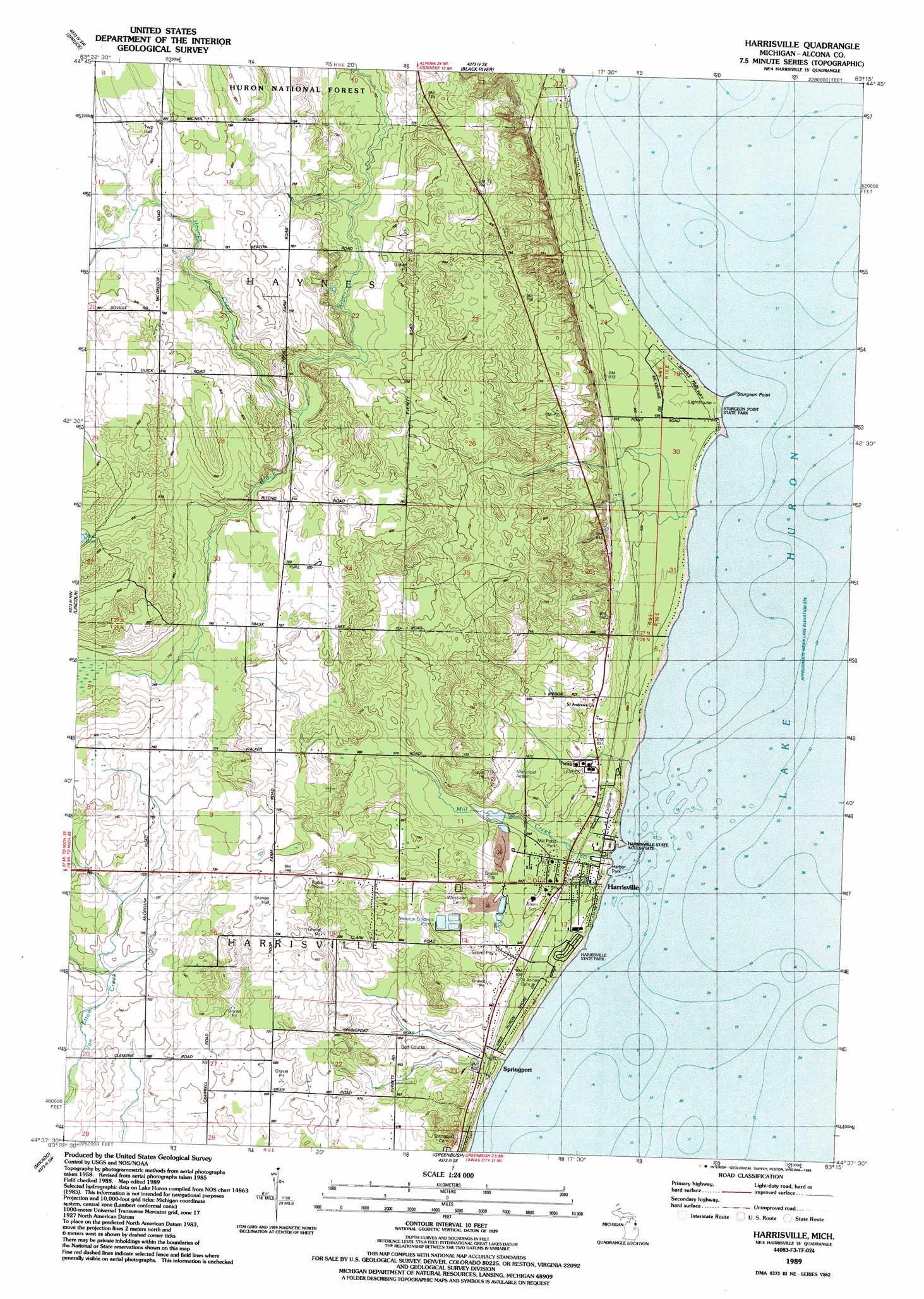
USGS Topo Quad 44083f3 - 1:24,000 scale
| Topo Map Name: | Harrisville |
| USGS Topo Quad ID: | 44083f3 |
| Print Size: | ca. 21 1/4" wide x 27" high |
| Southeast Coordinates: | 44.625° N latitude / 83.25° W longitude |
| Map Center Coordinates: | 44.6875° N latitude / 83.3125° W longitude |
| U.S. State: | MI |
| Filename: | o44083f3.jpg |
| Download Map JPG Image: | Harrisville topo map 1:24,000 scale |
| Map Type: | Topographic |
| Topo Series: | 7.5´ |
| Map Scale: | 1:24,000 |
| Source of Map Images: | United States Geological Survey (USGS) |
| Alternate Map Versions: |
Harrisville MI 1989, updated 1989 Download PDF Buy paper map Harrisville MI 2012 Download PDF Buy paper map Harrisville MI 2014 Download PDF Buy paper map Harrisville MI 2016 Download PDF Buy paper map |
| FStopo: | US Forest Service topo Harrisville is available: Download FStopo PDF Download FStopo TIF |
1:24,000 Topo Quads surrounding Harrisville
Big Ravine Creek |
Ossineke |
South Point |
||
Hubbard Lake |
Spruce |
Black River |
||
Barton City |
Lincoln |
Harrisville |
||
Sprinkler Creek |
Mikado |
Greenbush |
||
Sid Town |
Foote Site Village |
Oscoda |
> Back to 44083e1 at 1:100,000 scale
> Back to 44082a1 at 1:250,000 scale
> Back to U.S. Topo Maps home
Harrisville topo map: Gazetteer
Harrisville: Airports
Harrisville Airport elevation 208m 682′Harrisville: Capes
Sturgeon Point elevation 177m 580′Harrisville: Parks
Harbor Park elevation 180m 590′Harrisville State Park elevation 179m 587′
Mill Pond Park elevation 191m 626′
Sturgeon Point State Park elevation 177m 580′
Harrisville: Populated Places
Harrisville elevation 190m 623′Springport elevation 186m 610′
Harrisville: Post Offices
Harrisville Post Office elevation 184m 603′Harrisville: Streams
Haynes Creek elevation 225m 738′Mill Creek elevation 177m 580′
Harrisville digital topo map on disk
Buy this Harrisville topo map showing relief, roads, GPS coordinates and other geographical features, as a high-resolution digital map file on DVD:
 map DVD")