Lunds Topo Map Wisconsin
To zoom in, hover over the map of Lunds
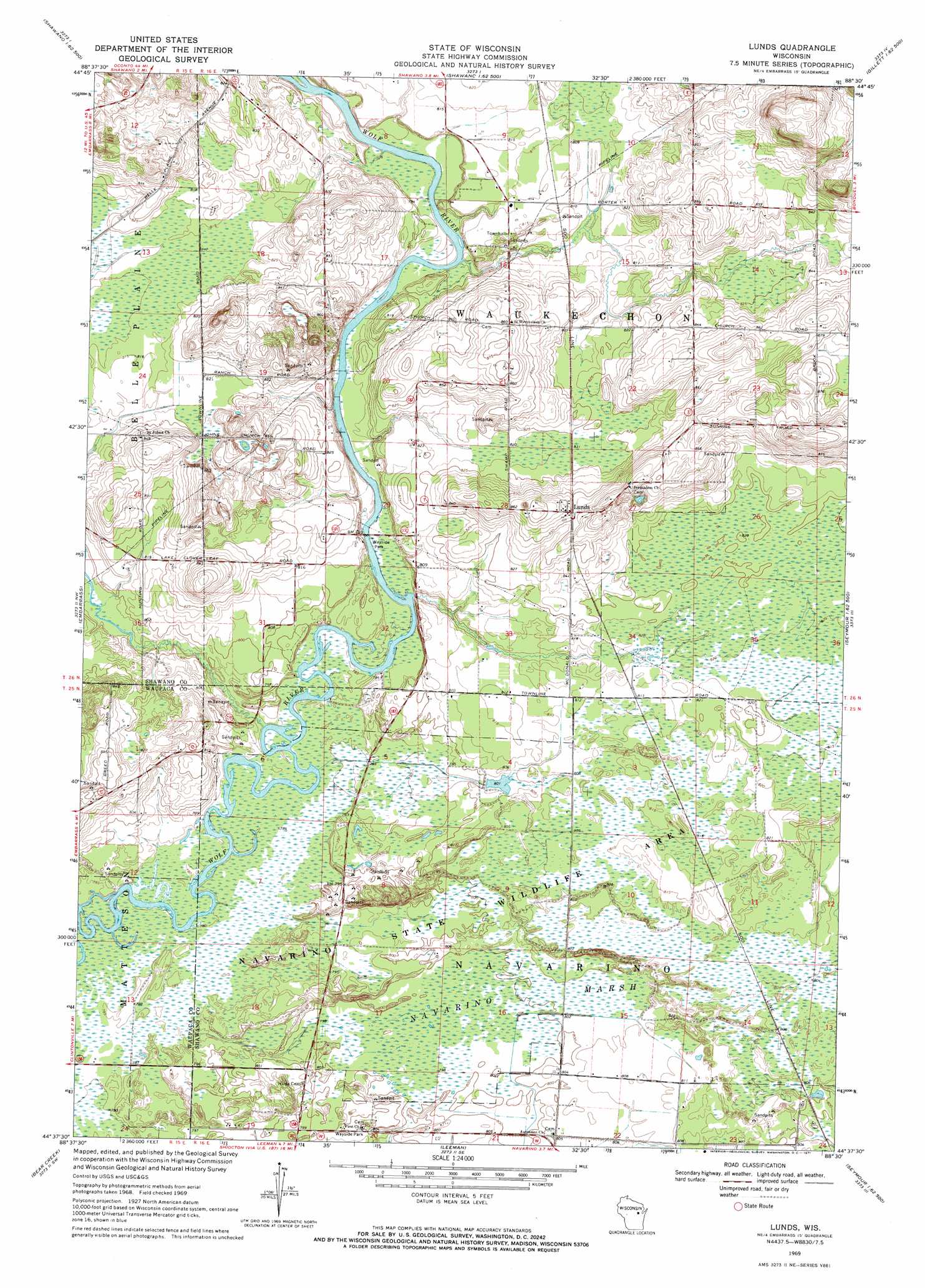
USGS Topo Quad 44088f5 - 1:24,000 scale
| Topo Map Name: | Lunds |
| USGS Topo Quad ID: | 44088f5 |
| Print Size: | ca. 21 1/4" wide x 27" high |
| Southeast Coordinates: | 44.625° N latitude / 88.5° W longitude |
| Map Center Coordinates: | 44.6875° N latitude / 88.5625° W longitude |
| U.S. State: | WI |
| Filename: | o44088f5.jpg |
| Download Map JPG Image: | Lunds topo map 1:24,000 scale |
| Map Type: | Topographic |
| Topo Series: | 7.5´ |
| Map Scale: | 1:24,000 |
| Source of Map Images: | United States Geological Survey (USGS) |
| Alternate Map Versions: |
Lunds WI 1969, updated 1971 Download PDF Buy paper map Lunds WI 2010 Download PDF Buy paper map Lunds WI 2013 Download PDF Buy paper map Lunds WI 2016 Download PDF Buy paper map |
1:24,000 Topo Quads surrounding Lunds
Neopit |
Keshena |
Legend Lake |
Berry Lake |
Gillett |
Gresham |
Thornton |
Shawano |
Cecil |
Krakow |
Clintonville North |
Embarrass |
Lunds |
Bonduel |
Zachow |
Clintonville South |
Bear Creek |
Leeman |
Nichols |
Seymour |
Northport |
New London |
Shiocton |
Black Creek |
Freedom |
> Back to 44088e1 at 1:100,000 scale
> Back to 44088a1 at 1:250,000 scale
> Back to U.S. Topo Maps home
Lunds topo map: Gazetteer
Lunds: Dams
Navarino Marsh 1 G12.470 Dam elevation 238m 780′Navarino Marsh 2 G12.470 Dam elevation 238m 780′
Navarino Marsh 3 G12.470 Dam elevation 238m 780′
Lunds: Parks
Navarino State Wildlife Area elevation 245m 803′Lunds: Populated Places
Lunds elevation 262m 859′Lunds: Streams
Schoenick Creek elevation 239m 784′School Section Creek elevation 241m 790′
Lunds: Swamps
Navarino Marsh elevation 244m 800′Lunds digital topo map on disk
Buy this Lunds topo map showing relief, roads, GPS coordinates and other geographical features, as a high-resolution digital map file on DVD: