Oldham Sw Topo Map South Dakota
To zoom in, hover over the map of Oldham Sw
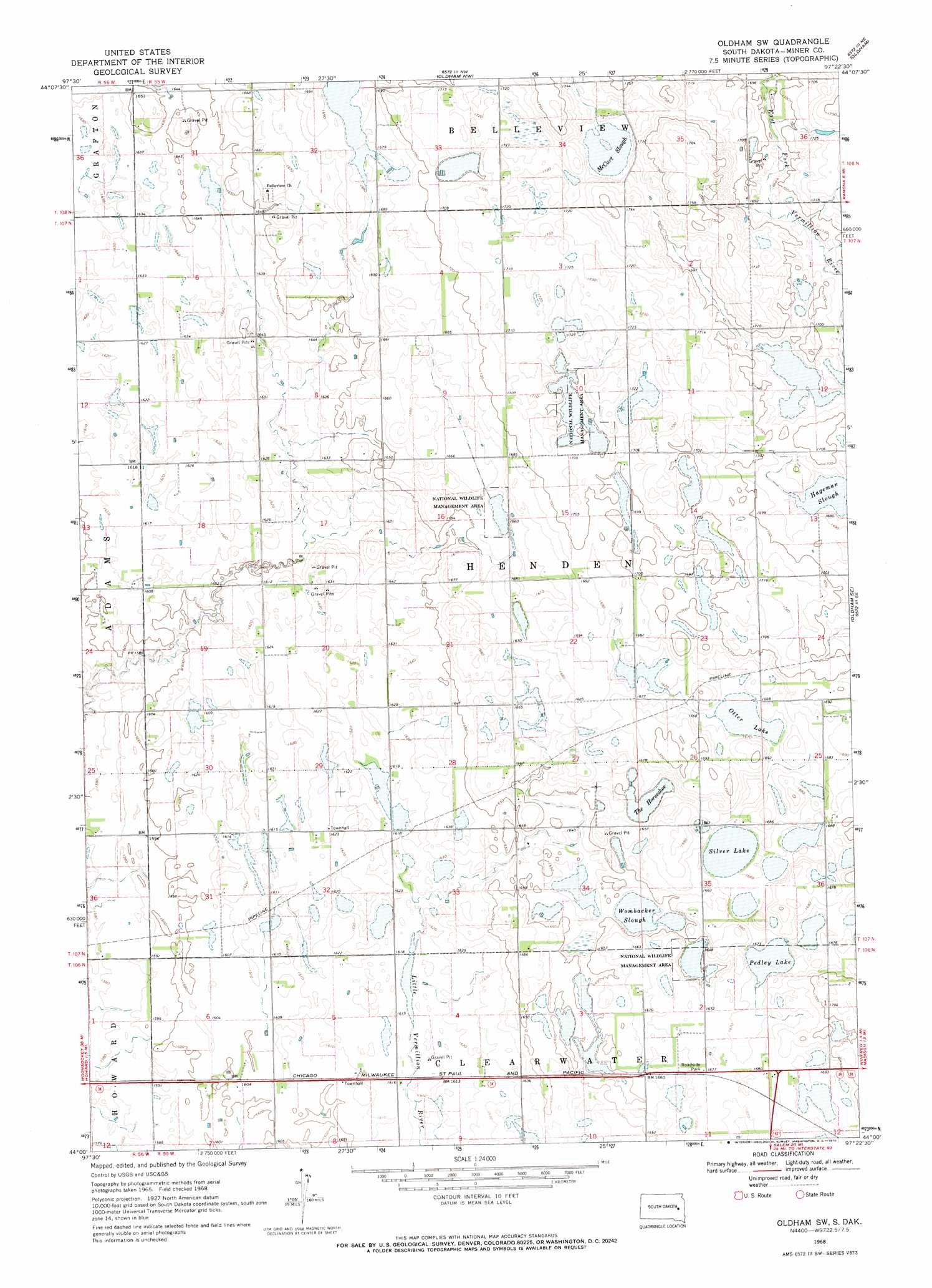
USGS Topo Quad 44097a4 - 1:24,000 scale
| Topo Map Name: | Oldham Sw |
| USGS Topo Quad ID: | 44097a4 |
| Print Size: | ca. 21 1/4" wide x 27" high |
| Southeast Coordinates: | 44° N latitude / 97.375° W longitude |
| Map Center Coordinates: | 44.0625° N latitude / 97.4375° W longitude |
| U.S. State: | SD |
| Filename: | o44097a4.jpg |
| Download Map JPG Image: | Oldham Sw topo map 1:24,000 scale |
| Map Type: | Topographic |
| Topo Series: | 7.5´ |
| Map Scale: | 1:24,000 |
| Source of Map Images: | United States Geological Survey (USGS) |
| Alternate Map Versions: |
Oldham SW SD 1968, updated 1970 Download PDF Buy paper map Oldham SW SD 2012 Download PDF Buy paper map Oldham SW SD 2015 Download PDF Buy paper map |
1:24,000 Topo Quads surrounding Oldham Sw
Manchester |
De Smet Se |
Lake Preston West |
Lake Preston East |
Arlington |
Carthage |
Howard Ne |
Oldham Nw |
Oldham |
Madison Nw |
Roswell |
Howard |
Oldham Sw |
Oldham Se |
Ramona |
Bitter Lake |
Canova West |
Canova East |
Winfred |
Lake Herman |
Epiphany |
Canova Se |
Unityville |
Winfred Se |
Lake Madison Sw |
> Back to 44097a1 at 1:100,000 scale
> Back to 44096a1 at 1:250,000 scale
> Back to U.S. Topo Maps home
Oldham Sw topo map: Gazetteer
Oldham Sw: Lakes
Hageman Slough elevation 510m 1673′McCart Slough elevation 520m 1706′
Otter Lake elevation 510m 1673′
Pedley Lake elevation 505m 1656′
Silver Lake elevation 505m 1656′
The Horseshoe elevation 502m 1646′
Wombacker Slough elevation 498m 1633′
Oldham Sw digital topo map on disk
Buy this Oldham Sw topo map showing relief, roads, GPS coordinates and other geographical features, as a high-resolution digital map file on DVD:
Eastern North Dakota & Eastern South Dakota
Buy digital topo maps: Eastern North Dakota & Eastern South Dakota