Cabin Creek Nw Topo Map Wyoming
To zoom in, hover over the map of Cabin Creek Nw
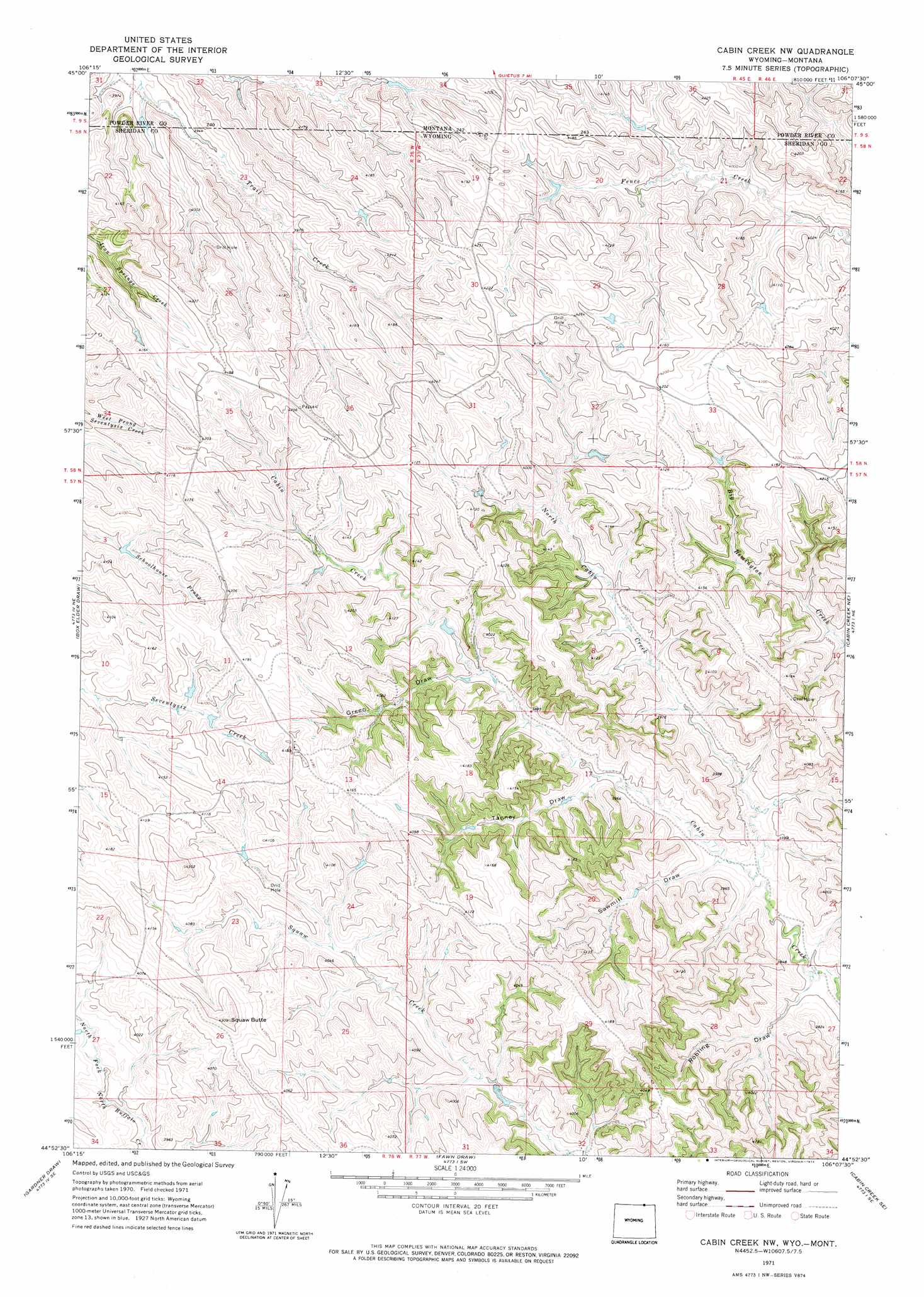
USGS Topo Quad 44106h2 - 1:24,000 scale
| Topo Map Name: | Cabin Creek Nw |
| USGS Topo Quad ID: | 44106h2 |
| Print Size: | ca. 21 1/4" wide x 27" high |
| Southeast Coordinates: | 44.875° N latitude / 106.125° W longitude |
| Map Center Coordinates: | 44.9375° N latitude / 106.1875° W longitude |
| U.S. States: | WY, MT |
| Filename: | o44106h2.jpg |
| Download Map JPG Image: | Cabin Creek Nw topo map 1:24,000 scale |
| Map Type: | Topographic |
| Topo Series: | 7.5´ |
| Map Scale: | 1:24,000 |
| Source of Map Images: | United States Geological Survey (USGS) |
| Alternate Map Versions: |
Cabin Creek NW WY 1971, updated 1974 Download PDF Buy paper map Cabin Creek NW WY 2011 Download PDF Buy paper map Cabin Creek NW WY 2012 Download PDF Buy paper map Cabin Creek NW WY 2015 Download PDF Buy paper map |
1:24,000 Topo Quads surrounding Cabin Creek Nw
Stroud Creek |
Hamilton Draw |
Otter |
Reanus Cone |
Sayle |
Forks Ranch |
Quietus |
Bear Creek School |
Sayle Hall |
Bradshaw Creek |
Roundup Draw |
Box Elder Draw |
Cabin Creek Nw |
Cabin Creek Ne |
Black Draw |
Shuler Draw |
Gardner Gulch |
Fawn Draw |
Cabin Creek Se |
Kline Draw |
Clearmont |
Leiter |
Arvada |
Arvada Ne |
Larey Draw |
> Back to 44106e1 at 1:100,000 scale
> Back to 44106a1 at 1:250,000 scale
> Back to U.S. Topo Maps home
Cabin Creek Nw topo map: Gazetteer
Cabin Creek Nw: Streams
North Cabin Creek elevation 1135m 3723′Cabin Creek Nw: Summits
Squaw Butte elevation 1308m 4291′Cabin Creek Nw: Valleys
Green Draw elevation 1181m 3874′Robling Draw elevation 1122m 3681′
Sawmill Draw elevation 1139m 3736′
Tanney Draw elevation 1157m 3795′
Cabin Creek Nw digital topo map on disk
Buy this Cabin Creek Nw topo map showing relief, roads, GPS coordinates and other geographical features, as a high-resolution digital map file on DVD:
Eastern Wyoming & Western South Dakota
Buy digital topo maps: Eastern Wyoming & Western South Dakota