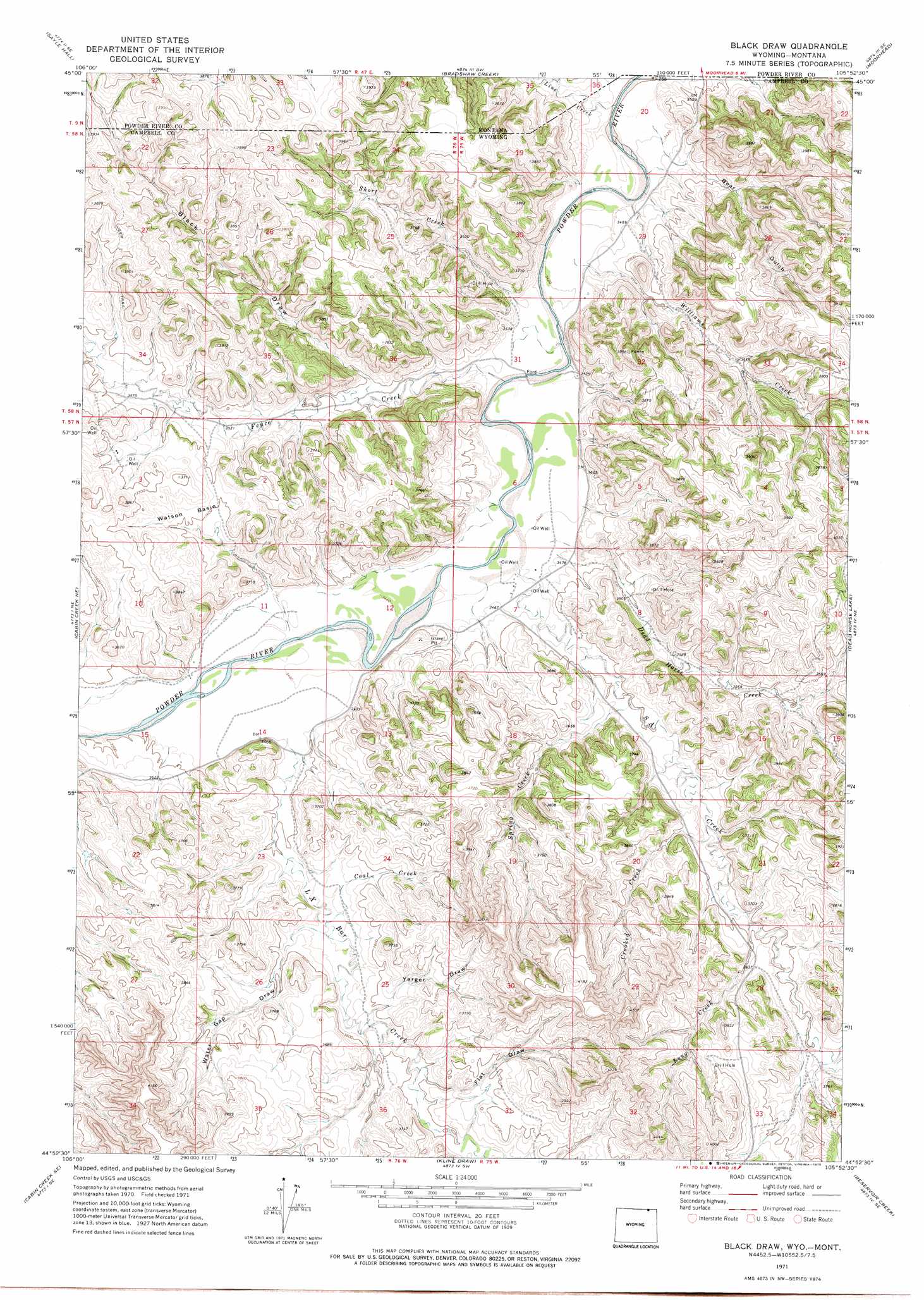
Black Draw Topo Map Wyoming
To zoom in, hover over the map of Black Draw
USGS Topo Quad 44105h8 - 1:24,000 scale
| Topo Map Name: | Black Draw |
| USGS Topo Quad ID: | 44105h8 |
| Print Size: | ca. 21 1/4" wide x 27" high |
| Southeast Coordinates: | 44.875° N latitude / 105.875° W longitude |
| Map Center Coordinates: | 44.9375° N latitude / 105.9375° W longitude |
| U.S. States: | WY, MT |
| Filename: | o44105h8.jpg |
| Download Map JPG Image: | Black Draw topo map 1:24,000 scale |
| Map Type: | Topographic |
| Topo Series: | 7.5´ |
| Map Scale: | 1:24,000 |
| Source of Map Images: | United States Geological Survey (USGS) |
| Alternate Map Versions: |
Black Draw WY 1971, updated 1975 Download PDF Buy paper map Black Draw WY 2011 Download PDF Buy paper map Black Draw WY 2012 Download PDF Buy paper map Black Draw WY 2015 Download PDF Buy paper map |
1:24,000 Topo Quads surrounding Black Draw
Otter |
Reanus Cone |
Sayle |
Bloom Creek |
Huckins School |
Bear Creek School |
Sayle Hall |
Bradshaw Creek |
Moorhead |
Three Bar Ranch |
Cabin Creek Nw |
Cabin Creek Ne |
Black Draw |
Dead Horse Lake |
Corral Creek |
Fawn Draw |
Cabin Creek Se |
Kline Draw |
Reservoir Creek |
Homestead Draw Sw |
Arvada |
Arvada Ne |
Larey Draw |
Spotted Horse |
Recluse |
> Back to 44105e1 at 1:100,000 scale
> Back to 44104a1 at 1:250,000 scale
> Back to U.S. Topo Maps home
Black Draw topo map: Gazetteer
Black Draw: Basins
Watson Basin elevation 1101m 3612′Black Draw: Dams
Greenough Dam elevation 1112m 3648′Warren Dam elevation 1141m 3743′
Black Draw: Reservoirs
Greenough Reservoir elevation 1112m 3648′Warren Reservoir elevation 1141m 3743′
Black Draw: Streams
Coal Creek elevation 1078m 3536′Crooked Creek elevation 1079m 3540′
Dead Horse Creek elevation 1049m 3441′
Fence Creek elevation 1043m 3421′
L X Bar Creek elevation 1068m 3503′
Line Creek elevation 1036m 3398′
Line Creek elevation 1035m 3395′
Long Creek elevation 1088m 3569′
SA Creek elevation 1045m 3428′
Short Creek elevation 1043m 3421′
Spring Creek elevation 1069m 3507′
Williams Creek elevation 1037m 3402′
Black Draw: Valleys
Bear Gulch elevation 1042m 3418′Black Draw elevation 1066m 3497′
Black Draw elevation 1066m 3497′
Flat Draw elevation 1096m 3595′
Water Gap Draw elevation 1082m 3549′
Yerger Draw elevation 1091m 3579′
Black Draw digital topo map on disk
Buy this Black Draw topo map showing relief, roads, GPS coordinates and other geographical features, as a high-resolution digital map file on DVD:
Eastern Wyoming & Western South Dakota
Buy digital topo maps: Eastern Wyoming & Western South Dakota