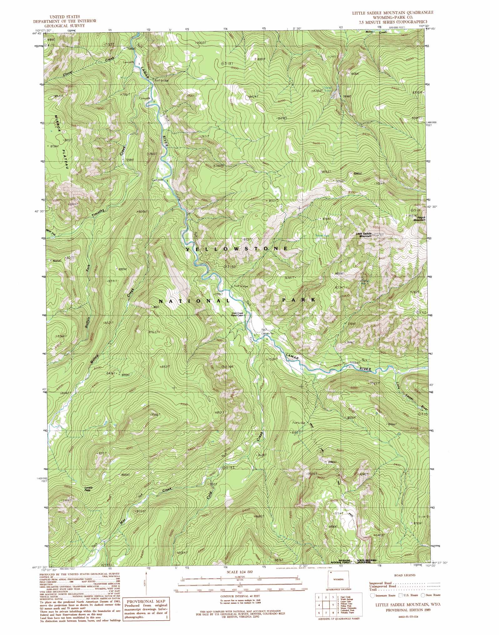
Little Saddle Mountain Topo Map Wyoming
To zoom in, hover over the map of Little Saddle Mountain
USGS Topo Quad 44110f1 - 1:24,000 scale
| Topo Map Name: | Little Saddle Mountain |
| USGS Topo Quad ID: | 44110f1 |
| Print Size: | ca. 21 1/4" wide x 27" high |
| Southeast Coordinates: | 44.625° N latitude / 110° W longitude |
| Map Center Coordinates: | 44.6875° N latitude / 110.0625° W longitude |
| U.S. State: | WY |
| Filename: | o44110f1.jpg |
| Download Map JPG Image: | Little Saddle Mountain topo map 1:24,000 scale |
| Map Type: | Topographic |
| Topo Series: | 7.5´ |
| Map Scale: | 1:24,000 |
| Source of Map Images: | United States Geological Survey (USGS) |
| Alternate Map Versions: |
Little Saddle Mountain WY 1989, updated 1989 Download PDF Buy paper map Little Saddle Mountain WY 1991, updated 1997 Download PDF Buy paper map Little Saddle Mountain WY 2012 Download PDF Buy paper map Little Saddle Mountain WY 2015 Download PDF Buy paper map |
| FStopo: | US Forest Service topo Little Saddle Mountain is available: Download FStopo PDF Download FStopo TIF |
1:24,000 Topo Quads surrounding Little Saddle Mountain
Lamar Canyon |
Mount Hornaday |
Abiathar Peak |
Pilot Peak |
Jim Smith Peak |
Amethyst Mountain |
Opal Creek |
Wahb Springs |
Canoe Lake |
Hurricane Mesa |
White Lake |
Pelican Cone |
Little Saddle Mountain |
Pollux Peak |
Stinkingwater Peak |
Lake Butte |
Mount Chittenden |
Cathedral Peak |
Pahaska Tepee |
Sunlight Peak |
Frank Island |
Sylvan Lake |
Plenty Coups Peak |
Eagle Creek |
Chimney Rock |
> Back to 44110e1 at 1:100,000 scale
> Back to 44110a1 at 1:250,000 scale
> Back to U.S. Topo Maps home
Little Saddle Mountain topo map: Gazetteer
Little Saddle Mountain: Gaps
Lovely Pass elevation 2672m 8766′Little Saddle Mountain: Streams
Buffalo Fork elevation 2268m 7440′Clover Creek elevation 2157m 7076′
Cold Creek elevation 2227m 7306′
Little Lamar River elevation 2266m 7434′
Mirror Fork elevation 2299m 7542′
Mist Creek elevation 2315m 7595′
Timothy Creek elevation 2153m 7063′
Willow Creek elevation 2171m 7122′
Little Saddle Mountain: Summits
Hague Mountain elevation 3137m 10291′Little Saddle Mountain elevation 3113m 10213′
Little Saddle Mountain: Trails
Frost Lake Trail elevation 2496m 8188′Lamar River Trail elevation 2265m 7431′
Mist Creek Trail elevation 2461m 8074′
Little Saddle Mountain digital topo map on disk
Buy this Little Saddle Mountain topo map showing relief, roads, GPS coordinates and other geographical features, as a high-resolution digital map file on DVD: