Big Chief Creek Topo Map Idaho
To zoom in, hover over the map of Big Chief Creek
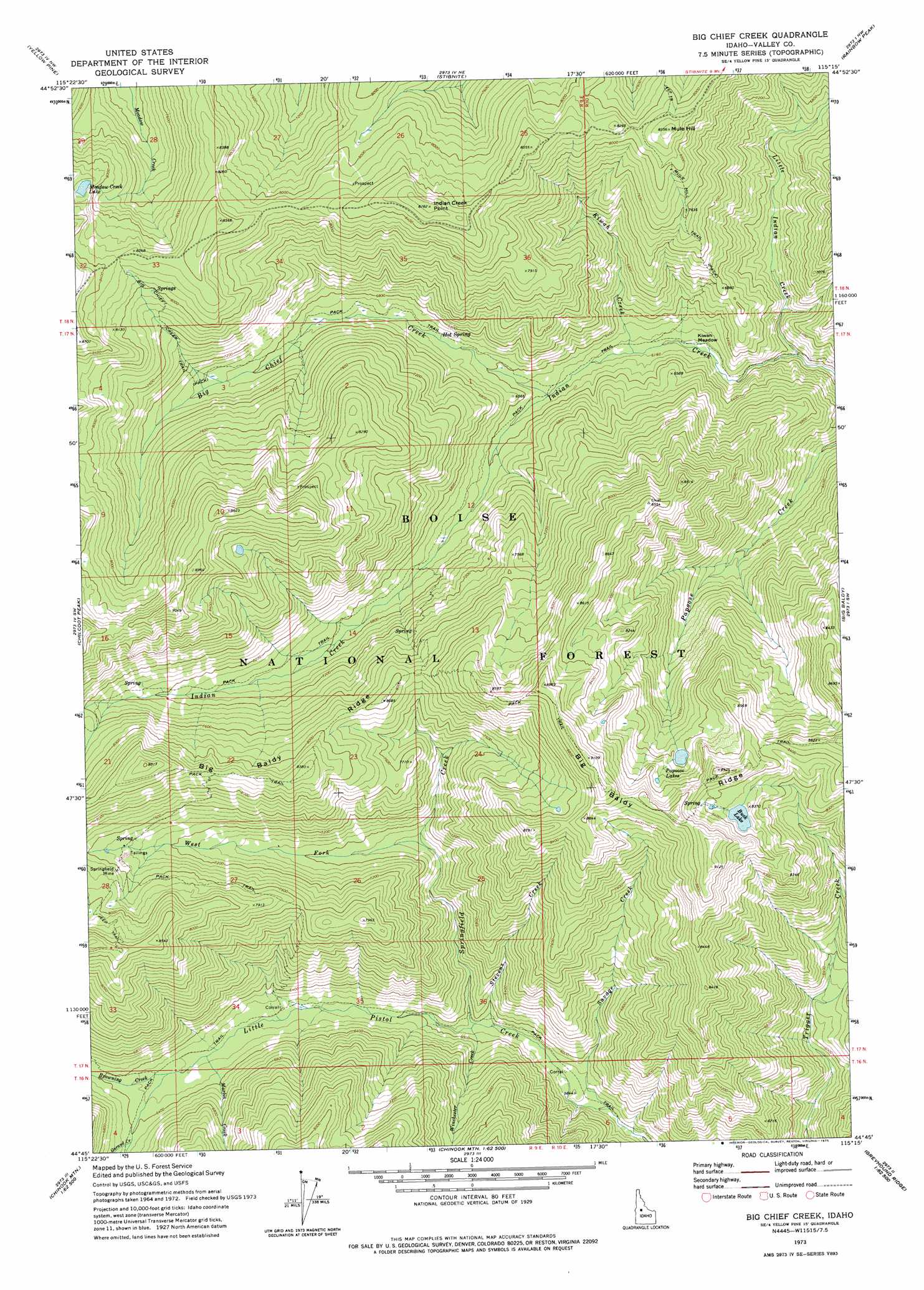
USGS Topo Quad 44115g3 - 1:24,000 scale
| Topo Map Name: | Big Chief Creek |
| USGS Topo Quad ID: | 44115g3 |
| Print Size: | ca. 21 1/4" wide x 27" high |
| Southeast Coordinates: | 44.75° N latitude / 115.25° W longitude |
| Map Center Coordinates: | 44.8125° N latitude / 115.3125° W longitude |
| U.S. State: | ID |
| Filename: | o44115g3.jpg |
| Download Map JPG Image: | Big Chief Creek topo map 1:24,000 scale |
| Map Type: | Topographic |
| Topo Series: | 7.5´ |
| Map Scale: | 1:24,000 |
| Source of Map Images: | United States Geological Survey (USGS) |
| Alternate Map Versions: |
Big Chief Creek ID 1973, updated 1975 Download PDF Buy paper map Big Chief Creek ID 2004, updated 2007 Download PDF Buy paper map Big Chief Creek ID 2011 Download PDF Buy paper map Big Chief Creek ID 2013 Download PDF Buy paper map |
| FStopo: | US Forest Service topo Big Chief Creek is available: Download FStopo PDF Download FStopo TIF |
1:24,000 Topo Quads surrounding Big Chief Creek
Parks Peak |
Profile Gap |
Edwardsburg |
Center Mountain |
Monument |
Caton Lake |
Yellow Pine |
Stibnite |
Rainbow Peak |
Safety Creek |
Log Mountain |
Chilcoot Peak |
Big Chief Creek |
Big Baldy |
Pungo Mountain |
Landmark |
Pistol Lake |
Chinook Mountain |
Artillery Dome |
Little Soldier Mountain |
Tyndall Meadows |
Honeymoon Lake |
Big Soldier Mountain |
Soldier Creek |
Greyhound Mountain |
> Back to 44115e1 at 1:100,000 scale
> Back to 44114a1 at 1:250,000 scale
> Back to U.S. Topo Maps home
Big Chief Creek topo map: Gazetteer
Big Chief Creek: Cliffs
Indian Creek Point elevation 2665m 8743′Big Chief Creek: Flats
Kiwah Meadow elevation 1855m 6085′Big Chief Creek: Lakes
Buck Lake elevation 2530m 8300′Meadow Creek Lake elevation 2483m 8146′
Papoose Lakes elevation 2475m 8120′
Big Chief Creek: Mines
Springfield Mine elevation 2336m 7664′Big Chief Creek: Ridges
Big Baldy Ridge elevation 2664m 8740′Big Chief Creek: Streams
Big Chief Creek elevation 1907m 6256′Browning Creek elevation 1912m 6272′
Garand Creek elevation 1969m 6459′
Kiwah Creek elevation 1872m 6141′
Little Indian Creek elevation 1802m 5912′
Marlin Creek elevation 1900m 6233′
Savage Creek elevation 1724m 5656′
Springfield Creek elevation 1800m 5905′
Stevens Creek elevation 1780m 5839′
West Fork Springfield Creek elevation 2008m 6587′
Winchester Creek elevation 1800m 5905′
Big Chief Creek: Summits
Mule Hill elevation 2544m 8346′Big Chief Creek: Trails
Big Chief Creek Trail elevation 2266m 7434′Mule Hill Trail elevation 2298m 7539′
Big Chief Creek digital topo map on disk
Buy this Big Chief Creek topo map showing relief, roads, GPS coordinates and other geographical features, as a high-resolution digital map file on DVD: