Ocqueoc Topo Map Michigan
To zoom in, hover over the map of Ocqueoc
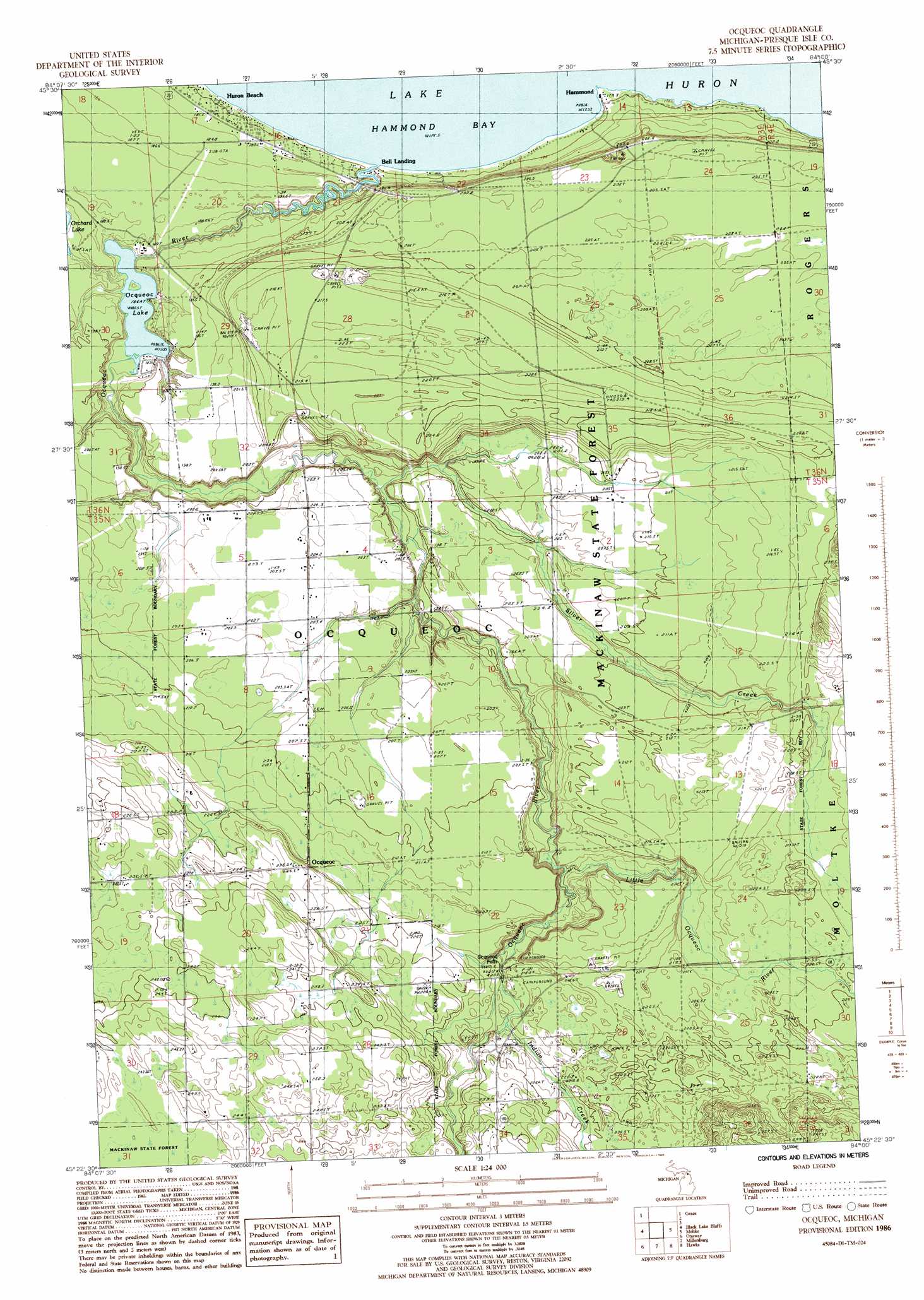
USGS Topo Quad 45084d1 - 1:24,000 scale
| Topo Map Name: | Ocqueoc |
| USGS Topo Quad ID: | 45084d1 |
| Print Size: | ca. 21 1/4" wide x 27" high |
| Southeast Coordinates: | 45.375° N latitude / 84° W longitude |
| Map Center Coordinates: | 45.4375° N latitude / 84.0625° W longitude |
| U.S. State: | MI |
| Filename: | o45084d1.jpg |
| Download Map JPG Image: | Ocqueoc topo map 1:24,000 scale |
| Map Type: | Topographic |
| Topo Series: | 7.5´ |
| Map Scale: | 1:24,000 |
| Source of Map Images: | United States Geological Survey (USGS) |
| Alternate Map Versions: |
Ocqueoc MI 1986, updated 1986 Download PDF Buy paper map Ocqueoc MI 2011 Download PDF Buy paper map Ocqueoc MI 2014 Download PDF Buy paper map Ocqueoc MI 2017 Download PDF Buy paper map |
1:24,000 Topo Quads surrounding Ocqueoc
Cordwood Point |
Ninemile Point |
|||
Manning |
Grace |
|||
Hangore Heights |
Black Lake Bluffs |
Ocqueoc |
Moltke |
Rogers City |
Tower |
Onaway |
Millersburg |
Hawks |
Metz |
Silver Lake |
Lake Geneva |
Cranberry Lake |
Royston |
Hillman Ne |
> Back to 45084a1 at 1:100,000 scale
> Back to 45084a1 at 1:250,000 scale
> Back to U.S. Topo Maps home
Ocqueoc topo map: Gazetteer
Ocqueoc: Falls
Ocqueoc Falls elevation 208m 682′Ocqueoc: Lakes
Ocqueoc Lake elevation 180m 590′Ocqueoc: Populated Places
Bell Landing elevation 178m 583′Hammond elevation 176m 577′
Huron Beach elevation 184m 603′
Ocqueoc elevation 234m 767′
Ocqueoc: Post Offices
Hammond Post Office (historical) elevation 176m 577′Ocqueoc Post Office (historical) elevation 234m 767′
Ocqueoc: Streams
Indian Creek elevation 213m 698′Little Ocqueoc River elevation 197m 646′
Ocqueoc River elevation 177m 580′
Silver Creek elevation 187m 613′
Ocqueoc digital topo map on disk
Buy this Ocqueoc topo map showing relief, roads, GPS coordinates and other geographical features, as a high-resolution digital map file on DVD: