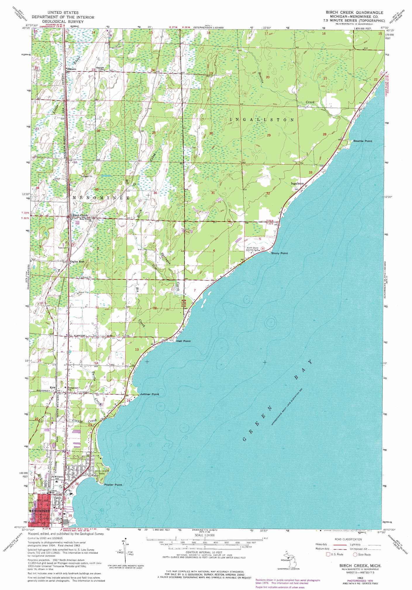
Birch Creek Topo Map Michigan
To zoom in, hover over the map of Birch Creek
USGS Topo Quad 45087b5 - 1:24,000 scale
| Topo Map Name: | Birch Creek |
| USGS Topo Quad ID: | 45087b5 |
| Print Size: | ca. 21 1/4" wide x 27" high |
| Southeast Coordinates: | 45.125° N latitude / 87.5° W longitude |
| Map Center Coordinates: | 45.1875° N latitude / 87.5625° W longitude |
| U.S. State: | MI |
| Filename: | o45087b5.jpg |
| Download Map JPG Image: | Birch Creek topo map 1:24,000 scale |
| Map Type: | Topographic |
| Topo Series: | 7.5´ |
| Map Scale: | 1:24,000 |
| Source of Map Images: | United States Geological Survey (USGS) |
| Alternate Map Versions: |
Birch Creek MI 1963, updated 1964 Download PDF Buy paper map Birch Creek MI 1963, updated 1977 Download PDF Buy paper map Birch Creek MI 2011 Download PDF Buy paper map Birch Creek MI 2014 Download PDF Buy paper map Birch Creek MI 2016 Download PDF Buy paper map |
1:24,000 Topo Quads surrounding Birch Creek
Resort Lake |
Swanson |
Stephenson |
North Lake |
Cedar River |
Bear Point |
Mcallister |
Wallace |
Arthur Bay |
|
Porterfield |
Chappee Rapids |
Birch Creek |
Chambers Island Nw |
Chambers Island |
Harmony |
Marinette West |
Marinette East |
Green Island |
Egg Harbor |
Oconto East |
Peshtigo Harbor |
Idlewild |
Institute |
> Back to 45087a1 at 1:100,000 scale
> Back to 45086a1 at 1:250,000 scale
> Back to U.S. Topo Maps home
Birch Creek topo map: Gazetteer
Birch Creek: Capes
Beattie Point elevation 177m 580′Hall Point elevation 177m 580′
Juttner Point elevation 177m 580′
Poplar Point elevation 179m 587′
Stony Point elevation 177m 580′
Birch Creek: Parks
John Henes Park elevation 180m 590′Watertower Park elevation 186m 610′
Birch Creek: Populated Places
Bayside Mobile Estates elevation 178m 583′Birch Creek elevation 198m 649′
Eagles Nest elevation 194m 636′
Hansen elevation 195m 639′
Ingallston elevation 180m 590′
Kew elevation 189m 620′
Birch Creek: Post Offices
Ingallston Post Office (historical) elevation 180m 590′Birch Creek: Streams
Beattie Creek elevation 177m 580′Birch Creek elevation 179m 587′
Bis Creek elevation 177m 580′
Hay Creek elevation 177m 580′
Hill Creek elevation 191m 626′
Springer Creek elevation 177m 580′
Turtle Creek elevation 177m 580′
Utopia Creek elevation 177m 580′
Birch Creek digital topo map on disk
Buy this Birch Creek topo map showing relief, roads, GPS coordinates and other geographical features, as a high-resolution digital map file on DVD: