Round Prairie Topo Map Minnesota
To zoom in, hover over the map of Round Prairie
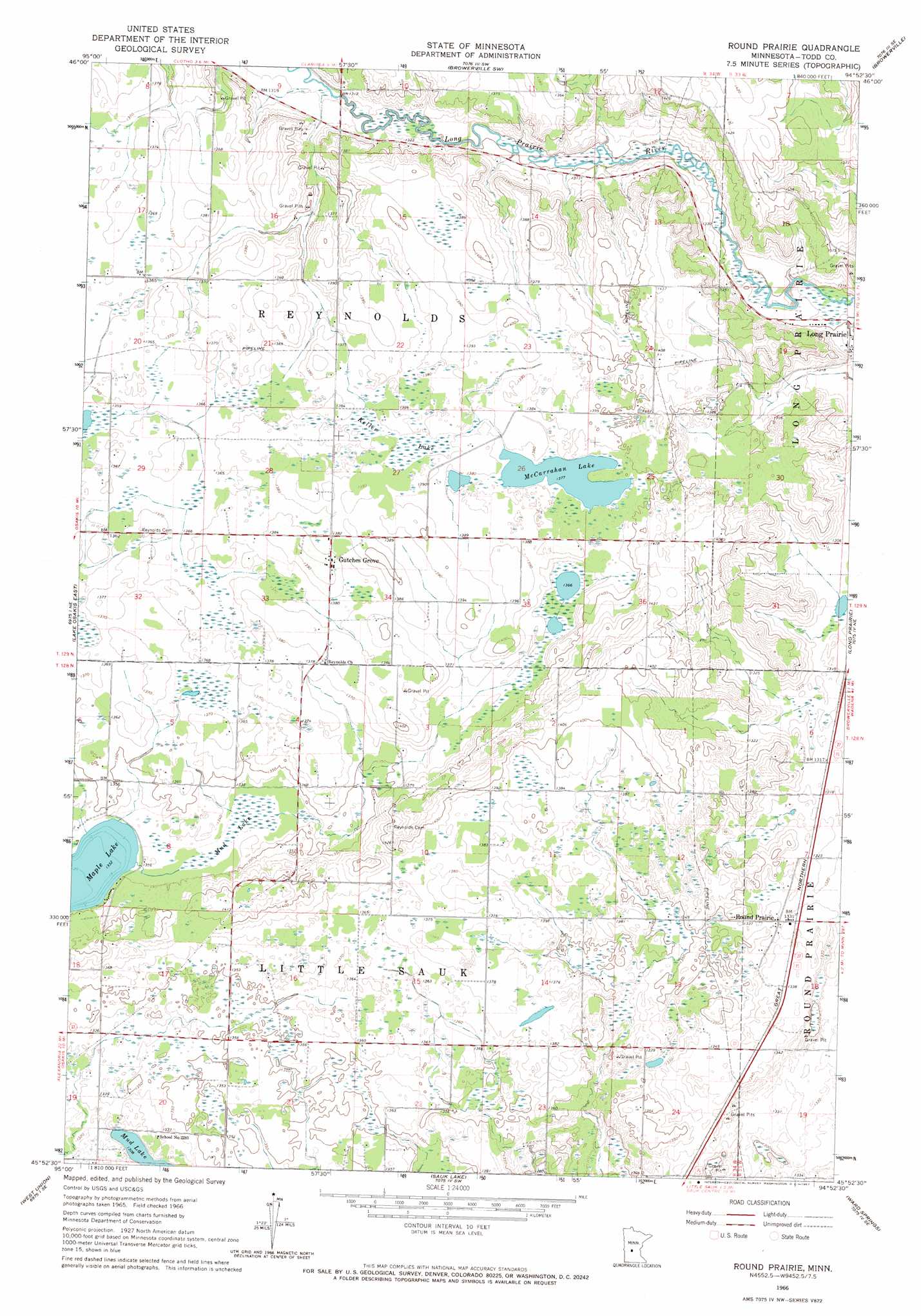
USGS Topo Quad 45094h8 - 1:24,000 scale
| Topo Map Name: | Round Prairie |
| USGS Topo Quad ID: | 45094h8 |
| Print Size: | ca. 21 1/4" wide x 27" high |
| Southeast Coordinates: | 45.875° N latitude / 94.875° W longitude |
| Map Center Coordinates: | 45.9375° N latitude / 94.9375° W longitude |
| U.S. State: | MN |
| Filename: | o45094h8.jpg |
| Download Map JPG Image: | Round Prairie topo map 1:24,000 scale |
| Map Type: | Topographic |
| Topo Series: | 7.5´ |
| Map Scale: | 1:24,000 |
| Source of Map Images: | United States Geological Survey (USGS) |
| Alternate Map Versions: |
Round Prairie MN 1966, updated 1967 Download PDF Buy paper map Round Prairie MN 2010 Download PDF Buy paper map Round Prairie MN 2013 Download PDF Buy paper map Round Prairie MN 2016 Download PDF Buy paper map |
1:24,000 Topo Quads surrounding Round Prairie
Eagle Bend Nw |
Eagle Bend |
Clarissa |
Browerville Ne |
Lincoln |
Rose City |
Clotho |
Browerville Sw |
Browerville |
Lake Beauty |
Lake Osakis West |
Lake Osakis East |
Round Prairie |
Long Prairie |
Swanville |
Osakis |
West Union |
Sauk Lake |
Ward Springs |
Burtrum |
Westport |
Raymond Lake |
Sauk Centre |
Melrose |
Freeport |
> Back to 45094e1 at 1:100,000 scale
> Back to 45094a1 at 1:250,000 scale
> Back to U.S. Topo Maps home
Round Prairie topo map: Gazetteer
Round Prairie: Lakes
McCarrahan Lake elevation 420m 1377′Mud Lake elevation 399m 1309′
Round Prairie: Populated Places
Gutches Grove elevation 422m 1384′Round Prairie elevation 406m 1332′
Round Prairie: Post Offices
Round Prairie Post Office (historical) elevation 406m 1332′Round Prairie: Swamps
Keller Lake elevation 421m 1381′Mud Lake elevation 408m 1338′
Round Prairie digital topo map on disk
Buy this Round Prairie topo map showing relief, roads, GPS coordinates and other geographical features, as a high-resolution digital map file on DVD: