Padua Topo Map Minnesota
To zoom in, hover over the map of Padua
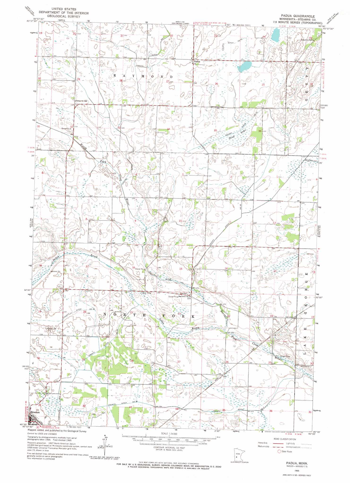
USGS Topo Quad 45095e1 - 1:24,000 scale
| Topo Map Name: | Padua |
| USGS Topo Quad ID: | 45095e1 |
| Print Size: | ca. 21 1/4" wide x 27" high |
| Southeast Coordinates: | 45.5° N latitude / 95° W longitude |
| Map Center Coordinates: | 45.5625° N latitude / 95.0625° W longitude |
| U.S. State: | MN |
| Filename: | o45095e1.jpg |
| Download Map JPG Image: | Padua topo map 1:24,000 scale |
| Map Type: | Topographic |
| Topo Series: | 7.5´ |
| Map Scale: | 1:24,000 |
| Source of Map Images: | United States Geological Survey (USGS) |
| Alternate Map Versions: |
Padua MN 1965, updated 1966 Download PDF Buy paper map Padua MN 2010 Download PDF Buy paper map Padua MN 2013 Download PDF Buy paper map Padua MN 2016 Download PDF Buy paper map |
1:24,000 Topo Quads surrounding Padua
Forada |
Osakis |
West Union |
Sauk Lake |
Ward Springs |
Villard |
Westport |
Raymond Lake |
Sauk Centre |
Melrose |
Terrace |
Sedan |
Padua |
Elrosa |
Greenwald |
Lake Simon |
Lake Johanna |
Belgrade |
Georgeville |
Lake Henry |
De Graff Se |
Sunburg |
Mount Tom |
New London |
Hawick |
> Back to 45095e1 at 1:100,000 scale
> Back to 45094a1 at 1:250,000 scale
> Back to U.S. Topo Maps home
Padua topo map: Gazetteer
Padua: Canals
County Ditch Number Fortysix elevation 408m 1338′County Ditch Number Thirtyeight elevation 393m 1289′
County Ditch Number Thirtysix elevation 393m 1289′
County Ditch Number Thirtytwo elevation 402m 1318′
Judicial Ditch Number One elevation 409m 1341′
Padua: Populated Places
Brooten elevation 399m 1309′Padua elevation 412m 1351′
Padua: Post Offices
Brooten Post Office elevation 400m 1312′Padua Post Office (historical) elevation 411m 1348′
Padua: Streams
Sedan Brook elevation 386m 1266′Padua: Swamps
Sand Lake elevation 402m 1318′Padua digital topo map on disk
Buy this Padua topo map showing relief, roads, GPS coordinates and other geographical features, as a high-resolution digital map file on DVD: